Baden Topo Map Georgia
To zoom in, hover over the map of Baden
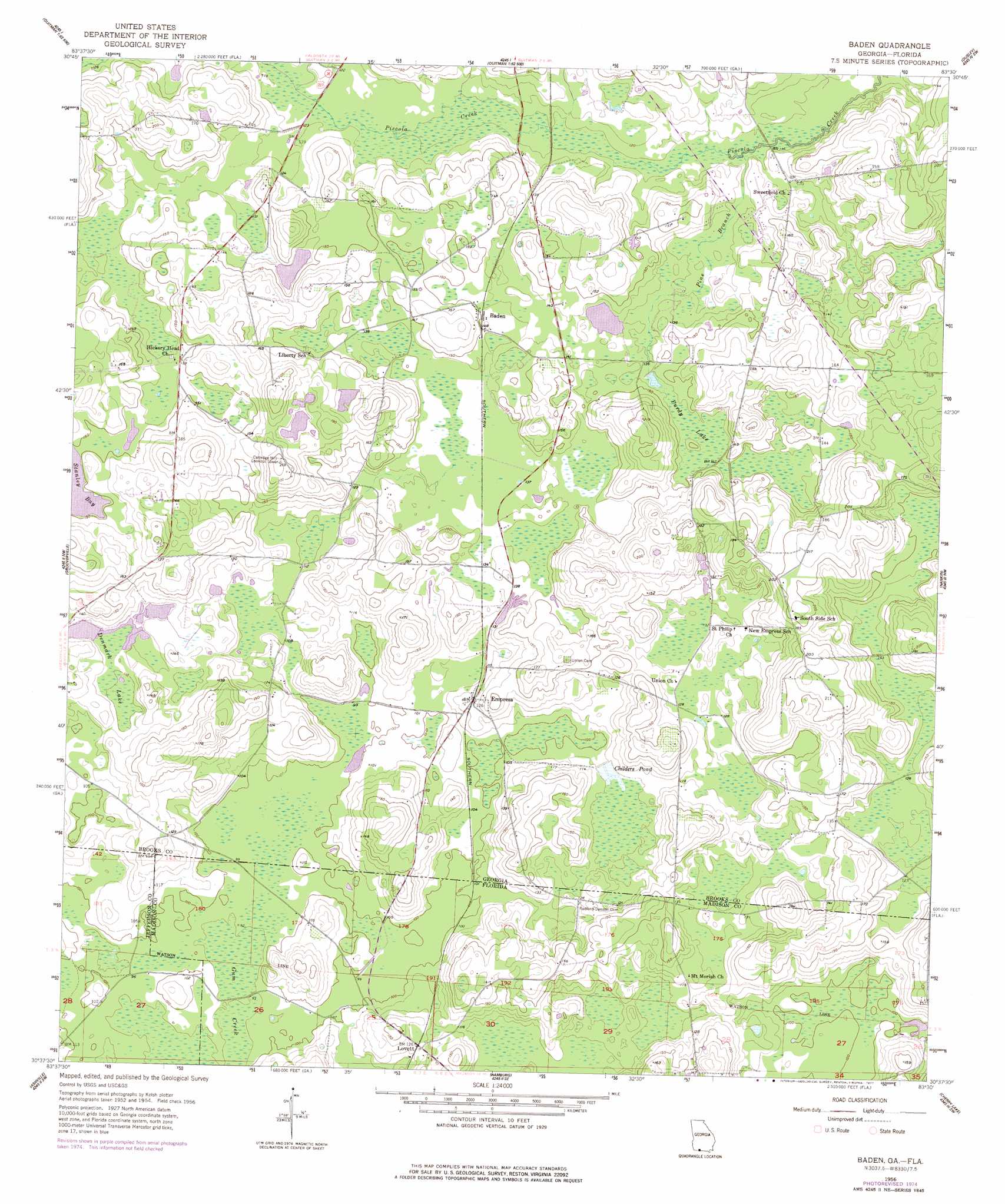
USGS Topo Quad 30083f5 - 1:24,000 scale
| Topo Map Name: | Baden |
| USGS Topo Quad ID: | 30083f5 |
| Print Size: | ca. 21 1/4" wide x 27" high |
| Southeast Coordinates: | 30.625° N latitude / 83.5° W longitude |
| Map Center Coordinates: | 30.6875° N latitude / 83.5625° W longitude |
| U.S. States: | GA, FL |
| Filename: | o30083f5.jpg |
| Download Map JPG Image: | Baden topo map 1:24,000 scale |
| Map Type: | Topographic |
| Topo Series: | 7.5´ |
| Map Scale: | 1:24,000 |
| Source of Map Images: | United States Geological Survey (USGS) |
| Alternate Map Versions: |
Baden GA 1956, updated 1958 Download PDF Buy paper map Baden GA 1956, updated 1977 Download PDF Buy paper map Baden GA 2011 Download PDF Buy paper map Baden GA 2014 Download PDF Buy paper map |
1:24,000 Topo Quads surrounding Baden
Patten |
Pavo |
Pebble Hill |
Hahira West |
Hahira East |
Boston |
Dixie |
Quitman |
Ousley |
Valdosta |
Monticello Ne |
Grooverville |
Baden |
Nankin |
Clyattville |
Monticello |
Ashville |
Hamburg |
Cherry Lake |
Pinetta |
Lamont |
Greenville |
Greenville Ne |
Madison |
Lee |
> Back to 30083e1 at 1:100,000 scale
> Back to 30082a1 at 1:250,000 scale
> Back to U.S. Topo Maps home
Baden topo map: Gazetteer
Baden: Populated Places
Baden elevation 43m 141′Empress elevation 38m 124′
Lovett elevation 38m 124′
Baden: Reservoirs
Childers Pond elevation 33m 108′Baden: Streams
Pine Branch elevation 31m 101′Pride Branch elevation 36m 118′
Baden: Swamps
Denmark Lake elevation 35m 114′Purdy Lake elevation 42m 137′
Baden digital topo map on disk
Buy this Baden topo map showing relief, roads, GPS coordinates and other geographical features, as a high-resolution digital map file on DVD: