Monticello Ne Topo Map Georgia
To zoom in, hover over the map of Monticello Ne
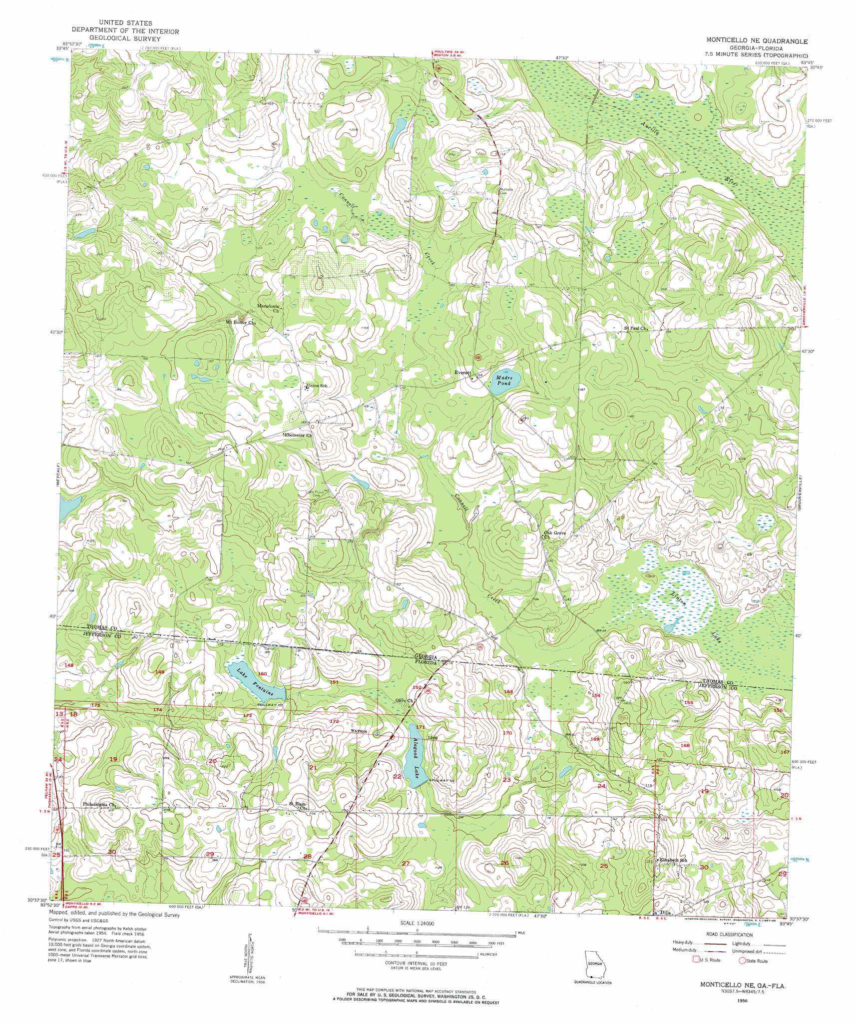
USGS Topo Quad 30083f7 - 1:24,000 scale
| Topo Map Name: | Monticello Ne |
| USGS Topo Quad ID: | 30083f7 |
| Print Size: | ca. 21 1/4" wide x 27" high |
| Southeast Coordinates: | 30.625° N latitude / 83.75° W longitude |
| Map Center Coordinates: | 30.6875° N latitude / 83.8125° W longitude |
| U.S. States: | GA, FL |
| Filename: | o30083f7.jpg |
| Download Map JPG Image: | Monticello Ne topo map 1:24,000 scale |
| Map Type: | Topographic |
| Topo Series: | 7.5´ |
| Map Scale: | 1:24,000 |
| Source of Map Images: | United States Geological Survey (USGS) |
| Alternate Map Versions: |
Monticello NE FL 1956, updated 1957 Download PDF Buy paper map Monticello NE FL 1956, updated 1997 Download PDF Buy paper map Monticello NE FL 2011 Download PDF Buy paper map Monticello NE FL 2012 Download PDF Buy paper map Monticello NE FL 2015 Download PDF Buy paper map |
1:24,000 Topo Quads surrounding Monticello Ne
Ochlocknee |
Merrillville |
Patten |
Pavo |
Pebble Hill |
Pine Park |
Thomasville |
Boston |
Dixie |
Quitman |
Miccosukee Ne |
Metcalf |
Monticello Ne |
Grooverville |
Baden |
Miccosukee |
Lake Miccosukee |
Monticello |
Ashville |
Hamburg |
Lloyd |
Waukeenah |
Lamont |
Greenville |
Greenville Ne |
> Back to 30083e1 at 1:100,000 scale
> Back to 30082a1 at 1:250,000 scale
> Back to U.S. Topo Maps home
Monticello Ne topo map: Gazetteer
Monticello Ne: Airports
Foxfire Plantation Airport elevation 37m 121′Monticello Ne: Dams
Madre Pond Dam elevation 40m 131′Monticello Ne: Lakes
Alagood Lake elevation 34m 111′Lake Fontaine elevation 46m 150′
Monticello Ne: Populated Places
Aucilla (historical) elevation 31m 101′Everett elevation 47m 154′
Monticello Ne: Reservoirs
Madre Pond elevation 40m 131′Monticello Ne: Streams
Connell Creek elevation 26m 85′Monticello Ne: Swamps
Linton Lake elevation 26m 85′Monticello Ne digital topo map on disk
Buy this Monticello Ne topo map showing relief, roads, GPS coordinates and other geographical features, as a high-resolution digital map file on DVD: