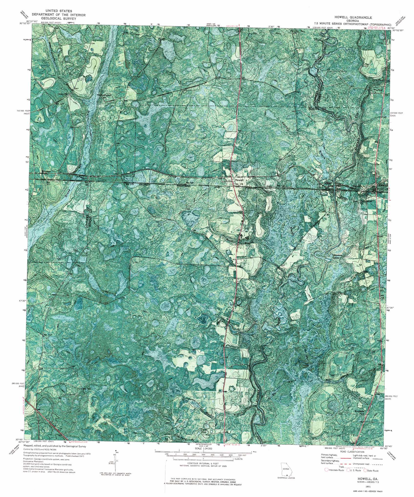
Howell Topo Map Georgia
To zoom in, hover over the map of Howell
USGS Topo Quad 30083g1 - 1:24,000 scale
| Topo Map Name: | Howell |
| USGS Topo Quad ID: | 30083g1 |
| Print Size: | ca. 21 1/4" wide x 27" high |
| Southeast Coordinates: | 30.75° N latitude / 83° W longitude |
| Map Center Coordinates: | 30.8125° N latitude / 83.0625° W longitude |
| U.S. State: | GA |
| Filename: | p30083g1.jpg |
| Download Map JPG Image: | Howell topo map 1:24,000 scale |
| Map Type: | Orthophoto |
| Topo Series: | 7.5´ |
| Map Scale: | 1:24,000 |
| Source of Map Images: | United States Geological Survey (USGS) |
| Alternate Map Versions: |
Howell GA 1971, updated 1976 Download PDF Buy paper map Howell GA 2011 Download PDF Buy paper map Howell GA 2014 Download PDF Buy paper map |
1:24,000 Topo Quads surrounding Howell
New Lois |
Ray City |
Lakeland |
Sirmans |
Homerville West |
Hahira East |
Bemiss |
Naylor |
Stockton |
Du Pont |
Valdosta |
Indianola |
Howell |
Haylow |
Thelma |
Clyattville |
Lake Park |
Statenville |
Tarver |
Pineland |
Pinetta |
Octahatchee |
Jennings |
Jasper |
Cypress Creek |
> Back to 30083e1 at 1:100,000 scale
> Back to 30082a1 at 1:250,000 scale
> Back to U.S. Topo Maps home
Howell topo map: Gazetteer
Howell: Bridges
Lee Bridge (historical) elevation 34m 111′Wetherington Bridge (historical) elevation 47m 154′
Howell: Lakes
Mayhaw Lakes elevation 32m 104′Howell: Populated Places
Blanton elevation 50m 164′Howell elevation 51m 167′
Mayday elevation 44m 144′
Howell: Streams
Big Branch elevation 30m 98′Bill Branch elevation 35m 114′
Connell Branch elevation 32m 104′
Cow Creek elevation 33m 108′
Howell Branch elevation 33m 108′
Martin Branch elevation 30m 98′
Meetinghouse Branch elevation 47m 154′
Pindar Creek elevation 33m 108′
Ray Branch elevation 37m 121′
Rentz Branch elevation 30m 98′
Howell digital topo map on disk
Buy this Howell topo map showing relief, roads, GPS coordinates and other geographical features, as a high-resolution digital map file on DVD: