Ousley Topo Map Georgia
To zoom in, hover over the map of Ousley
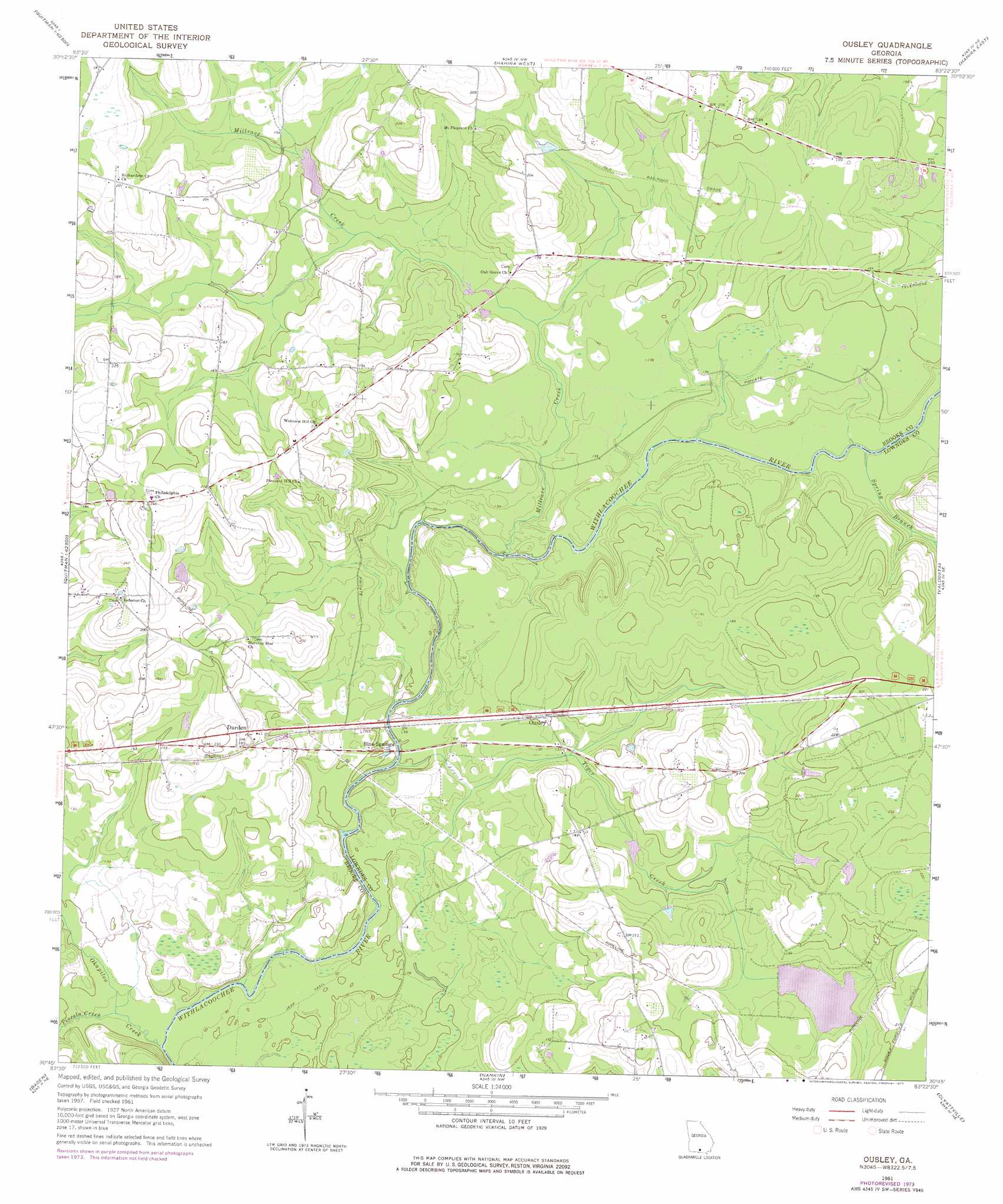
USGS Topo Quad 30083g4 - 1:24,000 scale
| Topo Map Name: | Ousley |
| USGS Topo Quad ID: | 30083g4 |
| Print Size: | ca. 21 1/4" wide x 27" high |
| Southeast Coordinates: | 30.75° N latitude / 83.375° W longitude |
| Map Center Coordinates: | 30.8125° N latitude / 83.4375° W longitude |
| U.S. State: | GA |
| Filename: | o30083g4.jpg |
| Download Map JPG Image: | Ousley topo map 1:24,000 scale |
| Map Type: | Topographic |
| Topo Series: | 7.5´ |
| Map Scale: | 1:24,000 |
| Source of Map Images: | United States Geological Survey (USGS) |
| Alternate Map Versions: |
Ousley GA 1961, updated 1965 Download PDF Buy paper map Ousley GA 1961, updated 1977 Download PDF Buy paper map Ousley GA 2011 Download PDF Buy paper map Ousley GA 2014 Download PDF Buy paper map |
1:24,000 Topo Quads surrounding Ousley
Berlin West |
Berlin East |
Cecil |
New Lois |
Ray City |
Pavo |
Pebble Hill |
Hahira West |
Hahira East |
Bemiss |
Dixie |
Quitman |
Ousley |
Valdosta |
Indianola |
Grooverville |
Baden |
Nankin |
Clyattville |
Lake Park |
Ashville |
Hamburg |
Cherry Lake |
Pinetta |
Octahatchee |
> Back to 30083e1 at 1:100,000 scale
> Back to 30082a1 at 1:250,000 scale
> Back to U.S. Topo Maps home
Ousley topo map: Gazetteer
Ousley: Dams
Chappell Lake Dam elevation 44m 144′Langdale Company Dam elevation 44m 144′
Langdale Lake Dam elevation 50m 164′
Ousley: Populated Places
Blue Springs elevation 33m 108′Durden elevation 56m 183′
Gates (historical) elevation 56m 183′
Golden (historical) elevation 58m 190′
Ousley elevation 46m 150′
Ousley: Reservoirs
Chappell Lake elevation 44m 144′Langdale Company Lake elevation 44m 144′
Langdale Lake elevation 50m 164′
Simmons Pond elevation 44m 144′
Ousley: Streams
Millrace Creek elevation 33m 108′Okapilco Creek elevation 24m 78′
Piscola Creek elevation 27m 88′
Spring Branch elevation 33m 108′
Tiger Creek elevation 27m 88′
Ousley digital topo map on disk
Buy this Ousley topo map showing relief, roads, GPS coordinates and other geographical features, as a high-resolution digital map file on DVD: