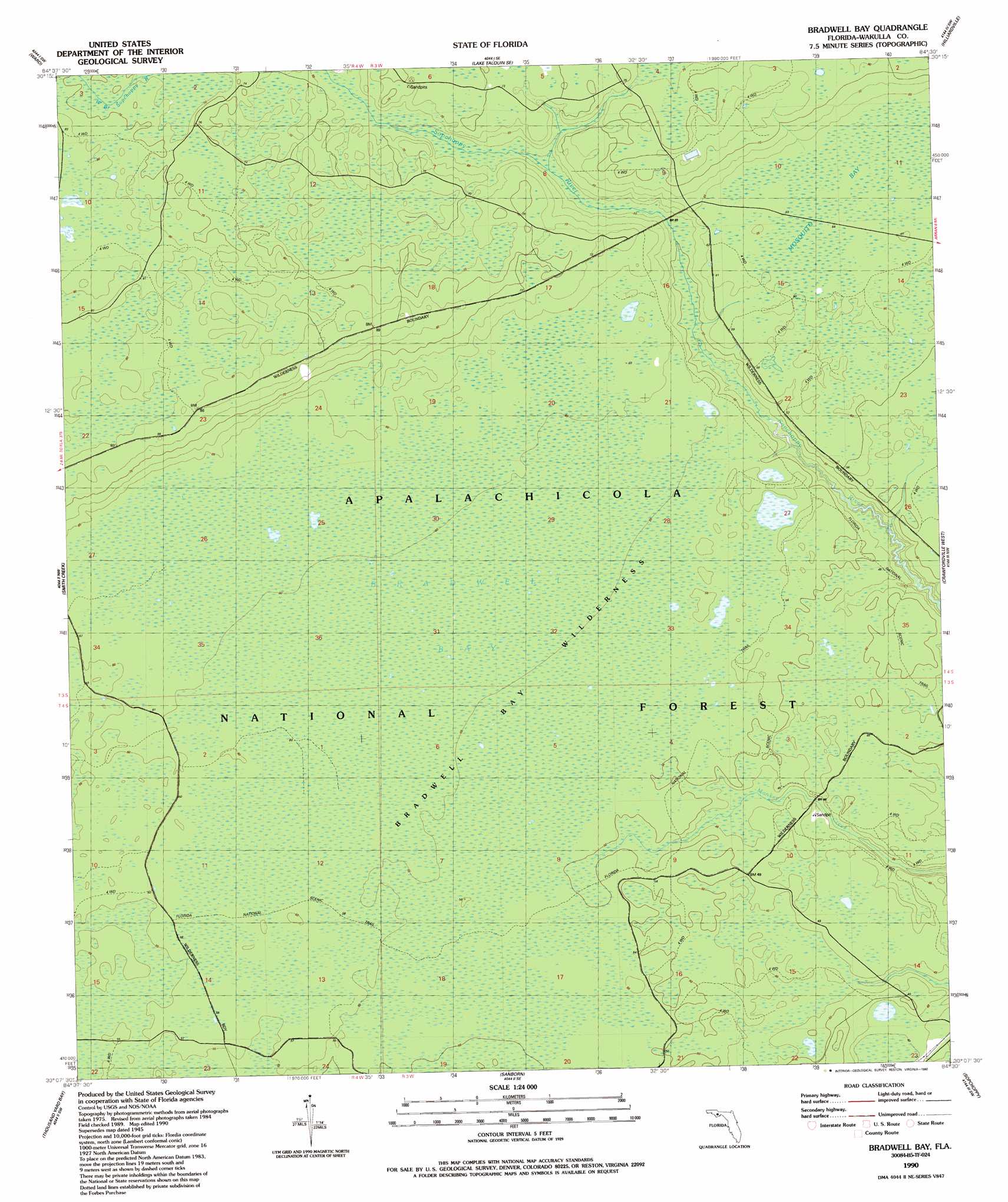
Bradwell Bay Topo Map Florida
To zoom in, hover over the map of Bradwell Bay
USGS Topo Quad 30084b5 - 1:24,000 scale
| Topo Map Name: | Bradwell Bay |
| USGS Topo Quad ID: | 30084b5 |
| Print Size: | ca. 21 1/4" wide x 27" high |
| Southeast Coordinates: | 30.125° N latitude / 84.5° W longitude |
| Map Center Coordinates: | 30.1875° N latitude / 84.5625° W longitude |
| U.S. State: | FL |
| Filename: | O30084B5.jpg |
| Download Map JPG Image: | Bradwell Bay topo map 1:24,000 scale |
| Map Type: | Topographic |
| Topo Series: | 7.5´ |
| Map Scale: | 1:24,000 |
| Source of Map Images: | United States Geological Survey (USGS) |
| Alternate Map Versions: |
Bradwell Bay FL 1945, updated 1960 Download PDF Buy paper map Bradwell Bay FL 1945, updated 1960 Download PDF Buy paper map Bradwell Bay FL 1990, updated 1990 Download PDF Buy paper map Bradwell Bay FL 2012 Download PDF Buy paper map Bradwell Bay FL 2015 Download PDF Buy paper map |
| FStopo: | US Forest Service topo Bradwell Bay is available: Download FStopo PDF Download FStopo TIF |
1:24,000 Topo Quads surrounding Bradwell Bay
Hosford |
Bloxham |
Lake Talquin |
Midway |
Tallahassee |
Telogia |
Ward |
Lake Talquin Se |
Hilliardville |
Lake Munson |
Queens Bay |
Smith Creek |
Bradwell Bay |
Crawfordville West |
Crawfordville East |
Owens Bridge |
Thousand Yard Bay |
Sanborn |
Sopchoppy |
Spring Creek |
Tates Hell Swamp |
Pickett Bay |
Mcintyre |
Saint Teresa Beach |
Lighthouse Point |
> Back to 30084a1 at 1:100,000 scale
> Back to 30084a1 at 1:250,000 scale
> Back to U.S. Topo Maps home
Bradwell Bay topo map: Gazetteer
Bradwell Bay: Bays
Bradwell Bay elevation 18m 59′Bradwell Bay: Swamps
Mosquito Bay elevation 19m 62′Bradwell Bay digital topo map on disk
Buy this Bradwell Bay topo map showing relief, roads, GPS coordinates and other geographical features, as a high-resolution digital map file on DVD:
Gulf Coast (LA, MS, AL, FL) & Southwestern Georgia
Buy digital topo maps: Gulf Coast (LA, MS, AL, FL) & Southwestern Georgia
 & Southwestern Georgia map DVD")