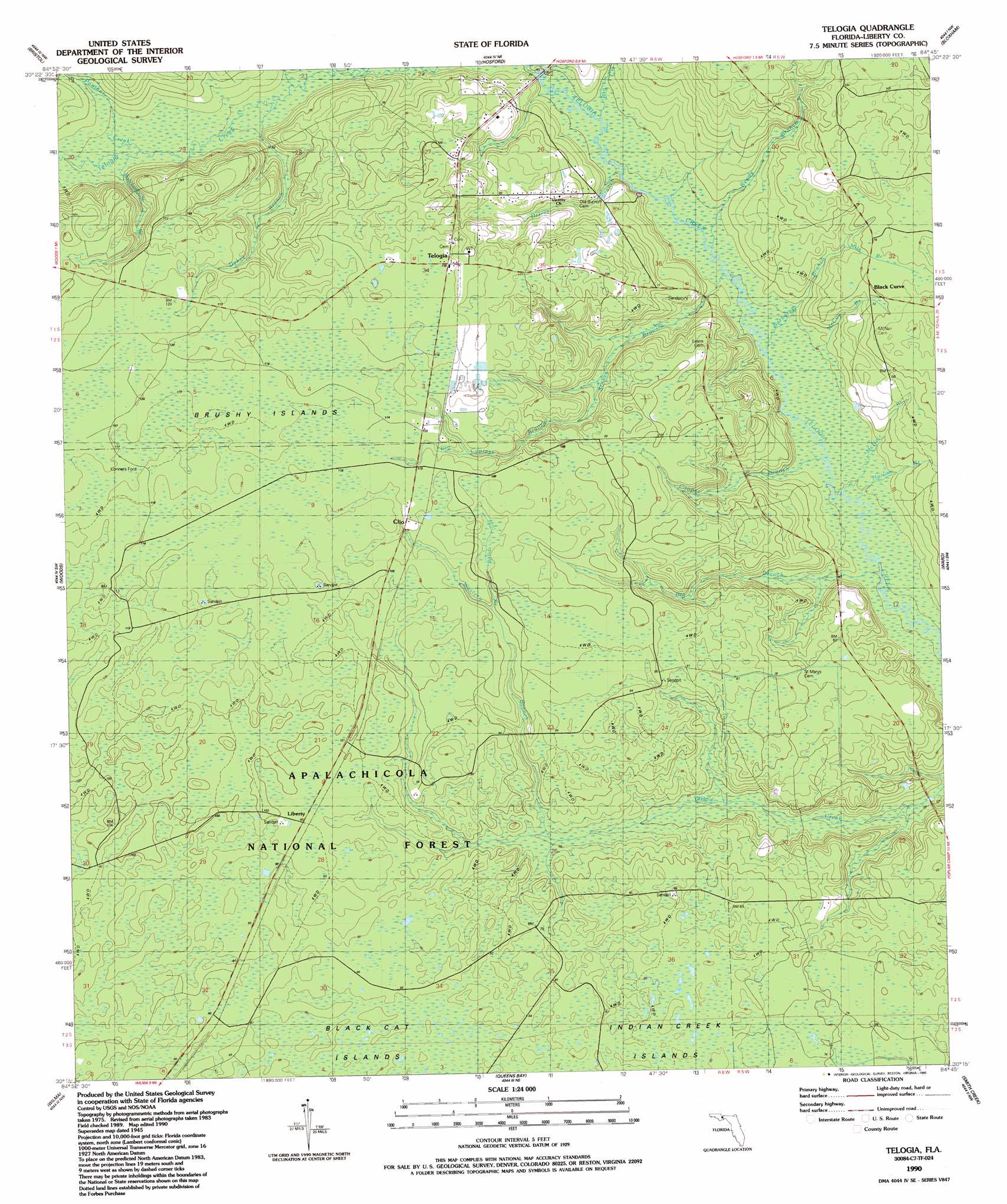
Telogia Topo Map Florida
To zoom in, hover over the map of Telogia
USGS Topo Quad 30084c7 - 1:24,000 scale
| Topo Map Name: | Telogia |
| USGS Topo Quad ID: | 30084c7 |
| Print Size: | ca. 21 1/4" wide x 27" high |
| Southeast Coordinates: | 30.25° N latitude / 84.75° W longitude |
| Map Center Coordinates: | 30.3125° N latitude / 84.8125° W longitude |
| U.S. State: | FL |
| Filename: | O30084C7.jpg |
| Download Map JPG Image: | Telogia topo map 1:24,000 scale |
| Map Type: | Topographic |
| Topo Series: | 7.5´ |
| Map Scale: | 1:24,000 |
| Source of Map Images: | United States Geological Survey (USGS) |
| Alternate Map Versions: |
Telogia FL 1945, updated 1960 Download PDF Buy paper map Telogia FL 1990, updated 1990 Download PDF Buy paper map Telogia FL 2012 Download PDF Buy paper map Telogia FL 2015 Download PDF Buy paper map |
| FStopo: | US Forest Service topo Telogia is available: Download FStopo PDF Download FStopo TIF |
1:24,000 Topo Quads surrounding Telogia
Altha East |
Rock Bluff |
Sycamore |
Gretna |
Quincy |
Blountstown |
Bristol |
Hosford |
Bloxham |
Lake Talquin |
Estiffanulga |
Woods |
Telogia |
Ward |
Lake Talquin Se |
Orange |
Wilma |
Queens Bay |
Smith Creek |
Bradwell Bay |
Kennedy Creek |
Sumatra |
Owens Bridge |
Thousand Yard Bay |
Sanborn |
> Back to 30084a1 at 1:100,000 scale
> Back to 30084a1 at 1:250,000 scale
> Back to U.S. Topo Maps home
Telogia topo map: Gazetteer
Telogia: Islands
Brushy Islands elevation 35m 114′Telogia: Populated Places
Clio elevation 33m 108′Conners Ford elevation 35m 114′
Liberty elevation 30m 98′
Telogia elevation 35m 114′
Telogia: Streams
Barbecue Branch elevation 11m 36′Big Branch elevation 9m 29′
Big Creek elevation 14m 45′
Big Cypress Branch elevation 24m 78′
Butcherknife Branch elevation 19m 62′
Cooper Branch elevation 11m 36′
Double Branch elevation 19m 62′
Driver Branch elevation 13m 42′
Dykes Branch elevation 18m 59′
Harlow Branch elevation 10m 32′
McCoy Branch elevation 11m 36′
McNair Branch elevation 11m 36′
Mile Branch elevation 18m 59′
Mill Pond Branch elevation 30m 98′
Panther Creek elevation 19m 62′
Reedy Branch elevation 13m 42′
Stokes Branch elevation 12m 39′
Western Branch elevation 18m 59′
Telogia digital topo map on disk
Buy this Telogia topo map showing relief, roads, GPS coordinates and other geographical features, as a high-resolution digital map file on DVD:
Gulf Coast (LA, MS, AL, FL) & Southwestern Georgia
Buy digital topo maps: Gulf Coast (LA, MS, AL, FL) & Southwestern Georgia
 & Southwestern Georgia map DVD")