Sycamore Topo Map Florida
To zoom in, hover over the map of Sycamore
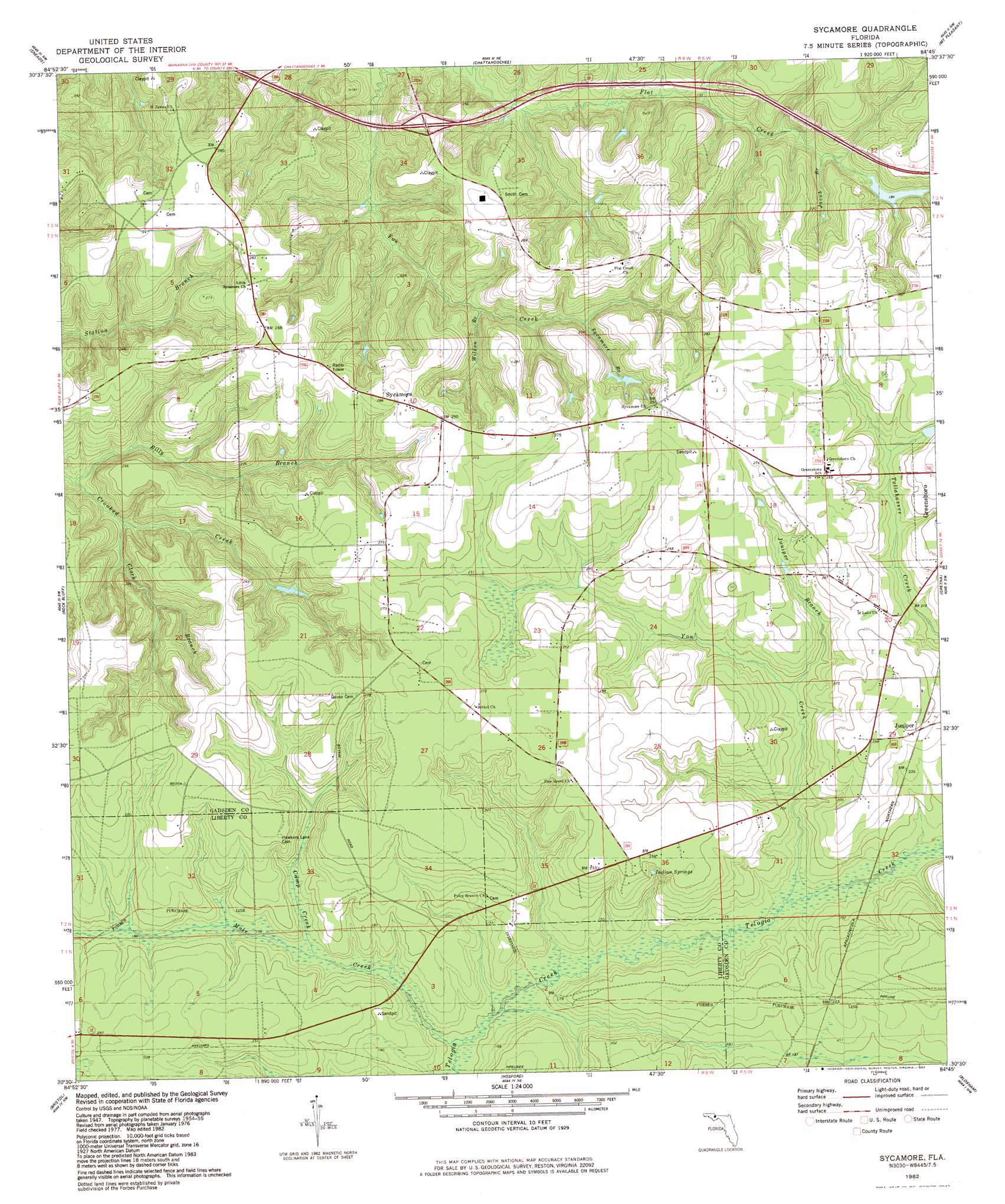
USGS Topo Quad 30084e7 - 1:24,000 scale
| Topo Map Name: | Sycamore |
| USGS Topo Quad ID: | 30084e7 |
| Print Size: | ca. 21 1/4" wide x 27" high |
| Southeast Coordinates: | 30.5° N latitude / 84.75° W longitude |
| Map Center Coordinates: | 30.5625° N latitude / 84.8125° W longitude |
| U.S. State: | FL |
| Filename: | O30084E7.jpg |
| Download Map JPG Image: | Sycamore topo map 1:24,000 scale |
| Map Type: | Topographic |
| Topo Series: | 7.5´ |
| Map Scale: | 1:24,000 |
| Source of Map Images: | United States Geological Survey (USGS) |
| Alternate Map Versions: |
Sycamore FL 1955, updated 1956 Download PDF Buy paper map Sycamore FL 1955, updated 1956 Download PDF Buy paper map Sycamore FL 1982, updated 1983 Download PDF Buy paper map Sycamore FL 1994, updated 1998 Download PDF Buy paper map Sycamore FL 1994, updated 2002 Download PDF Buy paper map Sycamore FL 2012 Download PDF Buy paper map Sycamore FL 2015 Download PDF Buy paper map |
1:24,000 Topo Quads surrounding Sycamore
Dellwood |
Fairchild |
Reynoldsville |
Faceville |
Fowlstown |
Cypress |
Sneads |
Chattahoochee |
Mount Pleasant |
Dogtown |
Altha East |
Rock Bluff |
Sycamore |
Gretna |
Quincy |
Blountstown |
Bristol |
Hosford |
Bloxham |
Lake Talquin |
Estiffanulga |
Woods |
Telogia |
Ward |
Lake Talquin Se |
> Back to 30084e1 at 1:100,000 scale
> Back to 30084a1 at 1:250,000 scale
> Back to U.S. Topo Maps home
Sycamore topo map: Gazetteer
Sycamore: Airports
Flat Creek Airport elevation 87m 285′Sycamore: Basins
Pitts Point elevation 65m 213′Sycamore: Lakes
H M Spooner Pond elevation 74m 242′Pitt Land Slide Pond elevation 51m 167′
Sycamore: Populated Places
Juniper elevation 77m 252′Sycamore elevation 87m 285′
Sycamore: Streams
Billy Branch elevation 39m 127′Camp Creek elevation 50m 164′
Clark Branch elevation 39m 127′
Jacob Branch elevation 48m 157′
Juniper Branch elevation 51m 167′
Mule Creek elevation 44m 144′
Sycamore Branch elevation 54m 177′
Wilson Branch elevation 45m 147′
Yon Creek elevation 51m 167′
Sycamore digital topo map on disk
Buy this Sycamore topo map showing relief, roads, GPS coordinates and other geographical features, as a high-resolution digital map file on DVD:
Gulf Coast (LA, MS, AL, FL) & Southwestern Georgia
Buy digital topo maps: Gulf Coast (LA, MS, AL, FL) & Southwestern Georgia
 & Southwestern Georgia map DVD")