Reno Topo Map Georgia
To zoom in, hover over the map of Reno
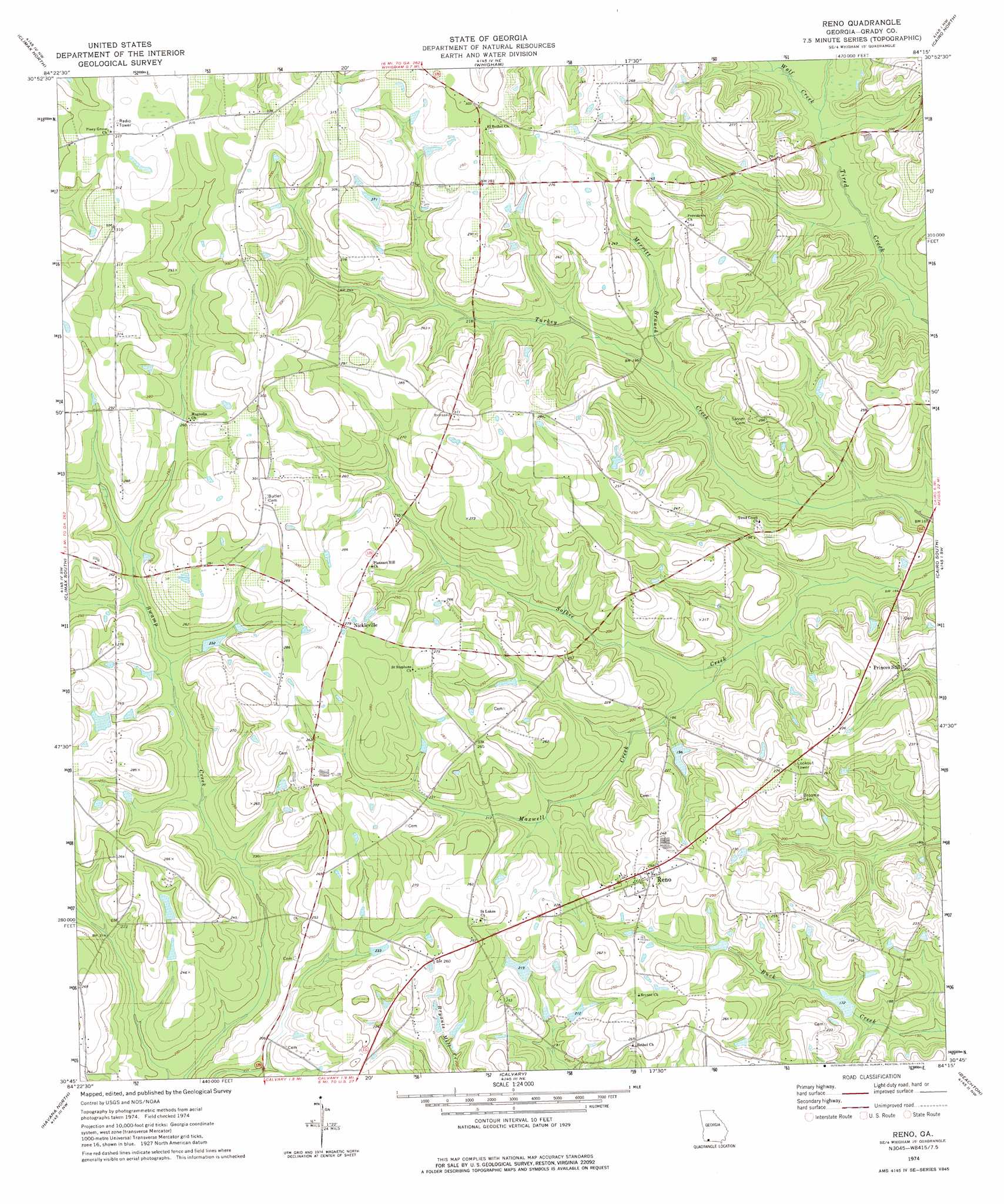
USGS Topo Quad 30084g3 - 1:24,000 scale
| Topo Map Name: | Reno |
| USGS Topo Quad ID: | 30084g3 |
| Print Size: | ca. 21 1/4" wide x 27" high |
| Southeast Coordinates: | 30.75° N latitude / 84.25° W longitude |
| Map Center Coordinates: | 30.8125° N latitude / 84.3125° W longitude |
| U.S. State: | GA |
| Filename: | o30084g3.jpg |
| Download Map JPG Image: | Reno topo map 1:24,000 scale |
| Map Type: | Topographic |
| Topo Series: | 7.5´ |
| Map Scale: | 1:24,000 |
| Source of Map Images: | United States Geological Survey (USGS) |
| Alternate Map Versions: |
Reno GA 1974, updated 1976 Download PDF Buy paper map Reno GA 2011 Download PDF Buy paper map Reno GA 2014 Download PDF Buy paper map |
1:24,000 Topo Quads surrounding Reno
Steadhams Store |
Vada |
Gee Pond |
Pelham |
Meigs |
Bainbridge |
Climax North |
Whigham |
Cairo North |
Ochlocknee |
Fowlstown |
Climax South |
Reno |
Cairo South |
Pine Park |
Dogtown |
Havana North |
Calvary |
Beachton |
Miccosukee Ne |
Quincy |
Havana South |
Lake Jackson |
Bradfordville |
Miccosukee |
> Back to 30084e1 at 1:100,000 scale
> Back to 30084a1 at 1:250,000 scale
> Back to U.S. Topo Maps home
Reno topo map: Gazetteer
Reno: Dams
Gainey Lake Dam elevation 67m 219′Harold Lake Dam elevation 52m 170′
Reno: Populated Places
Bethel elevation 81m 265′Good Hope (historical) elevation 47m 154′
Magnolia elevation 80m 262′
Nickleville elevation 85m 278′
Orange Springs elevation 87m 285′
Providence elevation 81m 265′
Reno elevation 83m 272′
Sofkee (historical) elevation 77m 252′
Reno: Reservoirs
Gainey Lake elevation 67m 219′Harold Lake elevation 52m 170′
Reno: Streams
Maxwell Creek elevation 52m 170′Merritt Branch elevation 57m 187′
Wolf Creek elevation 50m 164′
Reno digital topo map on disk
Buy this Reno topo map showing relief, roads, GPS coordinates and other geographical features, as a high-resolution digital map file on DVD:
Gulf Coast (LA, MS, AL, FL) & Southwestern Georgia
Buy digital topo maps: Gulf Coast (LA, MS, AL, FL) & Southwestern Georgia
 & Southwestern Georgia map DVD")