Brinson Topo Map Georgia
To zoom in, hover over the map of Brinson
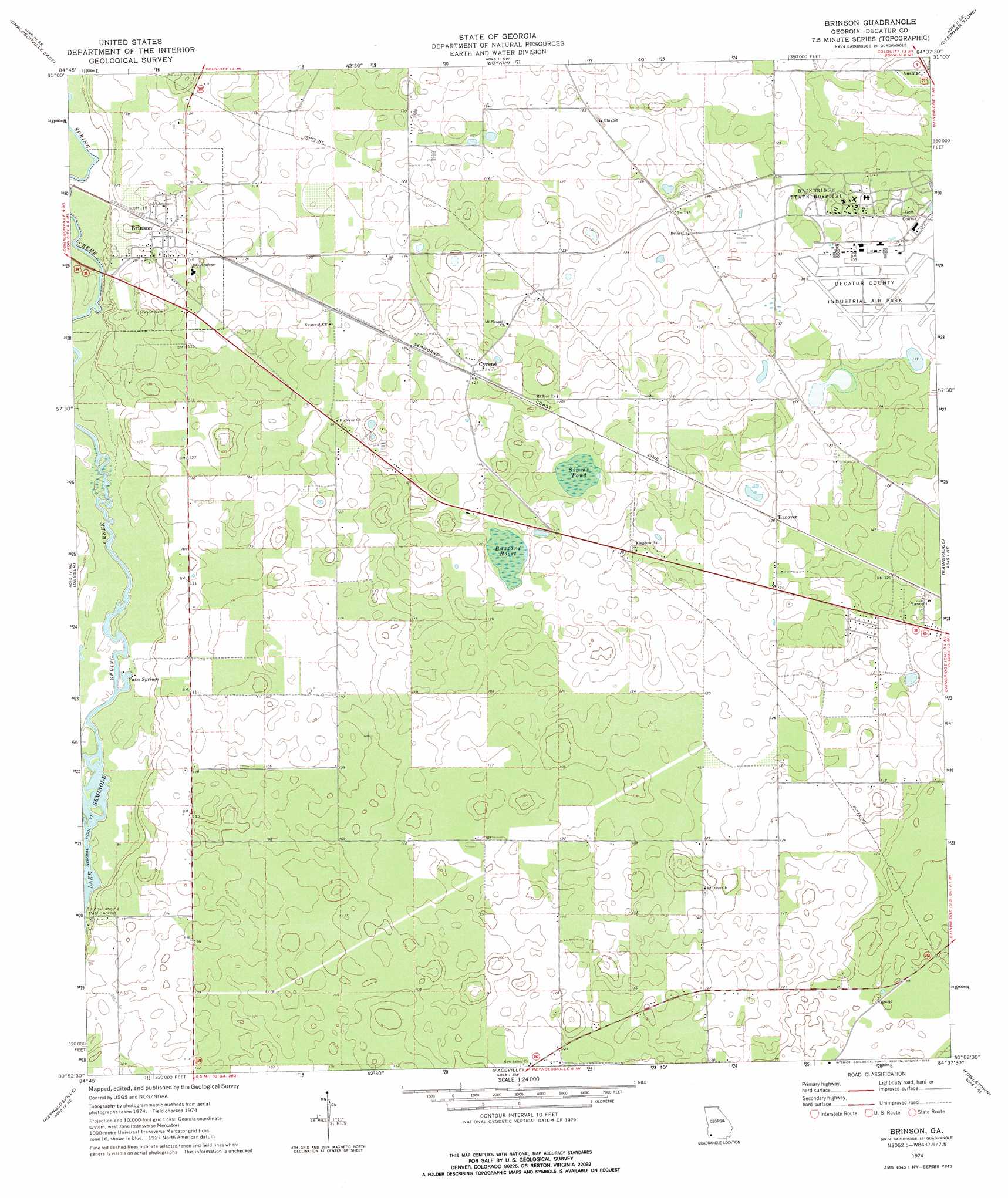
USGS Topo Quad 30084h6 - 1:24,000 scale
| Topo Map Name: | Brinson |
| USGS Topo Quad ID: | 30084h6 |
| Print Size: | ca. 21 1/4" wide x 27" high |
| Southeast Coordinates: | 30.875° N latitude / 84.625° W longitude |
| Map Center Coordinates: | 30.9375° N latitude / 84.6875° W longitude |
| U.S. State: | GA |
| Filename: | o30084h6.jpg |
| Download Map JPG Image: | Brinson topo map 1:24,000 scale |
| Map Type: | Topographic |
| Topo Series: | 7.5´ |
| Map Scale: | 1:24,000 |
| Source of Map Images: | United States Geological Survey (USGS) |
| Alternate Map Versions: |
Brinson GA 1974, updated 1976 Download PDF Buy paper map Brinson GA 2011 Download PDF Buy paper map Brinson GA 2014 Download PDF Buy paper map |
1:24,000 Topo Quads surrounding Brinson
Lucile |
Donalsonville Ne |
Colquitt |
Cooktown |
Hopeful |
Donalsonville West |
Donalsonville East |
Boykin |
Steadhams Store |
Vada |
Steam Mill |
Desser |
Brinson |
Bainbridge |
Climax North |
Fairchild |
Reynoldsville |
Faceville |
Fowlstown |
Climax South |
Sneads |
Chattahoochee |
Mount Pleasant |
Dogtown |
Havana North |
> Back to 30084e1 at 1:100,000 scale
> Back to 30084a1 at 1:250,000 scale
> Back to U.S. Topo Maps home
Brinson topo map: Gazetteer
Brinson: Airports
Decatur County Industrial Air Park elevation 40m 131′Brinson: Lakes
Buzzard Roost elevation 35m 114′Simms Pond elevation 38m 124′
Brinson: Parks
Brinson Family Historic District elevation 35m 114′Brinson: Populated Places
Brinson elevation 36m 118′Cyrene elevation 38m 124′
Hanover elevation 38m 124′
Smiths Landing elevation 25m 82′
Brinson: Springs
Yates Springs elevation 24m 78′Brinson digital topo map on disk
Buy this Brinson topo map showing relief, roads, GPS coordinates and other geographical features, as a high-resolution digital map file on DVD:
Gulf Coast (LA, MS, AL, FL) & Southwestern Georgia
Buy digital topo maps: Gulf Coast (LA, MS, AL, FL) & Southwestern Georgia
 & Southwestern Georgia map DVD")