Pine Beach Topo Map Alabama
To zoom in, hover over the map of Pine Beach
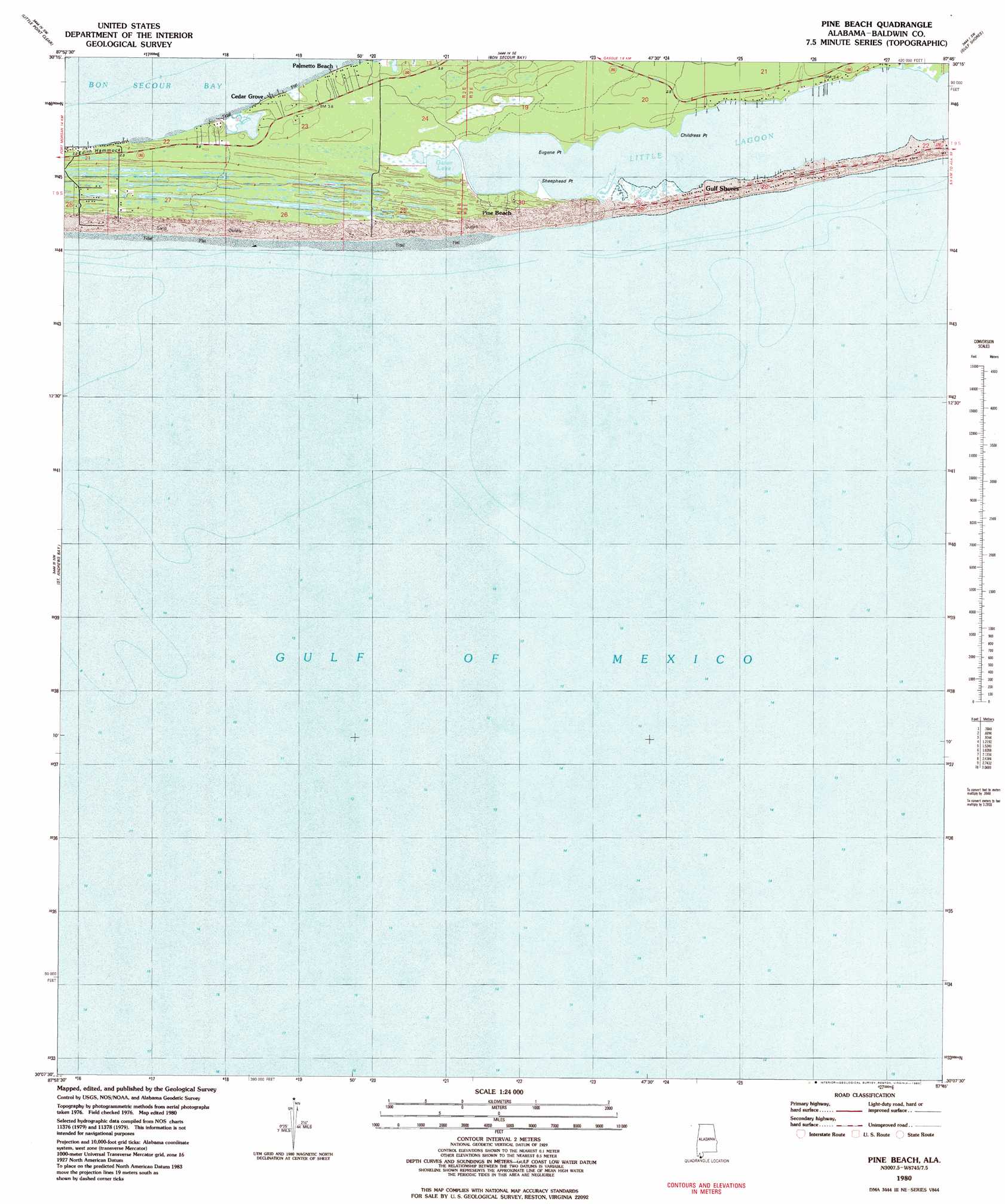
USGS Topo Quad 30087b7 - 1:24,000 scale
| Topo Map Name: | Pine Beach |
| USGS Topo Quad ID: | 30087b7 |
| Print Size: | ca. 21 1/4" wide x 27" high |
| Southeast Coordinates: | 30.125° N latitude / 87.75° W longitude |
| Map Center Coordinates: | 30.1875° N latitude / 87.8125° W longitude |
| U.S. State: | AL |
| Filename: | o30087b7.jpg |
| Download Map JPG Image: | Pine Beach topo map 1:24,000 scale |
| Map Type: | Topographic |
| Topo Series: | 7.5´ |
| Map Scale: | 1:24,000 |
| Source of Map Images: | United States Geological Survey (USGS) |
| Alternate Map Versions: |
Pine Beach AL 1980, updated 1980 Download PDF Buy paper map Pine Beach AL 2011 Download PDF Buy paper map Pine Beach AL 2014 Download PDF Buy paper map |
1:24,000 Topo Quads surrounding Pine Beach
Bellefontaine |
Point Clear |
Magnolia Springs |
Foley |
Elberta |
Little Dauphin Island |
Little Point Clear |
Bon Secour Bay |
Gulf Shores |
Orange Beach |
Fort Morgan |
Saint Andrews Bay |
Pine Beach |
||
> Back to 30087a1 at 1:100,000 scale
> Back to 30086a1 at 1:250,000 scale
> Back to U.S. Topo Maps home
Pine Beach topo map: Gazetteer
Pine Beach: Capes
Childress Point elevation 1m 3′Eugene Point elevation 1m 3′
Sheephead Point elevation 1m 3′
Willet Point elevation 0m 0′
Pine Beach: Guts
Ewing Bayou elevation 1m 3′Pine Beach: Islands
Edith Hammock elevation 3m 9′Pine Beach: Lakes
Gator Lake elevation 1m 3′Little Lagoon elevation 0m 0′
Pine Beach: Parks
Bon Secour National Wildlife Refuge elevation 1m 3′Pine Beach: Populated Places
Cedar Grove elevation 3m 9′Palmetto Beach elevation 1m 3′
Pine Beach digital topo map on disk
Buy this Pine Beach topo map showing relief, roads, GPS coordinates and other geographical features, as a high-resolution digital map file on DVD:
Gulf Coast (LA, MS, AL, FL) & Southwestern Georgia
Buy digital topo maps: Gulf Coast (LA, MS, AL, FL) & Southwestern Georgia
 & Southwestern Georgia map DVD")