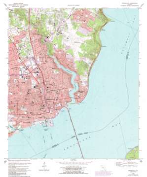
Pensacola Topo Map Florida
To zoom in, hover over the map of Pensacola
USGS Topo Quad 30087d2 - 1:24,000 scale
| Topo Map Name: | Pensacola |
| USGS Topo Quad ID: | 30087d2 |
| Print Size: | ca. 21 1/4" wide x 27" high |
| Southeast Coordinates: | 30.375° N latitude / 87.125° W longitude |
| Map Center Coordinates: | 30.4375° N latitude / 87.1875° W longitude |
| U.S. State: | FL |
| Filename: | O30087D2.jpg |
| Download Map JPG Image: | Pensacola topo map 1:24,000 scale |
| Map Type: | Topographic |
| Topo Series: | 7.5´ |
| Map Scale: | 1:24,000 |
| Source of Map Images: | United States Geological Survey (USGS) |
| Alternate Map Versions: |
Pensacola FL 1970, updated 1972 Download PDF Buy paper map Pensacola FL 1970, updated 1984 Download PDF Buy paper map Pensacola FL 1970, updated 1988 Download PDF Buy paper map Pensacola FL 1994, updated 1999 Download PDF Buy paper map Pensacola FL 2012 Download PDF Buy paper map Pensacola FL 2015 Download PDF Buy paper map |
1:24,000 Topo Quads surrounding Pensacola
> Back to 30087a1 at 1:100,000 scale
> Back to 30086a1 at 1:250,000 scale
> Back to U.S. Topo Maps home
Pensacola topo map: Gazetteer
Pensacola: Airports
Baptist Hospital Heliport elevation 20m 65′Pensacola Regional Airport elevation 29m 95′
Sacred Heart Hospital Heliport elevation 27m 88′
Pensacola: Bays
Bayou Texter elevation 0m 0′Pensacola: Bridges
Bayou Chico Bridge elevation 0m 0′Pensacola Bay Bridge elevation 0m 0′
Pensacola: Capes
Butcherpen Point elevation 2m 6′Devils Point elevation 6m 19′
Emanuel Point elevation 4m 13′
Pensacola: Channels
East Channel elevation 0m 0′Inner Harbor Channel elevation 0m 0′
West Channel elevation 0m 0′
Pensacola: Cliffs
Magnolia Bluff elevation 3m 9′Red Bluff elevation 0m 0′
Pensacola: Guts
Bayou Texar elevation 0m 0′Pensacola: Parks
Legion Field elevation 8m 26′Lions Park elevation 12m 39′
Miraflores Park elevation 10m 32′
Pintado Park elevation 24m 78′
Plaza Ferdinand VII elevation 3m 9′
Seville Square elevation 3m 9′
Wayside Park elevation 0m 0′
Pensacola: Populated Places
Bohemia elevation 2m 6′Brent elevation 34m 111′
East Pensacola Heights elevation 13m 42′
Gaberonne elevation 3m 9′
Goulding elevation 23m 75′
Pensacola elevation 16m 52′
Sanders Beach elevation 0m 0′
Pensacola: Streams
Carpenter Creek elevation 0m 0′Pensacola digital topo map on disk
Buy this Pensacola topo map showing relief, roads, GPS coordinates and other geographical features, as a high-resolution digital map file on DVD:
Gulf Coast (LA, MS, AL, FL) & Southwestern Georgia
Buy digital topo maps: Gulf Coast (LA, MS, AL, FL) & Southwestern Georgia


