Cantonment Topo Map Florida
To zoom in, hover over the map of Cantonment
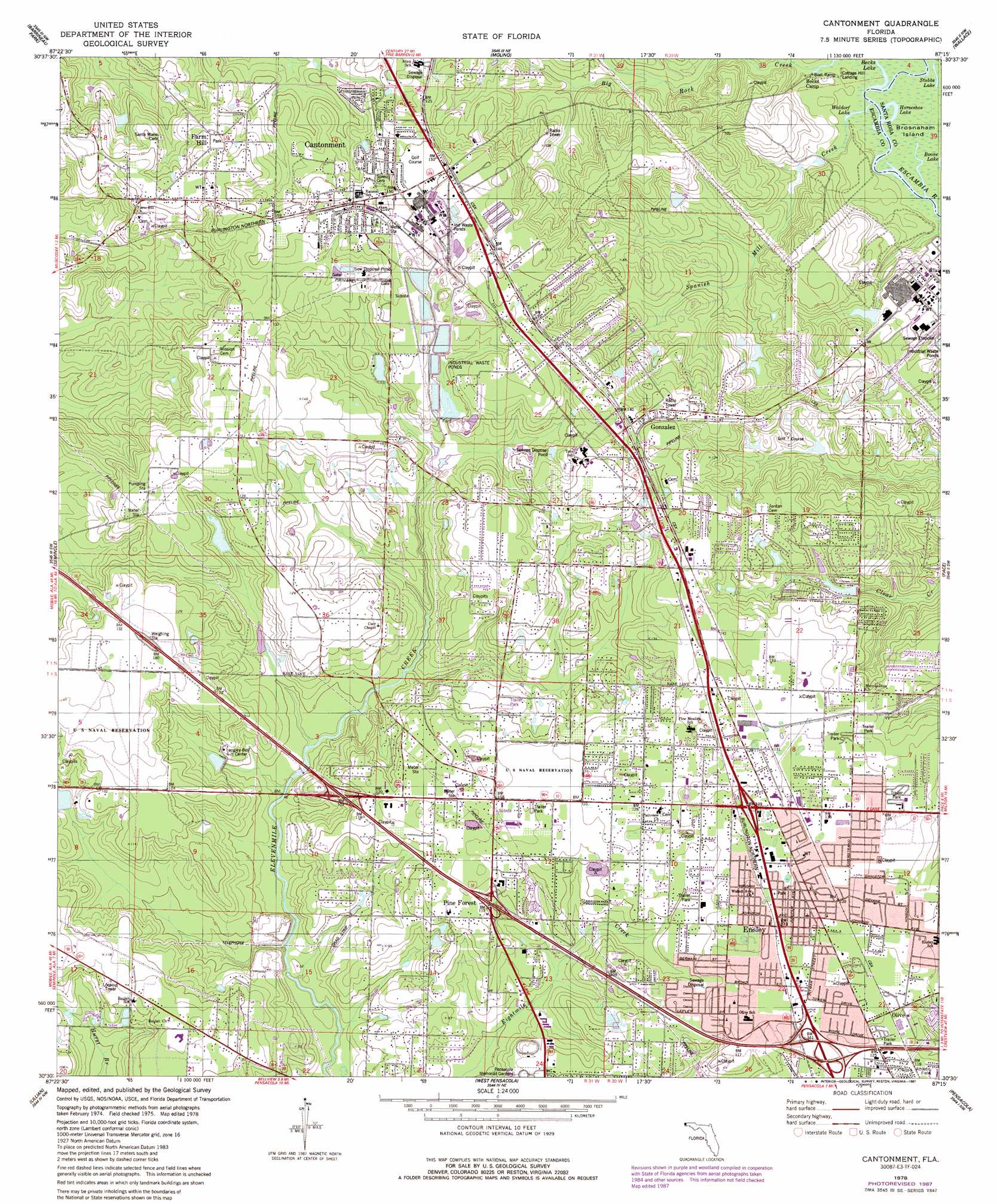
USGS Topo Quad 30087e3 - 1:24,000 scale
| Topo Map Name: | Cantonment |
| USGS Topo Quad ID: | 30087e3 |
| Print Size: | ca. 21 1/4" wide x 27" high |
| Southeast Coordinates: | 30.5° N latitude / 87.25° W longitude |
| Map Center Coordinates: | 30.5625° N latitude / 87.3125° W longitude |
| U.S. State: | FL |
| Filename: | O30087E3.jpg |
| Download Map JPG Image: | Cantonment topo map 1:24,000 scale |
| Map Type: | Topographic |
| Topo Series: | 7.5´ |
| Map Scale: | 1:24,000 |
| Source of Map Images: | United States Geological Survey (USGS) |
| Alternate Map Versions: |
Cantonment FL 1978, updated 1978 Download PDF Buy paper map Cantonment FL 1978, updated 1987 Download PDF Buy paper map Cantonment FL 1978, updated 1987 Download PDF Buy paper map Cantonment FL 1994, updated 2000 Download PDF Buy paper map Cantonment FL 2012 Download PDF Buy paper map Cantonment FL 2015 Download PDF Buy paper map |
1:24,000 Topo Quads surrounding Cantonment
Enon |
Bay Springs |
Mcdavid |
Chumuckla |
Allentown |
Gateswood |
Barrineau Park |
Molino |
Wallace |
Milton North |
Elsanor |
Seminole |
Cantonment |
Pace |
Milton South |
Elberta |
Lillian |
West Pensacola |
Pensacola |
Garcon Point |
Orange Beach |
Perdido Bay |
Fort Barrancas |
Gulf Breeze |
Oriole Beach |
> Back to 30087e1 at 1:100,000 scale
> Back to 30086a1 at 1:250,000 scale
> Back to U.S. Topo Maps home
Cantonment topo map: Gazetteer
Cantonment: Lakes
Horseshoe Lake elevation 1m 3′Stubbs Lake elevation 1m 3′
Waldorf Lake elevation 1m 3′
Cantonment: Parks
Escambia River State Wildlife Management Area elevation 1m 3′Cantonment: Populated Places
Cantonment elevation 45m 147′Ensley elevation 40m 131′
Farm Hill elevation 48m 157′
Gonzalez elevation 46m 150′
Olive elevation 40m 131′
Pine Forest elevation 35m 114′
Satsuma Heights elevation 40m 131′
Cantonment: Streams
Big Rock Creek elevation 2m 6′Spanish Mill Creek elevation 1m 3′
Cantonment digital topo map on disk
Buy this Cantonment topo map showing relief, roads, GPS coordinates and other geographical features, as a high-resolution digital map file on DVD:
Gulf Coast (LA, MS, AL, FL) & Southwestern Georgia
Buy digital topo maps: Gulf Coast (LA, MS, AL, FL) & Southwestern Georgia
 & Southwestern Georgia map DVD")