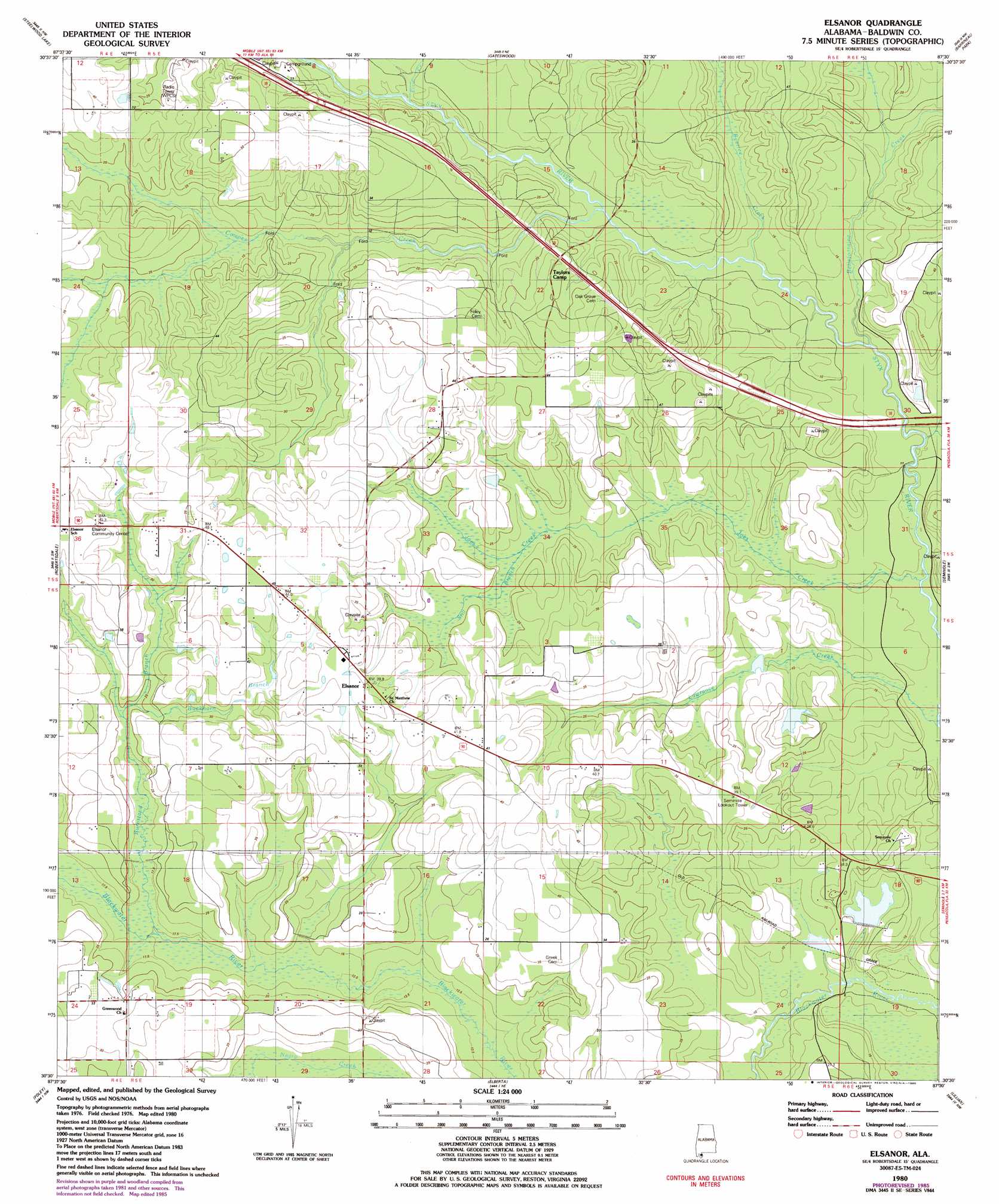
Elsanor Topo Map Alabama
To zoom in, hover over the map of Elsanor
USGS Topo Quad 30087e5 - 1:24,000 scale
| Topo Map Name: | Elsanor |
| USGS Topo Quad ID: | 30087e5 |
| Print Size: | ca. 21 1/4" wide x 27" high |
| Southeast Coordinates: | 30.5° N latitude / 87.5° W longitude |
| Map Center Coordinates: | 30.5625° N latitude / 87.5625° W longitude |
| U.S. State: | AL |
| Filename: | o30087e5.jpg |
| Download Map JPG Image: | Elsanor topo map 1:24,000 scale |
| Map Type: | Topographic |
| Topo Series: | 7.5´ |
| Map Scale: | 1:24,000 |
| Source of Map Images: | United States Geological Survey (USGS) |
| Alternate Map Versions: |
Elsanor AL 1980, updated 1981 Download PDF Buy paper map Elsanor AL 1980, updated 1985 Download PDF Buy paper map Elsanor AL 1980, updated 1985 Download PDF Buy paper map Elsanor AL 2011 Download PDF Buy paper map Elsanor AL 2014 Download PDF Buy paper map |
1:24,000 Topo Quads surrounding Elsanor
Bay Minette South |
Dogwood Creek |
Enon |
Bay Springs |
Mcdavid |
Stapleton |
Steelwood Lake |
Gateswood |
Barrineau Park |
Molino |
Silverhill |
Robertsdale |
Elsanor |
Seminole |
Cantonment |
Magnolia Springs |
Foley |
Elberta |
Lillian |
West Pensacola |
Bon Secour Bay |
Gulf Shores |
Orange Beach |
Perdido Bay |
Fort Barrancas |
> Back to 30087e1 at 1:100,000 scale
> Back to 30086a1 at 1:250,000 scale
> Back to U.S. Topo Maps home
Elsanor topo map: Gazetteer
Elsanor: Airports
Wallace Field elevation 39m 127′Elsanor: Crossings
Lees Ferry (historical) elevation 10m 32′Elsanor: Dams
Bob Pace Dam elevation 13m 42′Cook Lake Dam elevation 8m 26′
Elsanor: Populated Places
Elsanor elevation 41m 134′Elsanor: Reservoirs
Cook Lake elevation 8m 26′Pace Lake elevation 13m 42′
Elsanor: Streams
Allen Spring Branch elevation 6m 19′Bear Branch elevation 5m 16′
Beetree Creek elevation 9m 29′
Bellefontaine Creek elevation 5m 16′
Buckhorn Branch elevation 23m 75′
Burnstand Branch elevation 16m 52′
Cowpen Creek elevation 10m 32′
Elam Creek elevation 10m 32′
Horsecollar Branch elevation 6m 19′
Joes Creek elevation 4m 13′
Lawrence Creek elevation 4m 13′
Still Branch elevation 18m 59′
Waterhole Branch elevation 18m 59′
Elsanor digital topo map on disk
Buy this Elsanor topo map showing relief, roads, GPS coordinates and other geographical features, as a high-resolution digital map file on DVD:
Gulf Coast (LA, MS, AL, FL) & Southwestern Georgia
Buy digital topo maps: Gulf Coast (LA, MS, AL, FL) & Southwestern Georgia
 & Southwestern Georgia map DVD")