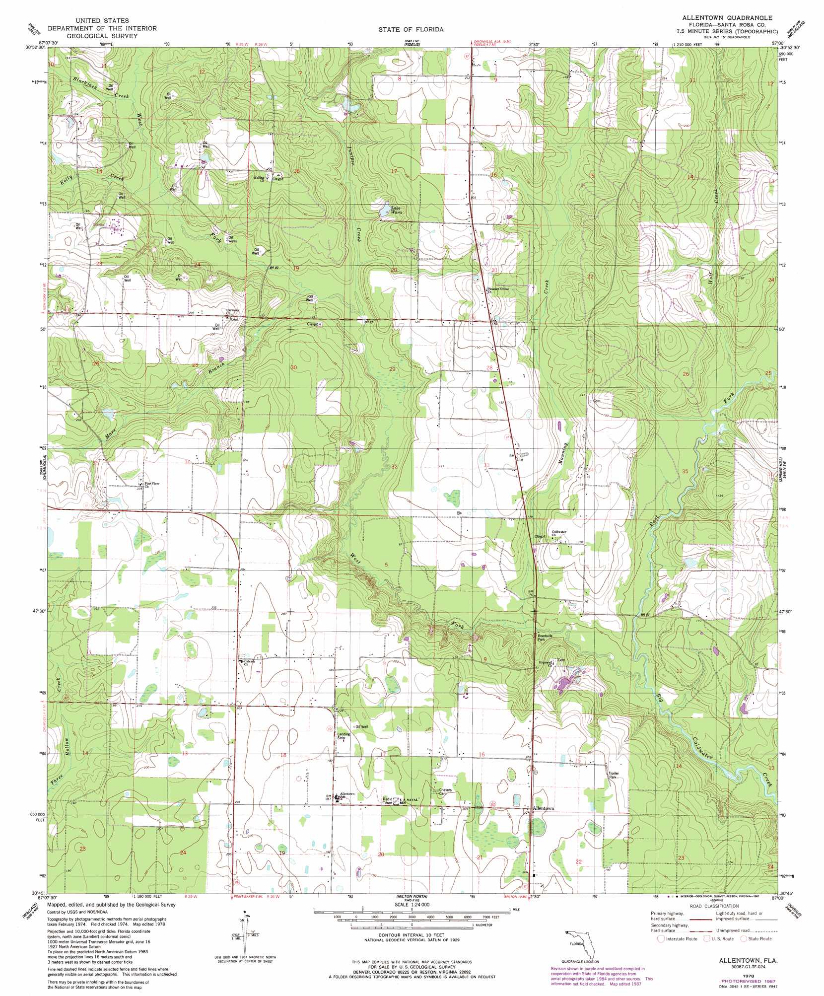
Allentown Topo Map Florida
To zoom in, hover over the map of Allentown
USGS Topo Quad 30087g1 - 1:24,000 scale
| Topo Map Name: | Allentown |
| USGS Topo Quad ID: | 30087g1 |
| Print Size: | ca. 21 1/4" wide x 27" high |
| Southeast Coordinates: | 30.75° N latitude / 87° W longitude |
| Map Center Coordinates: | 30.8125° N latitude / 87.0625° W longitude |
| U.S. State: | FL |
| Filename: | O30087G1.jpg |
| Download Map JPG Image: | Allentown topo map 1:24,000 scale |
| Map Type: | Topographic |
| Topo Series: | 7.5´ |
| Map Scale: | 1:24,000 |
| Source of Map Images: | United States Geological Survey (USGS) |
| Alternate Map Versions: |
Allentown FL 1978, updated 1978 Download PDF Buy paper map Allentown FL 1978, updated 1987 Download PDF Buy paper map Allentown FL 1994, updated 1998 Download PDF Buy paper map Allentown FL 2012 Download PDF Buy paper map Allentown FL 2015 Download PDF Buy paper map |
1:24,000 Topo Quads surrounding Allentown
Flomaton |
Pollard |
Brewton South |
Roberts |
Parker Springs |
Century |
Jay |
Fidelis |
Mclellan |
Hurricane Lake |
Mcdavid |
Chumuckla |
Allentown |
Spring Hill |
Munson |
Molino |
Wallace |
Milton North |
Harold |
Floridale |
Cantonment |
Pace |
Milton South |
Ward Basin |
Harold Se |
> Back to 30087e1 at 1:100,000 scale
> Back to 30086a1 at 1:250,000 scale
> Back to U.S. Topo Maps home
Allentown topo map: Gazetteer
Allentown: Airports
Porter Stolport elevation 54m 177′Allentown: Populated Places
Allentown elevation 61m 200′Allentown: Reservoirs
Lake Wami elevation 32m 104′Allentown: Streams
Bass Brinks Creek elevation 9m 29′Blackjack Creek elevation 27m 88′
East Fork Big Coldwater Creek elevation 11m 36′
Juniper Creek elevation 22m 72′
Kelly Creek elevation 26m 85′
Manning Creek elevation 13m 42′
Mare Branch elevation 22m 72′
West Fork Big Coldwater Creek elevation 11m 36′
Wolf Creek elevation 18m 59′
Allentown digital topo map on disk
Buy this Allentown topo map showing relief, roads, GPS coordinates and other geographical features, as a high-resolution digital map file on DVD:
Gulf Coast (LA, MS, AL, FL) & Southwestern Georgia
Buy digital topo maps: Gulf Coast (LA, MS, AL, FL) & Southwestern Georgia
 & Southwestern Georgia map DVD")