Horn Island West Topo Map Mississippi
To zoom in, hover over the map of Horn Island West
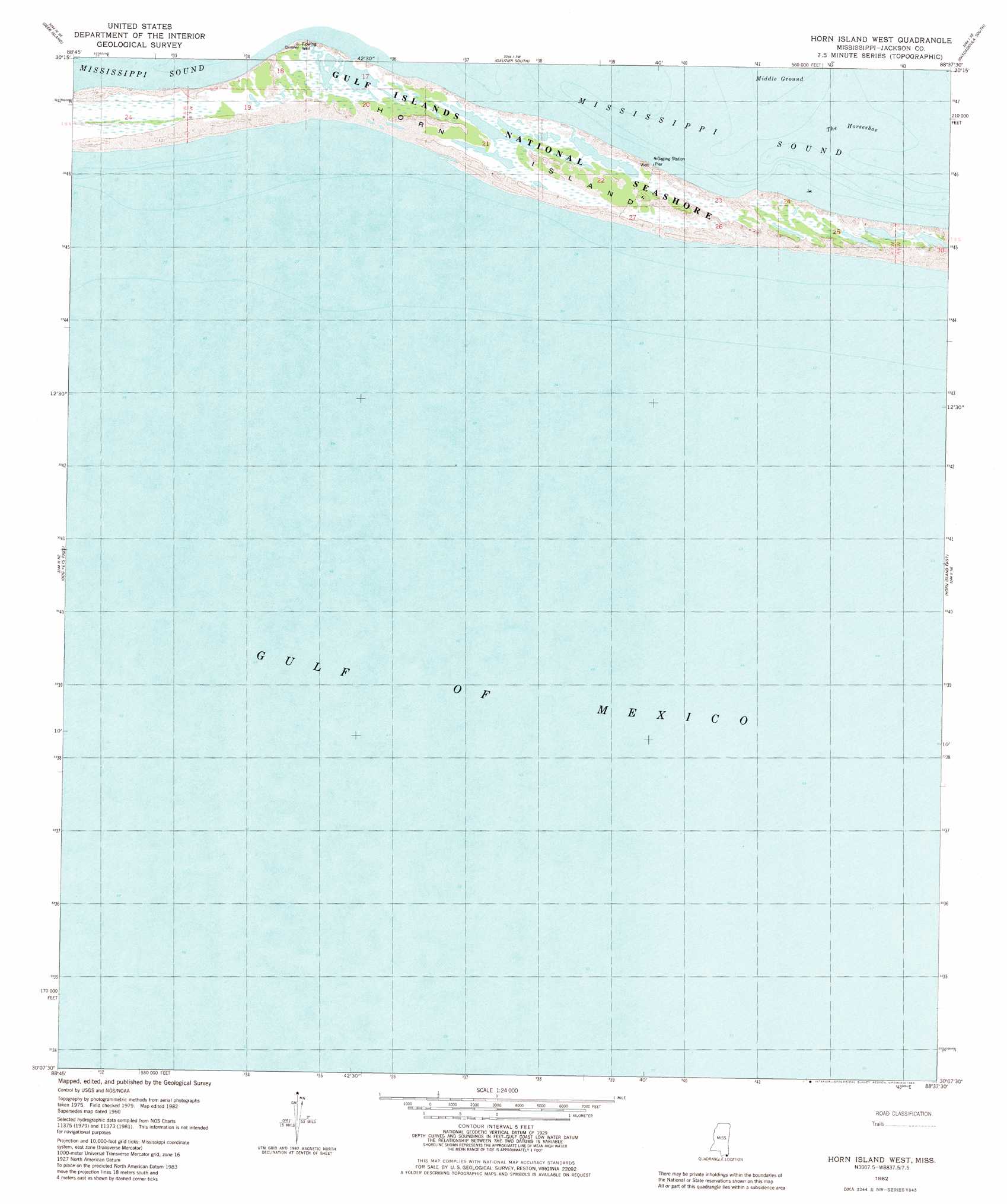
USGS Topo Quad 30088b6 - 1:24,000 scale
| Topo Map Name: | Horn Island West |
| USGS Topo Quad ID: | 30088b6 |
| Print Size: | ca. 21 1/4" wide x 27" high |
| Southeast Coordinates: | 30.125° N latitude / 88.625° W longitude |
| Map Center Coordinates: | 30.1875° N latitude / 88.6875° W longitude |
| U.S. State: | MS |
| Filename: | o30088b6.jpg |
| Download Map JPG Image: | Horn Island West topo map 1:24,000 scale |
| Map Type: | Topographic |
| Topo Series: | 7.5´ |
| Map Scale: | 1:24,000 |
| Source of Map Images: | United States Geological Survey (USGS) |
| Alternate Map Versions: |
Horn Island West MS 1960, updated 1961 Download PDF Buy paper map Horn Island West MS 1982, updated 1983 Download PDF Buy paper map Horn Island West MS 1982, updated 1983 Download PDF Buy paper map Horn Island West MS 2000, updated 2001 Download PDF Buy paper map Horn Island West MS 2012 Download PDF Buy paper map Horn Island West MS 2015 Download PDF Buy paper map |
1:24,000 Topo Quads surrounding Horn Island West
Biloxi |
Ocean Springs |
Gautier North |
Pascagoula North |
Kreole |
Deer Island |
Gautier South |
Pascagoula South |
Grand Bay Sw |
|
Ship Island |
Dog Keys Pass |
Horn Island West |
Horn Island East |
Petit Bois Island |
Chandeleur Light |
||||
North Islands |
> Back to 30088a1 at 1:100,000 scale
> Back to 30088a1 at 1:250,000 scale
> Back to U.S. Topo Maps home
Horn Island West topo map: Gazetteer
Horn Island West: Bars
The Horseshoe elevation 0m 0′Horn Island West: Islands
Horn Island elevation 2m 6′Horn Island West: Parks
Gulf Islands National Seashore elevation 1m 3′Horn Island National Wildlife Refuge (historical) elevation 2m 6′
Horn Island West digital topo map on disk
Buy this Horn Island West topo map showing relief, roads, GPS coordinates and other geographical features, as a high-resolution digital map file on DVD:
Gulf Coast (LA, MS, AL, FL) & Southwestern Georgia
Buy digital topo maps: Gulf Coast (LA, MS, AL, FL) & Southwestern Georgia
 & Southwestern Georgia map DVD")