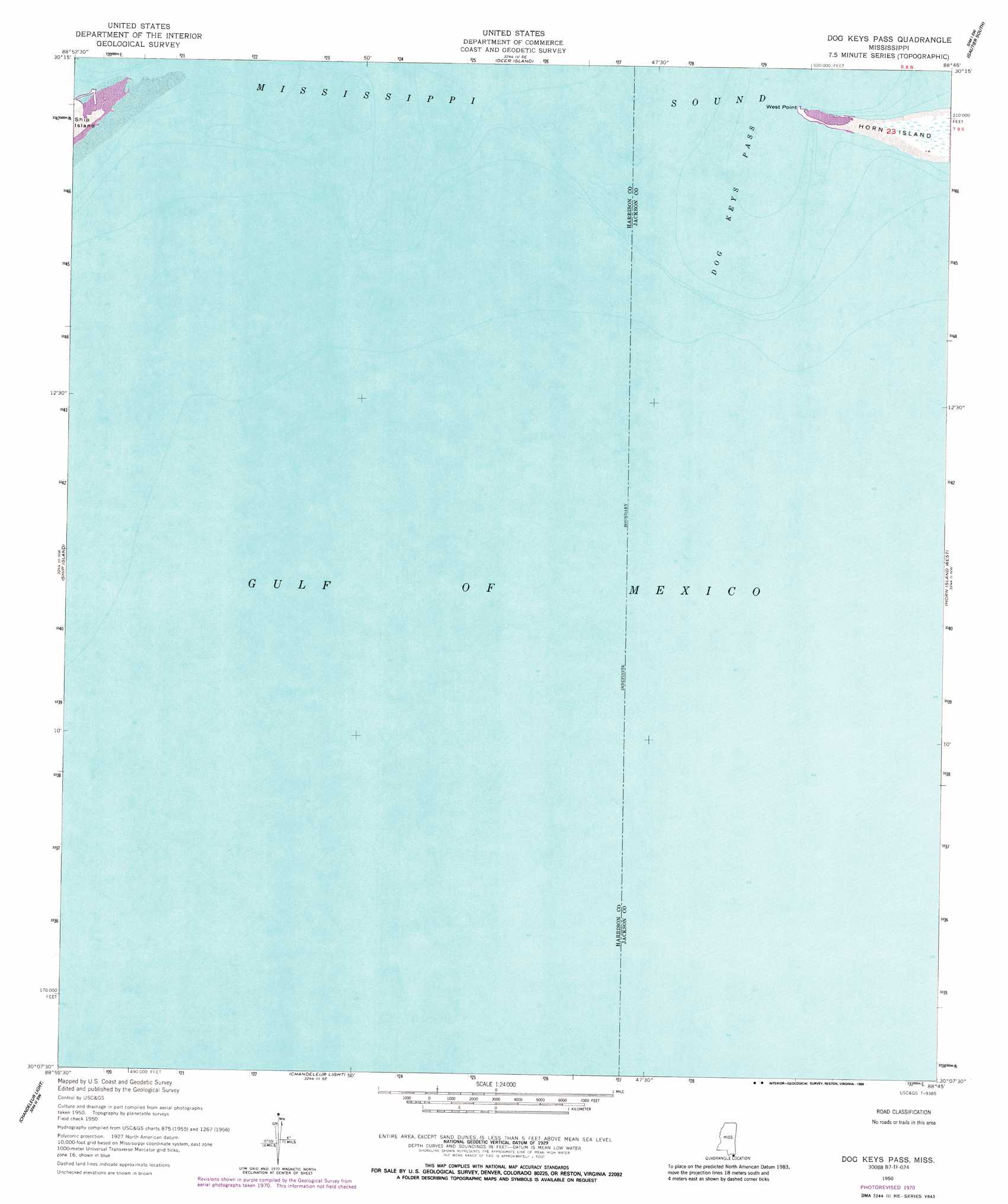
Dog Keys Pass Topo Map Mississippi
To zoom in, hover over the map of Dog Keys Pass
USGS Topo Quad 30088b7 - 1:24,000 scale
| Topo Map Name: | Dog Keys Pass |
| USGS Topo Quad ID: | 30088b7 |
| Print Size: | ca. 21 1/4" wide x 27" high |
| Southeast Coordinates: | 30.125° N latitude / 88.75° W longitude |
| Map Center Coordinates: | 30.1875° N latitude / 88.8125° W longitude |
| U.S. State: | MS |
| Filename: | o30088b7.jpg |
| Download Map JPG Image: | Dog Keys Pass topo map 1:24,000 scale |
| Map Type: | Topographic |
| Topo Series: | 7.5´ |
| Map Scale: | 1:24,000 |
| Source of Map Images: | United States Geological Survey (USGS) |
| Alternate Map Versions: |
Dog Keys Pass MS 1950, updated 1958 Download PDF Buy paper map Dog Keys Pass MS 1950, updated 1971 Download PDF Buy paper map Dog Keys Pass MS 1950, updated 1988 Download PDF Buy paper map Dog Keys Pass MS 2012 Download PDF Buy paper map Dog Keys Pass MS 2015 Download PDF Buy paper map |
1:24,000 Topo Quads surrounding Dog Keys Pass
Gulfport North |
Biloxi |
Ocean Springs |
Gautier North |
Pascagoula North |
Gulfport South |
Deer Island |
Gautier South |
Pascagoula South |
|
Cat Island |
Ship Island |
Dog Keys Pass |
Horn Island West |
Horn Island East |
Chandeleur Light |
||||
North Islands |
> Back to 30088a1 at 1:100,000 scale
> Back to 30088a1 at 1:250,000 scale
> Back to U.S. Topo Maps home
Dog Keys Pass topo map: Gazetteer
Dog Keys Pass: Capes
East Point elevation 1m 3′West Point elevation 0m 0′
Dog Keys Pass: Channels
Dog Keys Pass elevation 0m 0′Dog Keys Pass: Islands
Dog Island (historical) elevation 0m 0′Dog Keys Pass digital topo map on disk
Buy this Dog Keys Pass topo map showing relief, roads, GPS coordinates and other geographical features, as a high-resolution digital map file on DVD:
Gulf Coast (LA, MS, AL, FL) & Southwestern Georgia
Buy digital topo maps: Gulf Coast (LA, MS, AL, FL) & Southwestern Georgia
 & Southwestern Georgia map DVD")