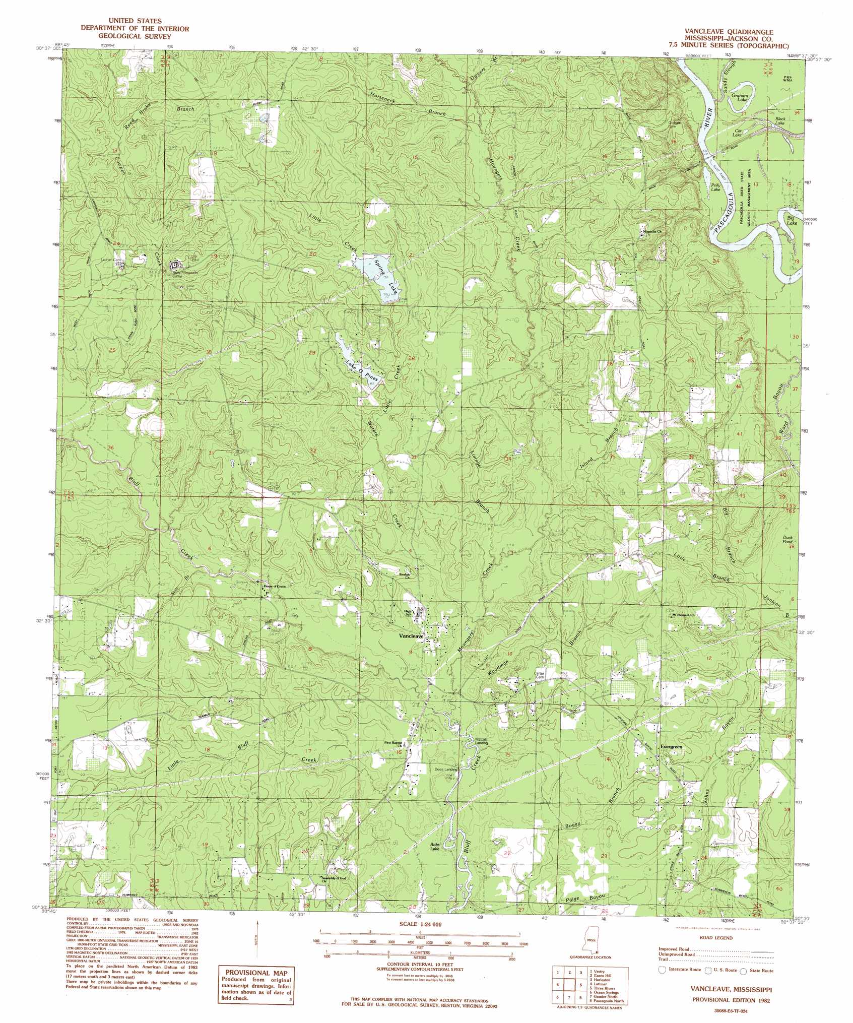
Vancleave Topo Map Mississippi
To zoom in, hover over the map of Vancleave
USGS Topo Quad 30088e6 - 1:24,000 scale
| Topo Map Name: | Vancleave |
| USGS Topo Quad ID: | 30088e6 |
| Print Size: | ca. 21 1/4" wide x 27" high |
| Southeast Coordinates: | 30.5° N latitude / 88.625° W longitude |
| Map Center Coordinates: | 30.5625° N latitude / 88.6875° W longitude |
| U.S. State: | MS |
| Filename: | o30088e6.jpg |
| Download Map JPG Image: | Vancleave topo map 1:24,000 scale |
| Map Type: | Topographic |
| Topo Series: | 7.5´ |
| Map Scale: | 1:24,000 |
| Source of Map Images: | United States Geological Survey (USGS) |
| Alternate Map Versions: |
Vancleave MS 1982, updated 1982 Download PDF Buy paper map Vancleave MS 1982, updated 1982 Download PDF Buy paper map Vancleave MS 2012 Download PDF Buy paper map Vancleave MS 2015 Download PDF Buy paper map |
1:24,000 Topo Quads surrounding Vancleave
Ramsey Springs |
Benndale |
Basin |
Agricola |
Howell |
Beatrice |
Vestry |
Easen Hill |
Harleston |
Hurley |
White Plains |
Latimer |
Vancleave |
Three Rivers |
Big Point |
Biloxi |
Ocean Springs |
Gautier North |
Pascagoula North |
Kreole |
Deer Island |
Gautier South |
Pascagoula South |
Grand Bay Sw |
> Back to 30088e1 at 1:100,000 scale
> Back to 30088a1 at 1:250,000 scale
> Back to U.S. Topo Maps home
Vancleave topo map: Gazetteer
Vancleave: Crossings
Graham Ferry elevation 37m 121′Vancleave: Dams
Lake of Pines Dam elevation 23m 75′Spring Lake Dam elevation 30m 98′
Vancleave: Lakes
Big Lake elevation 3m 9′Black Lake elevation 6m 19′
Bobs Lake elevation 1m 3′
Cat Lake elevation 5m 16′
Duck Pond (historical) elevation 24m 78′
Graham Lake elevation 5m 16′
Polly Lake elevation 7m 22′
Vancleave: Populated Places
Dees Landing elevation 2m 6′Evergreen elevation 17m 55′
McCall Landing elevation 1m 3′
Vancleave elevation 9m 29′
Vancleave: Reservoirs
O Pines Lake elevation 20m 65′Spring Lake elevation 22m 72′
Vancleave: Streams
Cowpen Creek elevation 9m 29′Dwyer Branch elevation 16m 52′
Horseneck Branch elevation 15m 49′
Island Branch elevation 4m 13′
Little Creek elevation 11m 36′
Livings Branch elevation 3m 9′
Moungers Creek elevation 1m 3′
Reed Brake Branch elevation 26m 85′
Still Branch elevation 5m 16′
Waters Creek elevation 2m 6′
Woodman Branch elevation 1m 3′
Vancleave digital topo map on disk
Buy this Vancleave topo map showing relief, roads, GPS coordinates and other geographical features, as a high-resolution digital map file on DVD:
Gulf Coast (LA, MS, AL, FL) & Southwestern Georgia
Buy digital topo maps: Gulf Coast (LA, MS, AL, FL) & Southwestern Georgia
 & Southwestern Georgia map DVD")