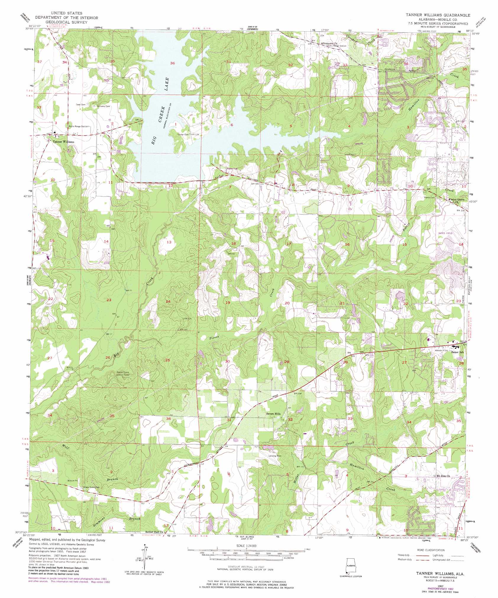
Tanner Williams Topo Map Alabama
To zoom in, hover over the map of Tanner Williams
USGS Topo Quad 30088f3 - 1:24,000 scale
| Topo Map Name: | Tanner Williams |
| USGS Topo Quad ID: | 30088f3 |
| Print Size: | ca. 21 1/4" wide x 27" high |
| Southeast Coordinates: | 30.625° N latitude / 88.25° W longitude |
| Map Center Coordinates: | 30.6875° N latitude / 88.3125° W longitude |
| U.S. State: | AL |
| Filename: | o30088f3.jpg |
| Download Map JPG Image: | Tanner Williams topo map 1:24,000 scale |
| Map Type: | Topographic |
| Topo Series: | 7.5´ |
| Map Scale: | 1:24,000 |
| Source of Map Images: | United States Geological Survey (USGS) |
| Alternate Map Versions: |
Tanner Williams AL 1957, updated 1958 Download PDF Buy paper map Tanner Williams AL 1957, updated 1967 Download PDF Buy paper map Tanner Williams AL 1957, updated 1975 Download PDF Buy paper map Tanner Williams AL 1957, updated 1983 Download PDF Buy paper map Tanner Williams AL 1957, updated 1984 Download PDF Buy paper map Tanner Williams AL 2011 Download PDF Buy paper map Tanner Williams AL 2014 Download PDF Buy paper map |
1:24,000 Topo Quads surrounding Tanner Williams
Lucedale |
Earlville |
Georgetown |
Chunchula |
Creola |
Agricola |
Howell |
Semmes |
Kushla |
Chickasaw |
Harleston |
Hurley |
Tanner Williams |
Spring Hill |
Mobile |
Three Rivers |
Big Point |
Saint Elmo |
Theodore |
Hollingers Island |
Pascagoula North |
Kreole |
Grand Bay |
Coden |
Bellefontaine |
> Back to 30088e1 at 1:100,000 scale
> Back to 30088a1 at 1:250,000 scale
> Back to U.S. Topo Maps home
Tanner Williams topo map: Gazetteer
Tanner Williams: Dams
Big Creek Lake Dam elevation 25m 82′W E Schmidt Dam elevation 52m 170′
Tanner Williams: Populated Places
Alderbrook elevation 45m 147′Cottage Park Estates elevation 55m 180′
Dawes Point elevation 55m 180′
Howells Ferry Heights elevation 47m 154′
Petaluma elevation 55m 180′
Ponderosa elevation 57m 187′
Scenic Hills elevation 68m 223′
Seven Hills elevation 54m 177′
Tanner Williams elevation 55m 180′
Tanner Williams: Reservoirs
Big Creek Lake elevation 37m 121′Tanner Williams: Streams
Hamilton Creek elevation 34m 111′Hamilton Creek elevation 30m 98′
Pierce Creek elevation 12m 39′
Tanner Williams digital topo map on disk
Buy this Tanner Williams topo map showing relief, roads, GPS coordinates and other geographical features, as a high-resolution digital map file on DVD:
Gulf Coast (LA, MS, AL, FL) & Southwestern Georgia
Buy digital topo maps: Gulf Coast (LA, MS, AL, FL) & Southwestern Georgia
 & Southwestern Georgia map DVD")