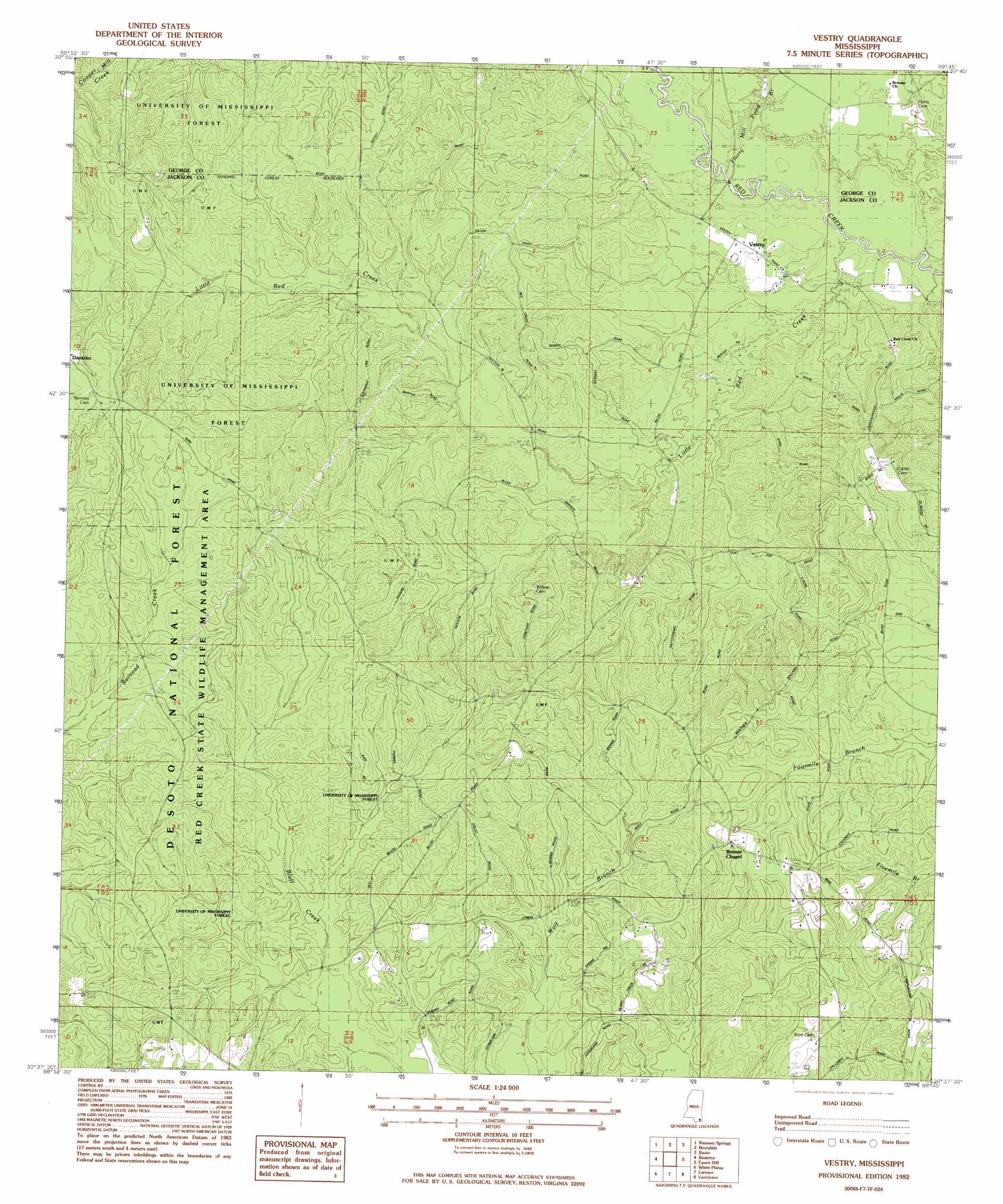
Vestry Topo Map Mississippi
To zoom in, hover over the map of Vestry
USGS Topo Quad 30088f7 - 1:24,000 scale
| Topo Map Name: | Vestry |
| USGS Topo Quad ID: | 30088f7 |
| Print Size: | ca. 21 1/4" wide x 27" high |
| Southeast Coordinates: | 30.625° N latitude / 88.75° W longitude |
| Map Center Coordinates: | 30.6875° N latitude / 88.8125° W longitude |
| U.S. State: | MS |
| Filename: | o30088f7.jpg |
| Download Map JPG Image: | Vestry topo map 1:24,000 scale |
| Map Type: | Topographic |
| Topo Series: | 7.5´ |
| Map Scale: | 1:24,000 |
| Source of Map Images: | United States Geological Survey (USGS) |
| Alternate Map Versions: |
Vestry MS 1982, updated 1982 Download PDF Buy paper map Vestry MS 1982, updated 1982 Download PDF Buy paper map Vestry MS 2012 Download PDF Buy paper map Vestry MS 2015 Download PDF Buy paper map |
| FStopo: | US Forest Service topo Vestry is available: Download FStopo PDF Download FStopo TIF |
1:24,000 Topo Quads surrounding Vestry
Bond Pond |
Barbara |
Avent |
Merrill |
Lucedale |
Whites Crossing |
Ramsey Springs |
Benndale |
Basin |
Agricola |
Airey |
Beatrice |
Vestry |
Easen Hill |
Harleston |
Success |
White Plains |
Latimer |
Vancleave |
Three Rivers |
Gulfport North |
Biloxi |
Ocean Springs |
Gautier North |
Pascagoula North |
> Back to 30088e1 at 1:100,000 scale
> Back to 30088a1 at 1:250,000 scale
> Back to U.S. Topo Maps home
Vestry topo map: Gazetteer
Vestry: Populated Places
Vestry elevation 12m 39′Vestry: Streams
Flurry Mill Pond Branch elevation 10m 32′Little Red Creek elevation 8m 26′
Vestry digital topo map on disk
Buy this Vestry topo map showing relief, roads, GPS coordinates and other geographical features, as a high-resolution digital map file on DVD:
Gulf Coast (LA, MS, AL, FL) & Southwestern Georgia
Buy digital topo maps: Gulf Coast (LA, MS, AL, FL) & Southwestern Georgia
 & Southwestern Georgia map DVD")