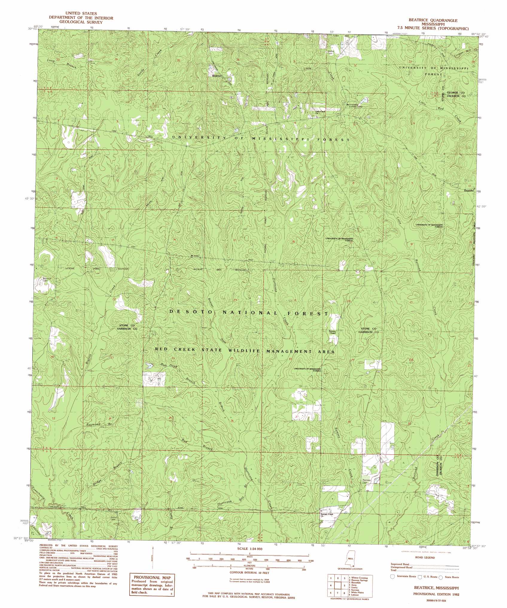
Beatrice Topo Map Mississippi
To zoom in, hover over the map of Beatrice
USGS Topo Quad 30088f8 - 1:24,000 scale
| Topo Map Name: | Beatrice |
| USGS Topo Quad ID: | 30088f8 |
| Print Size: | ca. 21 1/4" wide x 27" high |
| Southeast Coordinates: | 30.625° N latitude / 88.875° W longitude |
| Map Center Coordinates: | 30.6875° N latitude / 88.9375° W longitude |
| U.S. State: | MS |
| Filename: | o30088f8.jpg |
| Download Map JPG Image: | Beatrice topo map 1:24,000 scale |
| Map Type: | Topographic |
| Topo Series: | 7.5´ |
| Map Scale: | 1:24,000 |
| Source of Map Images: | United States Geological Survey (USGS) |
| Alternate Map Versions: |
Beatrice MS 1982, updated 1982 Download PDF Buy paper map Beatrice MS 2012 Download PDF Buy paper map Beatrice MS 2015 Download PDF Buy paper map |
| FStopo: | US Forest Service topo Beatrice is available: Download FStopo PDF Download FStopo TIF |
1:24,000 Topo Quads surrounding Beatrice
Bond |
Bond Pond |
Barbara |
Avent |
Merrill |
Wiggins |
Whites Crossing |
Ramsey Springs |
Benndale |
Basin |
Mchenry |
Airey |
Beatrice |
Vestry |
Easen Hill |
Wortham |
Success |
White Plains |
Latimer |
Vancleave |
Gulfport Nw |
Gulfport North |
Biloxi |
Ocean Springs |
Gautier North |
> Back to 30088e1 at 1:100,000 scale
> Back to 30088a1 at 1:250,000 scale
> Back to U.S. Topo Maps home
Beatrice topo map: Gazetteer
Beatrice: Dams
Merts Bond Lake Dam elevation 46m 150′Beatrice: Parks
Red Creek State Wildlife Management Area elevation 40m 131′Beatrice: Populated Places
Beatrice elevation 49m 160′Dantzler elevation 52m 170′
Beatrice: Streams
Beaver Dam Branch elevation 23m 75′Bigfoot Creek elevation 19m 62′
Bridge Branch elevation 19m 62′
Bud Branch elevation 21m 68′
Butt Head Branch elevation 25m 82′
Little Railroad Creek elevation 31m 101′
Raymond Branch elevation 26m 85′
Beatrice digital topo map on disk
Buy this Beatrice topo map showing relief, roads, GPS coordinates and other geographical features, as a high-resolution digital map file on DVD:
Gulf Coast (LA, MS, AL, FL) & Southwestern Georgia
Buy digital topo maps: Gulf Coast (LA, MS, AL, FL) & Southwestern Georgia
 & Southwestern Georgia map DVD")