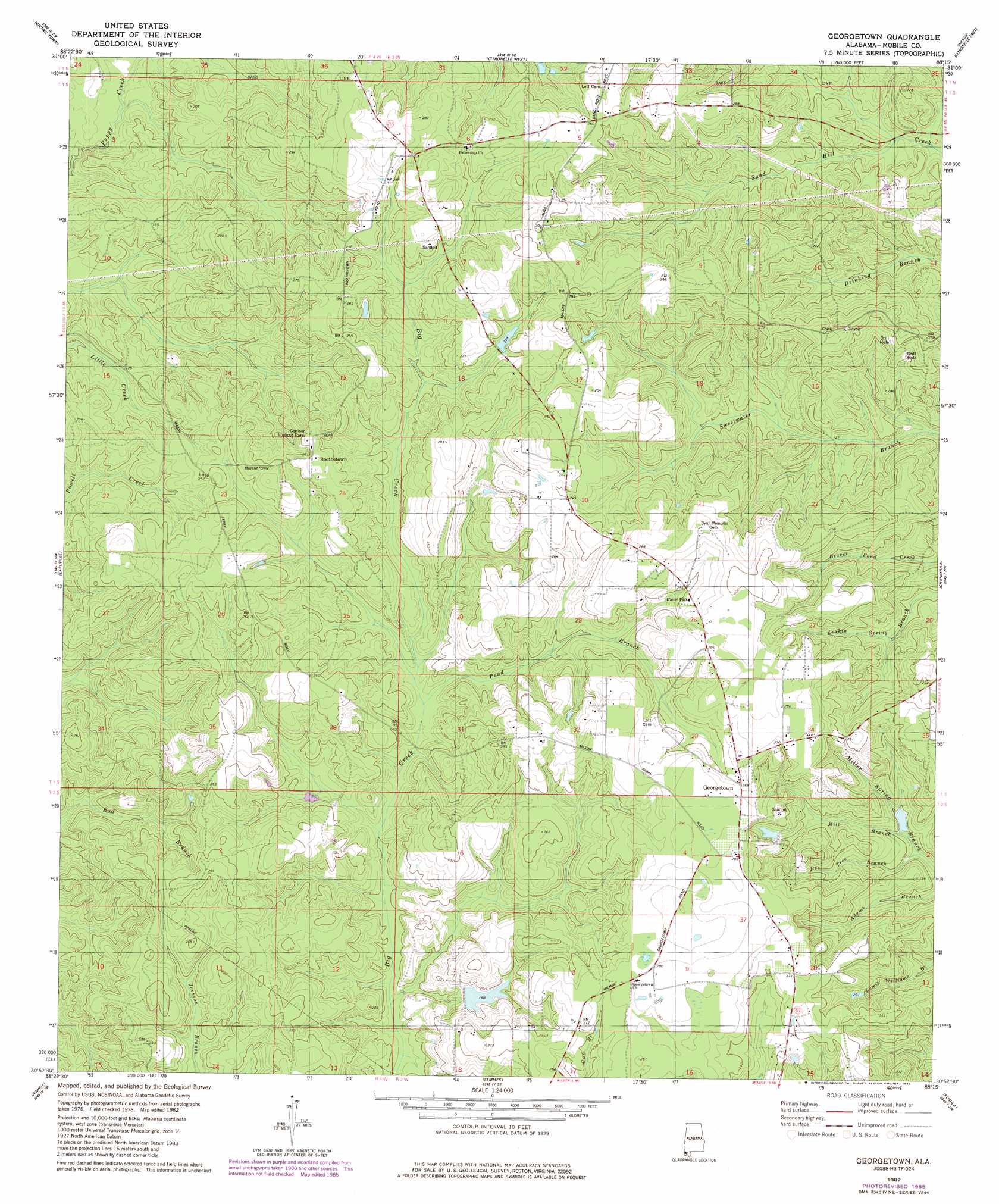
Georgetown Topo Map Alabama
To zoom in, hover over the map of Georgetown
USGS Topo Quad 30088h3 - 1:24,000 scale
| Topo Map Name: | Georgetown |
| USGS Topo Quad ID: | 30088h3 |
| Print Size: | ca. 21 1/4" wide x 27" high |
| Southeast Coordinates: | 30.875° N latitude / 88.25° W longitude |
| Map Center Coordinates: | 30.9375° N latitude / 88.3125° W longitude |
| U.S. State: | AL |
| Filename: | o30088h3.jpg |
| Download Map JPG Image: | Georgetown topo map 1:24,000 scale |
| Map Type: | Topographic |
| Topo Series: | 7.5´ |
| Map Scale: | 1:24,000 |
| Source of Map Images: | United States Geological Survey (USGS) |
| Alternate Map Versions: |
Georgetown AL 1982, updated 1982 Download PDF Buy paper map Georgetown AL 1982, updated 1984 Download PDF Buy paper map Georgetown AL 1982, updated 1985 Download PDF Buy paper map Georgetown AL 2011 Download PDF Buy paper map Georgetown AL 2014 Download PDF Buy paper map |
1:24,000 Topo Quads surrounding Georgetown
Leakesville |
Rounsaville |
Deer Park |
Sims Chapel |
Calvert |
Vernal |
Brown Town |
Citronelle West |
Citronelle East |
Mount Vernon |
Lucedale |
Earlville |
Georgetown |
Chunchula |
Creola |
Agricola |
Howell |
Semmes |
Kushla |
Chickasaw |
Harleston |
Hurley |
Tanner Williams |
Spring Hill |
Mobile |
> Back to 30088e1 at 1:100,000 scale
> Back to 30088a1 at 1:250,000 scale
> Back to U.S. Topo Maps home
Georgetown topo map: Gazetteer
Georgetown: Dams
R L Lambert Dam elevation 72m 236′Georgetown: Populated Places
Boothetown elevation 83m 272′Georgetown elevation 82m 269′
Georgetown: Streams
Adams Branch elevation 45m 147′Bad Branch elevation 55m 180′
Bee Tree Branch elevation 41m 134′
Mill Branch elevation 42m 137′
Pond Branch elevation 55m 180′
Georgetown digital topo map on disk
Buy this Georgetown topo map showing relief, roads, GPS coordinates and other geographical features, as a high-resolution digital map file on DVD:
Gulf Coast (LA, MS, AL, FL) & Southwestern Georgia
Buy digital topo maps: Gulf Coast (LA, MS, AL, FL) & Southwestern Georgia
 & Southwestern Georgia map DVD")