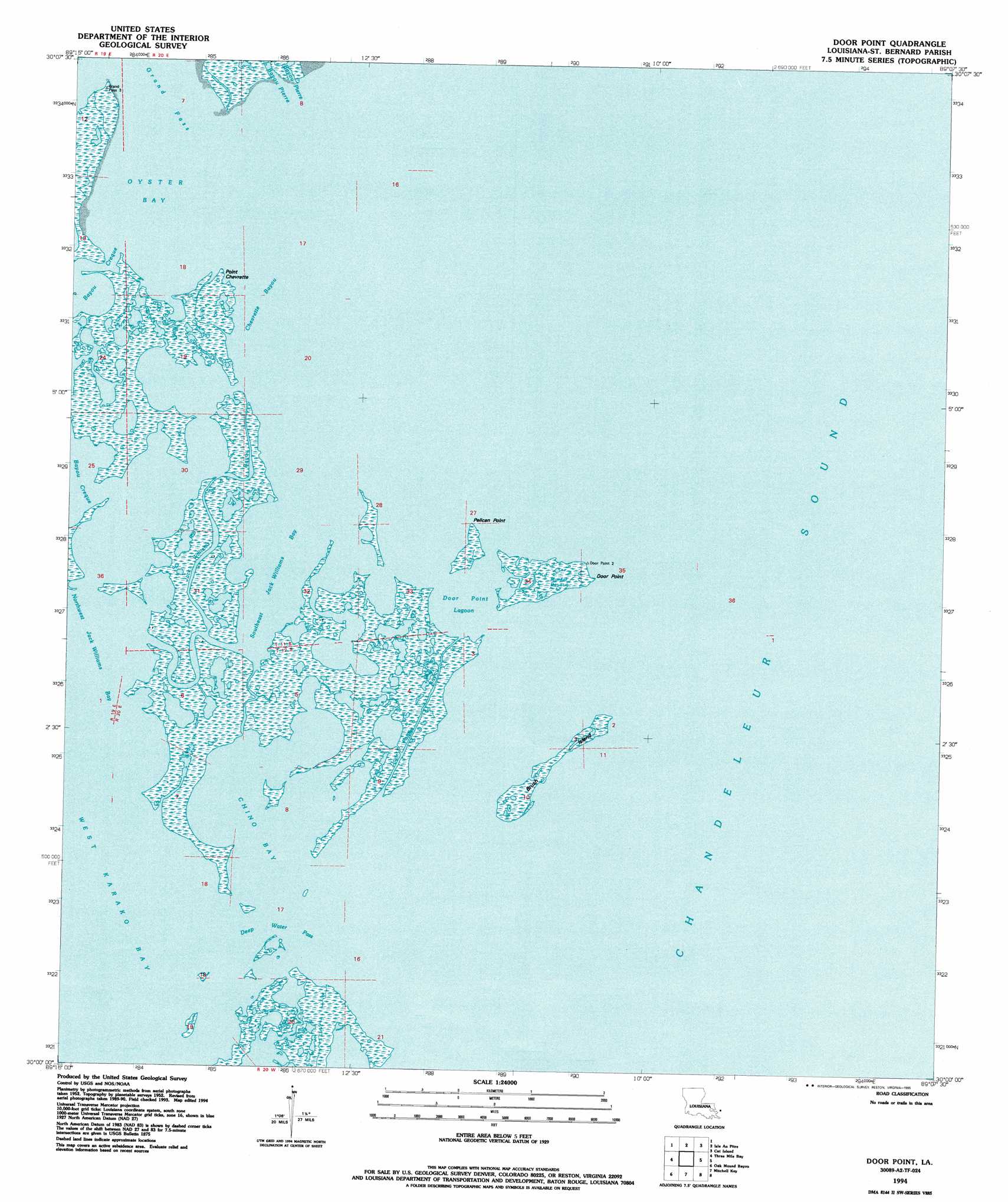
Door Point Topo Map Louisiana
To zoom in, hover over the map of Door Point
USGS Topo Quad 30089a2 - 1:24,000 scale
| Topo Map Name: | Door Point |
| USGS Topo Quad ID: | 30089a2 |
| Print Size: | ca. 21 1/4" wide x 27" high |
| Southeast Coordinates: | 30° N latitude / 89.125° W longitude |
| Map Center Coordinates: | 30.0625° N latitude / 89.1875° W longitude |
| U.S. State: | LA |
| Filename: | o30089a2.jpg |
| Download Map JPG Image: | Door Point topo map 1:24,000 scale |
| Map Type: | Topographic |
| Topo Series: | 7.5´ |
| Map Scale: | 1:24,000 |
| Source of Map Images: | United States Geological Survey (USGS) |
| Alternate Map Versions: |
Door Point LA 1955, updated 1959 Download PDF Buy paper map Door Point LA 1955, updated 1976 Download PDF Buy paper map Door Point LA 1994, updated 1995 Download PDF Buy paper map Door Point LA 2012 Download PDF Buy paper map Door Point LA 2015 Download PDF Buy paper map |
1:24,000 Topo Quads surrounding Door Point
Waveland |
Bay Saint Louis |
Pass Christian |
Gulfport South |
|
Grand Island Pass |
Isle Au Pitre |
Cat Island |
Ship Island |
|
Malheureux Point |
Three Mile Bay |
Door Point |
||
Lake Eugenie |
Oak Mound Bayou |
Mitchell Key |
||
Lake Eloi |
Morgan Harbor |
Freemason Islands |
> Back to 30089a1 at 1:100,000 scale
> Back to 30088a1 at 1:250,000 scale
> Back to U.S. Topo Maps home
Door Point topo map: Gazetteer
Door Point: Bays
Chino Bay elevation 0m 0′Door Point Lagoon elevation 0m 0′
Oyster Bay elevation 0m 0′
Southeast Jack Williams Bay elevation 0m 0′
Door Point: Capes
Door Point elevation 1m 3′Pelican Point elevation 0m 0′
Point Chevrette elevation 1m 3′
Door Point: Channels
Chevrette Bayou elevation 0m 0′Deep Water Pass elevation 0m 0′
Door Point: Guts
Bayou Pintou elevation 1m 3′Door Point Bayou elevation 0m 0′
Jack Williams Bayou elevation 0m 0′
Murder Bayou elevation 1m 3′
Door Point: Islands
Brush Island elevation 1m 3′Pfiefer Keys elevation 1m 3′
Sundown Island elevation 0m 0′
Door Point digital topo map on disk
Buy this Door Point topo map showing relief, roads, GPS coordinates and other geographical features, as a high-resolution digital map file on DVD:
Gulf Coast (LA, MS, AL, FL) & Southwestern Georgia
Buy digital topo maps: Gulf Coast (LA, MS, AL, FL) & Southwestern Georgia
 & Southwestern Georgia map DVD")