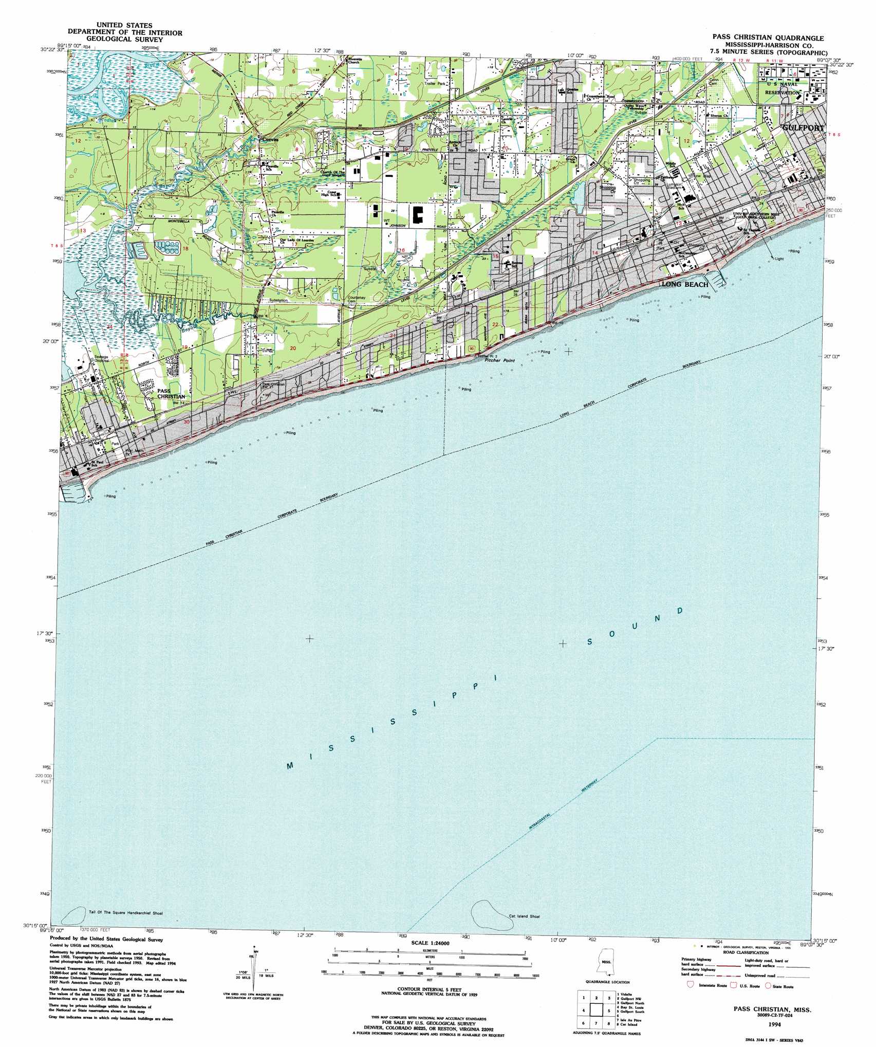
Pass Christian Topo Map Mississippi
To zoom in, hover over the map of Pass Christian
USGS Topo Quad 30089c2 - 1:24,000 scale
| Topo Map Name: | Pass Christian |
| USGS Topo Quad ID: | 30089c2 |
| Print Size: | ca. 21 1/4" wide x 27" high |
| Southeast Coordinates: | 30.25° N latitude / 89.125° W longitude |
| Map Center Coordinates: | 30.3125° N latitude / 89.1875° W longitude |
| U.S. State: | MS |
| Filename: | o30089c2.jpg |
| Download Map JPG Image: | Pass Christian topo map 1:24,000 scale |
| Map Type: | Topographic |
| Topo Series: | 7.5´ |
| Map Scale: | 1:24,000 |
| Source of Map Images: | United States Geological Survey (USGS) |
| Alternate Map Versions: |
Pass Christian MS 1955, updated 1958 Download PDF Buy paper map Pass Christian MS 1955, updated 1965 Download PDF Buy paper map Pass Christian MS 1955, updated 1971 Download PDF Buy paper map Pass Christian MS 1955, updated 1978 Download PDF Buy paper map Pass Christian MS 1955, updated 1985 Download PDF Buy paper map Pass Christian MS 1955, updated 1991 Download PDF Buy paper map Pass Christian MS 1994, updated 1995 Download PDF Buy paper map Pass Christian MS 2012 Download PDF Buy paper map Pass Christian MS 2015 Download PDF Buy paper map |
1:24,000 Topo Quads surrounding Pass Christian
Necaise |
Sellers |
Wortham |
Success |
White Plains |
Kiln |
Vidalia |
Gulfport Nw |
Gulfport North |
Biloxi |
Waveland |
Bay Saint Louis |
Pass Christian |
Gulfport South |
|
Grand Island Pass |
Isle Au Pitre |
Cat Island |
Ship Island |
|
Malheureux Point |
Three Mile Bay |
Door Point |
> Back to 30089a1 at 1:100,000 scale
> Back to 30088a1 at 1:250,000 scale
> Back to U.S. Topo Maps home
Pass Christian topo map: Gazetteer
Pass Christian: Bars
Cat Island Shoal elevation 0m 0′Pass Christian: Canals
Canal Number One elevation 5m 16′Canal Number Three elevation 6m 19′
Pass Christian: Capes
Pitcher Point elevation 2m 6′Pass Christian: Harbors
Long Beach Harbor elevation 0m 0′Pass Christian: Parks
Lance Lumpkin Stadium elevation 8m 26′War Memorial Park elevation 6m 19′
Pass Christian: Populated Places
Cuevas elevation 2m 6′Long Beach elevation 8m 26′
Pass Christian elevation 4m 13′
White Harbor elevation 8m 26′
Pass Christian: Streams
Indian Bayou elevation 1m 3′Johnson Bayou elevation 0m 0′
Pass Christian digital topo map on disk
Buy this Pass Christian topo map showing relief, roads, GPS coordinates and other geographical features, as a high-resolution digital map file on DVD:
Gulf Coast (LA, MS, AL, FL) & Southwestern Georgia
Buy digital topo maps: Gulf Coast (LA, MS, AL, FL) & Southwestern Georgia
 & Southwestern Georgia map DVD")