Ruddock Topo Map Louisiana
To zoom in, hover over the map of Ruddock
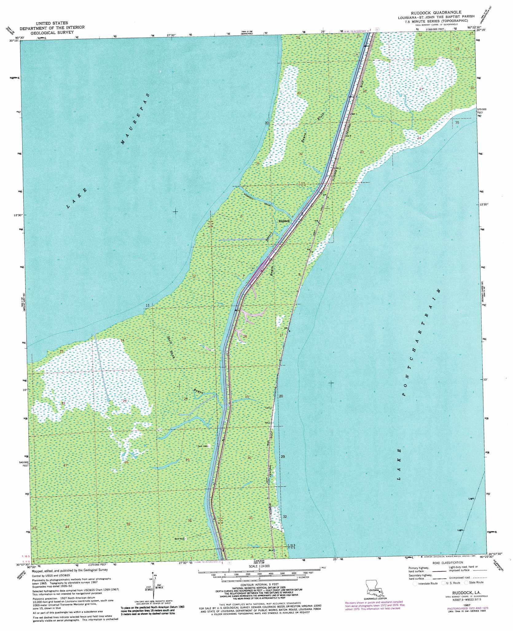
USGS Topo Quad 30090b4 - 1:24,000 scale
| Topo Map Name: | Ruddock |
| USGS Topo Quad ID: | 30090b4 |
| Print Size: | ca. 21 1/4" wide x 27" high |
| Southeast Coordinates: | 30.125° N latitude / 90.375° W longitude |
| Map Center Coordinates: | 30.1875° N latitude / 90.4375° W longitude |
| U.S. State: | LA |
| Filename: | o30090b4.jpg |
| Download Map JPG Image: | Ruddock topo map 1:24,000 scale |
| Map Type: | Topographic |
| Topo Series: | 7.5´ |
| Map Scale: | 1:24,000 |
| Source of Map Images: | United States Geological Survey (USGS) |
| Alternate Map Versions: |
Ruddock LA 1952, updated 1953 Download PDF Buy paper map Ruddock LA 1967, updated 1968 Download PDF Buy paper map Ruddock LA 1967, updated 1973 Download PDF Buy paper map Ruddock LA 1967, updated 1980 Download PDF Buy paper map Ruddock LA 2012 Download PDF Buy paper map Ruddock LA 2015 Download PDF Buy paper map |
1:24,000 Topo Quads surrounding Ruddock
Frost |
Springfield |
Ponchatoula |
Ponchatoula Ne |
Madisonville |
Whitehall |
Killian |
Manchac |
Ponchatoula Se |
Covington Sw |
Mount Airy Nw |
Mount Airy Ne |
Ruddock |
Bonnett Carre Ne |
|
Lutcher |
Reserve |
Laplace |
La Branche |
Indian Beach |
Lower Vacherie |
Lac Des Allemands |
Hahnville |
Luling |
New Orleans West |
> Back to 30090a1 at 1:100,000 scale
> Back to 30090a1 at 1:250,000 scale
> Back to U.S. Topo Maps home
Ruddock topo map: Gazetteer
Ruddock: Canals
Ruddock Canal elevation 0m 0′Ruddock: Crossings
Interchange 7 elevation 0m 0′Ruddock: Guts
Bayou Black elevation 0m 0′Bayou Desert elevation 0m 0′
Shell Bank Bayou elevation -1m -4′
Ruddock: Populated Places
Ruddock elevation 1m 3′Ruddock digital topo map on disk
Buy this Ruddock topo map showing relief, roads, GPS coordinates and other geographical features, as a high-resolution digital map file on DVD: