Mount Airy Ne Topo Map Louisiana
To zoom in, hover over the map of Mount Airy Ne
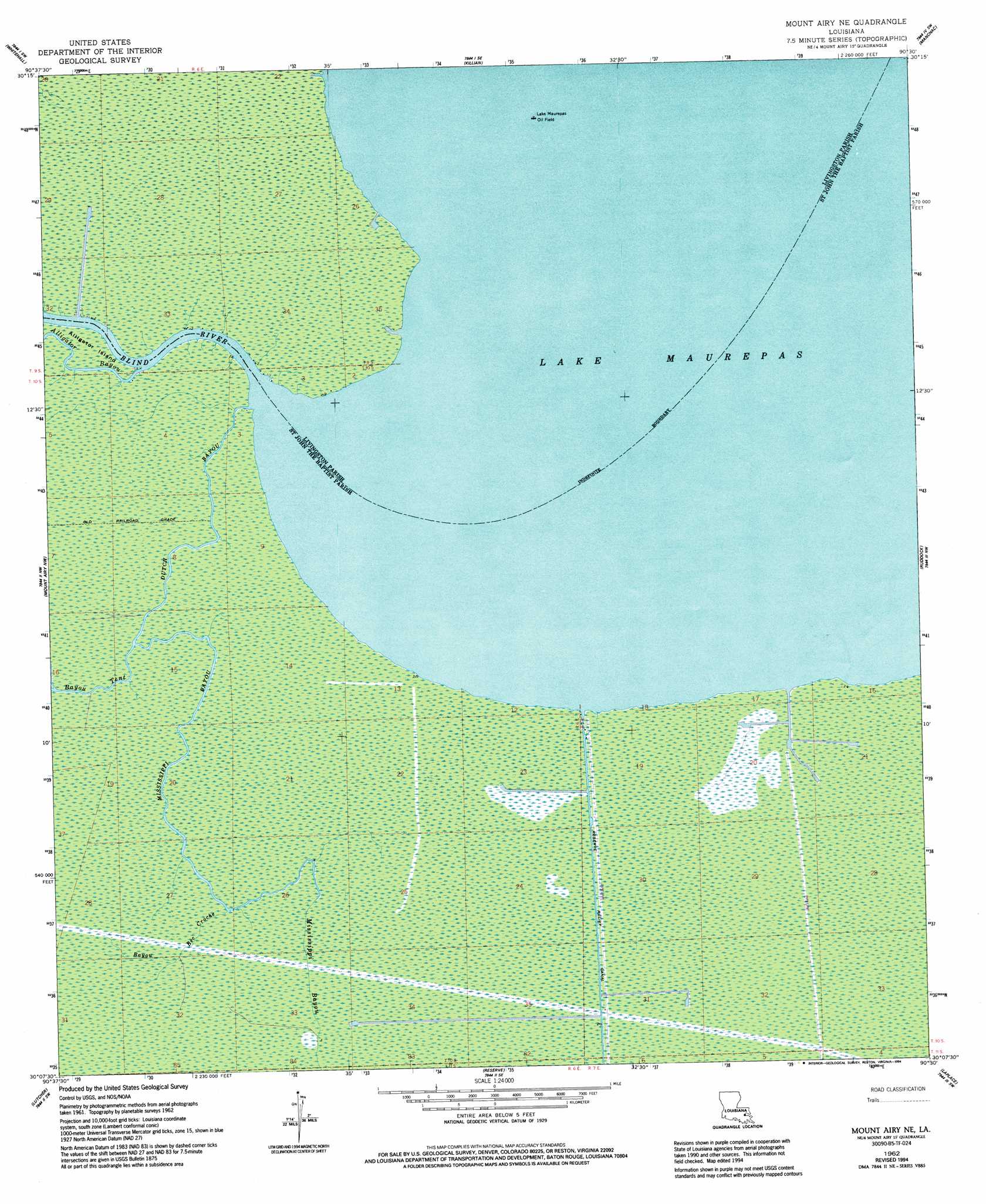
USGS Topo Quad 30090b5 - 1:24,000 scale
| Topo Map Name: | Mount Airy Ne |
| USGS Topo Quad ID: | 30090b5 |
| Print Size: | ca. 21 1/4" wide x 27" high |
| Southeast Coordinates: | 30.125° N latitude / 90.5° W longitude |
| Map Center Coordinates: | 30.1875° N latitude / 90.5625° W longitude |
| U.S. State: | LA |
| Filename: | o30090b5.jpg |
| Download Map JPG Image: | Mount Airy Ne topo map 1:24,000 scale |
| Map Type: | Topographic |
| Topo Series: | 7.5´ |
| Map Scale: | 1:24,000 |
| Source of Map Images: | United States Geological Survey (USGS) |
| Alternate Map Versions: |
Mount Airy NE LA 1962, updated 1963 Download PDF Buy paper map Mount Airy NE LA 1962, updated 1972 Download PDF Buy paper map Mount Airy NE LA 1962, updated 1981 Download PDF Buy paper map Mount Airy NE LA 1962, updated 1994 Download PDF Buy paper map Mount Airy NE LA 2012 Download PDF Buy paper map Mount Airy NE LA 2015 Download PDF Buy paper map |
1:24,000 Topo Quads surrounding Mount Airy Ne
Walker |
Frost |
Springfield |
Ponchatoula |
Ponchatoula Ne |
French Settlement |
Whitehall |
Killian |
Manchac |
Ponchatoula Se |
Sorrento |
Mount Airy Nw |
Mount Airy Ne |
Ruddock |
Bonnett Carre Ne |
Convent |
Lutcher |
Reserve |
Laplace |
La Branche |
Lagan |
Lower Vacherie |
Lac Des Allemands |
Hahnville |
Luling |
> Back to 30090a1 at 1:100,000 scale
> Back to 30090a1 at 1:250,000 scale
> Back to U.S. Topo Maps home
Mount Airy Ne topo map: Gazetteer
Mount Airy Ne: Capes
Big Cypress Point elevation -1m -4′Little Cypress Point elevation -1m -4′
Mount Airy Ne: Guts
Blind Rigolets elevation -1m -4′Mount Airy Ne: Oilfields
Lake Maurepas Oil Field elevation -1m -4′South Lake Maurepas Gas Field elevation 0m 0′
Mount Airy Ne: Streams
Alligator Bayou elevation -1m -4′Bayou Bec Croche elevation 0m 0′
Bayou Tent elevation 0m 0′
Blind River elevation -1m -4′
Dutch Bayou elevation -1m -4′
Mississippi Bayou elevation 0m 0′
Mount Airy Ne digital topo map on disk
Buy this Mount Airy Ne topo map showing relief, roads, GPS coordinates and other geographical features, as a high-resolution digital map file on DVD: