Killian Topo Map Louisiana
To zoom in, hover over the map of Killian
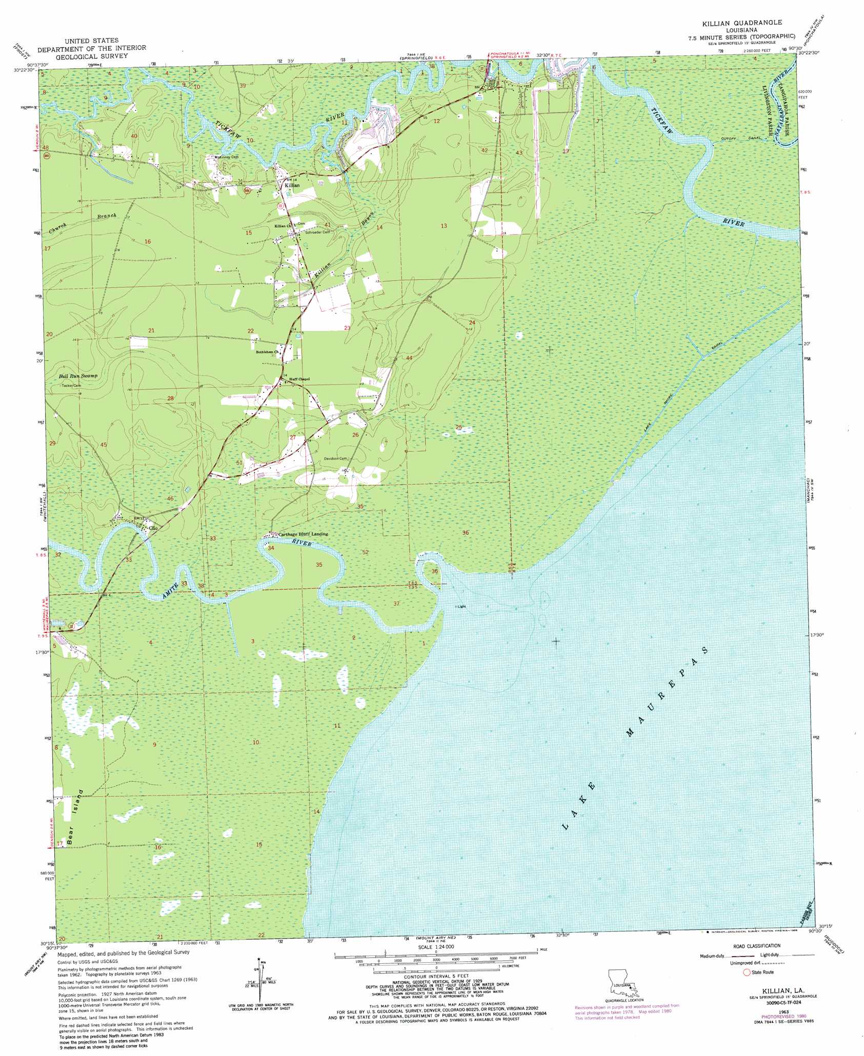
USGS Topo Quad 30090c5 - 1:24,000 scale
| Topo Map Name: | Killian |
| USGS Topo Quad ID: | 30090c5 |
| Print Size: | ca. 21 1/4" wide x 27" high |
| Southeast Coordinates: | 30.25° N latitude / 90.5° W longitude |
| Map Center Coordinates: | 30.3125° N latitude / 90.5625° W longitude |
| U.S. State: | LA |
| Filename: | o30090c5.jpg |
| Download Map JPG Image: | Killian topo map 1:24,000 scale |
| Map Type: | Topographic |
| Topo Series: | 7.5´ |
| Map Scale: | 1:24,000 |
| Source of Map Images: | United States Geological Survey (USGS) |
| Alternate Map Versions: |
Killian LA 1963, updated 1964 Download PDF Buy paper map Killian LA 1963, updated 1976 Download PDF Buy paper map Killian LA 1963, updated 1980 Download PDF Buy paper map Killian LA 1963, updated 1981 Download PDF Buy paper map Killian LA 2012 Download PDF Buy paper map Killian LA 2015 Download PDF Buy paper map |
1:24,000 Topo Quads surrounding Killian
Satsuma |
Holden |
Albany |
Hammond |
Robert |
Walker |
Frost |
Springfield |
Ponchatoula |
Ponchatoula Ne |
French Settlement |
Whitehall |
Killian |
Manchac |
Ponchatoula Se |
Sorrento |
Mount Airy Nw |
Mount Airy Ne |
Ruddock |
Bonnett Carre Ne |
Convent |
Lutcher |
Reserve |
Laplace |
La Branche |
> Back to 30090a1 at 1:100,000 scale
> Back to 30090a1 at 1:250,000 scale
> Back to U.S. Topo Maps home
Killian topo map: Gazetteer
Killian: Areas
Bear Island elevation 1m 3′Killian: Canals
Cutoff Canal elevation 0m 0′Lake Shore Canal elevation 0m 0′
Killian: Islands
Big Liveoak Island elevation 1m 3′Little Liveoak Island elevation 0m 0′
Long Island elevation 0m 0′
Pine Island elevation 0m 0′
Sharp Islands elevation 0m 0′
Killian: Populated Places
Carthage Bluff Landing elevation 1m 3′Clio elevation 3m 9′
Killian elevation 4m 13′
Killian: Streams
Amite River elevation -1m -4′Killian Bayou elevation 0m 0′
Killian: Swamps
Gum Swamp elevation 0m 0′Killian digital topo map on disk
Buy this Killian topo map showing relief, roads, GPS coordinates and other geographical features, as a high-resolution digital map file on DVD: