Springfield Topo Map Louisiana
To zoom in, hover over the map of Springfield
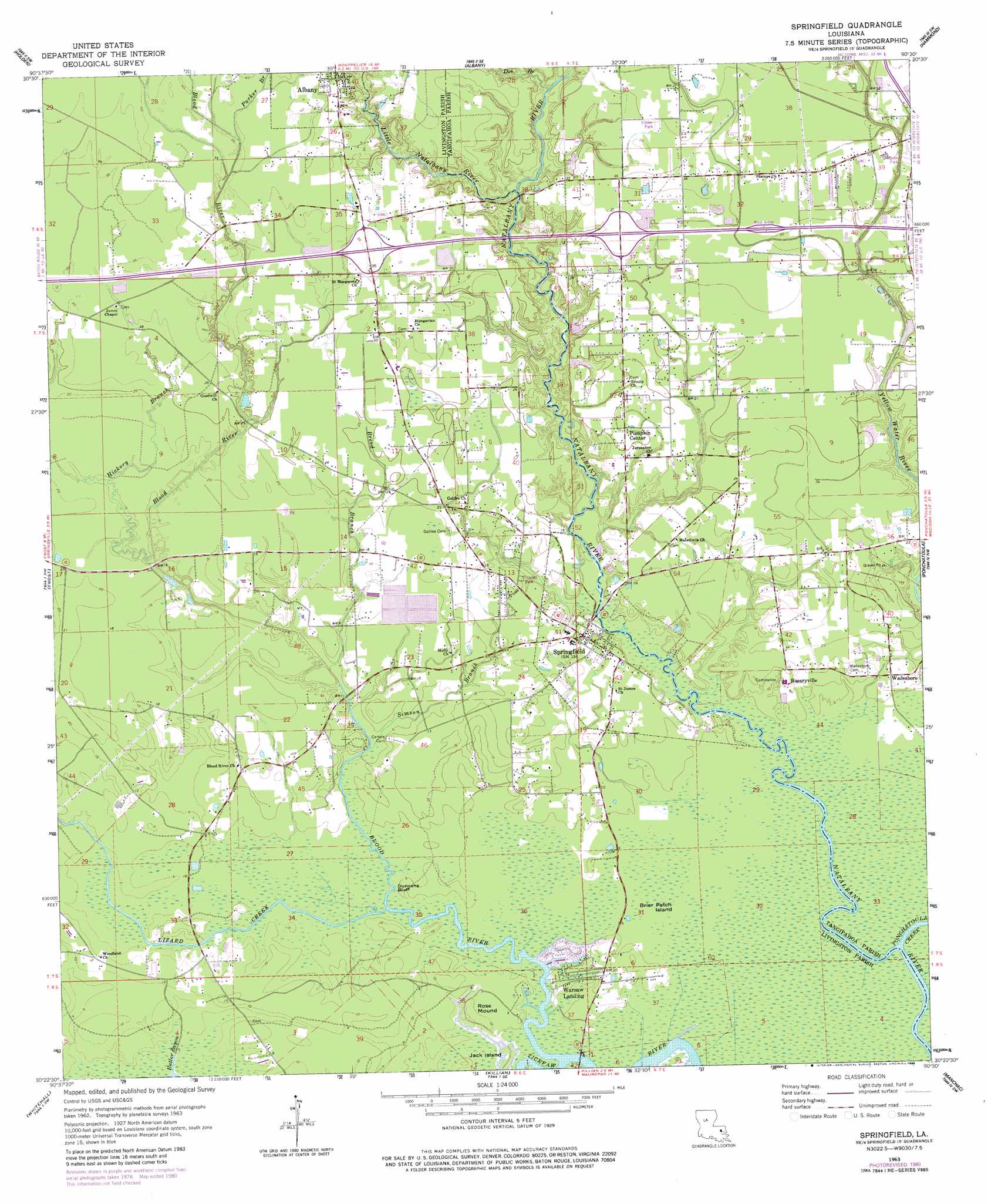
USGS Topo Quad 30090d5 - 1:24,000 scale
| Topo Map Name: | Springfield |
| USGS Topo Quad ID: | 30090d5 |
| Print Size: | ca. 21 1/4" wide x 27" high |
| Southeast Coordinates: | 30.375° N latitude / 90.5° W longitude |
| Map Center Coordinates: | 30.4375° N latitude / 90.5625° W longitude |
| U.S. State: | LA |
| Filename: | o30090d5.jpg |
| Download Map JPG Image: | Springfield topo map 1:24,000 scale |
| Map Type: | Topographic |
| Topo Series: | 7.5´ |
| Map Scale: | 1:24,000 |
| Source of Map Images: | United States Geological Survey (USGS) |
| Alternate Map Versions: |
Springfield LA 1963, updated 1964 Download PDF Buy paper map Springfield LA 1963, updated 1977 Download PDF Buy paper map Springfield LA 1963, updated 1981 Download PDF Buy paper map Springfield LA 1963, updated 1984 Download PDF Buy paper map Springfield LA 1994, updated 1996 Download PDF Buy paper map Springfield LA 2012 Download PDF Buy paper map Springfield LA 2015 Download PDF Buy paper map |
1:24,000 Topo Quads surrounding Springfield
Pine Grove |
Montpelier |
Amite |
Loranger |
Husser |
Satsuma |
Holden |
Albany |
Hammond |
Robert |
Walker |
Frost |
Springfield |
Ponchatoula |
Ponchatoula Ne |
French Settlement |
Whitehall |
Killian |
Manchac |
Ponchatoula Se |
Sorrento |
Mount Airy Nw |
Mount Airy Ne |
Ruddock |
Bonnett Carre Ne |
> Back to 30090a1 at 1:100,000 scale
> Back to 30090a1 at 1:250,000 scale
> Back to U.S. Topo Maps home
Springfield topo map: Gazetteer
Springfield: Bridges
Rome Ferry Bridge elevation 0m 0′Springfield: Cliffs
Duncans Bluff elevation 2m 6′Springfield: Crossings
Interchange 32 elevation 12m 39′Interchange 35 elevation 12m 39′
Romes Ferry (historical) elevation 0m 0′
Springfield: Dams
Lobell Farms Dam elevation 4m 13′Springfield: Flats
Brier Patch Island elevation 1m 3′Springfield: Islands
Jack Island elevation 0m 0′Springfield: Populated Places
Hungarian Settlement elevation 9m 29′Pumpkin Center elevation 7m 22′
Robinwood elevation 8m 26′
Rome elevation 1m 3′
Rosaryville elevation 4m 13′
Springfield elevation 5m 16′
Tilman Park elevation 10m 32′
Warsaw Landing elevation 3m 9′
Springfield: Streams
Blood River elevation 0m 0′Breed Branch elevation 1m 3′
Butler Bayou elevation 0m 0′
Doe Branch elevation 4m 13′
Hickory Branch elevation 3m 9′
Little Natalbany River elevation 2m 6′
Lizard Creek elevation 0m 0′
Parker Branch elevation 10m 32′
Ponchatoula Creek elevation 0m 0′
Simeon Branch elevation 1m 3′
Turkey Creek elevation 10m 32′
Springfield: Summits
Rose Mound elevation 3m 9′Springfield digital topo map on disk
Buy this Springfield topo map showing relief, roads, GPS coordinates and other geographical features, as a high-resolution digital map file on DVD: