Walker Topo Map Louisiana
To zoom in, hover over the map of Walker
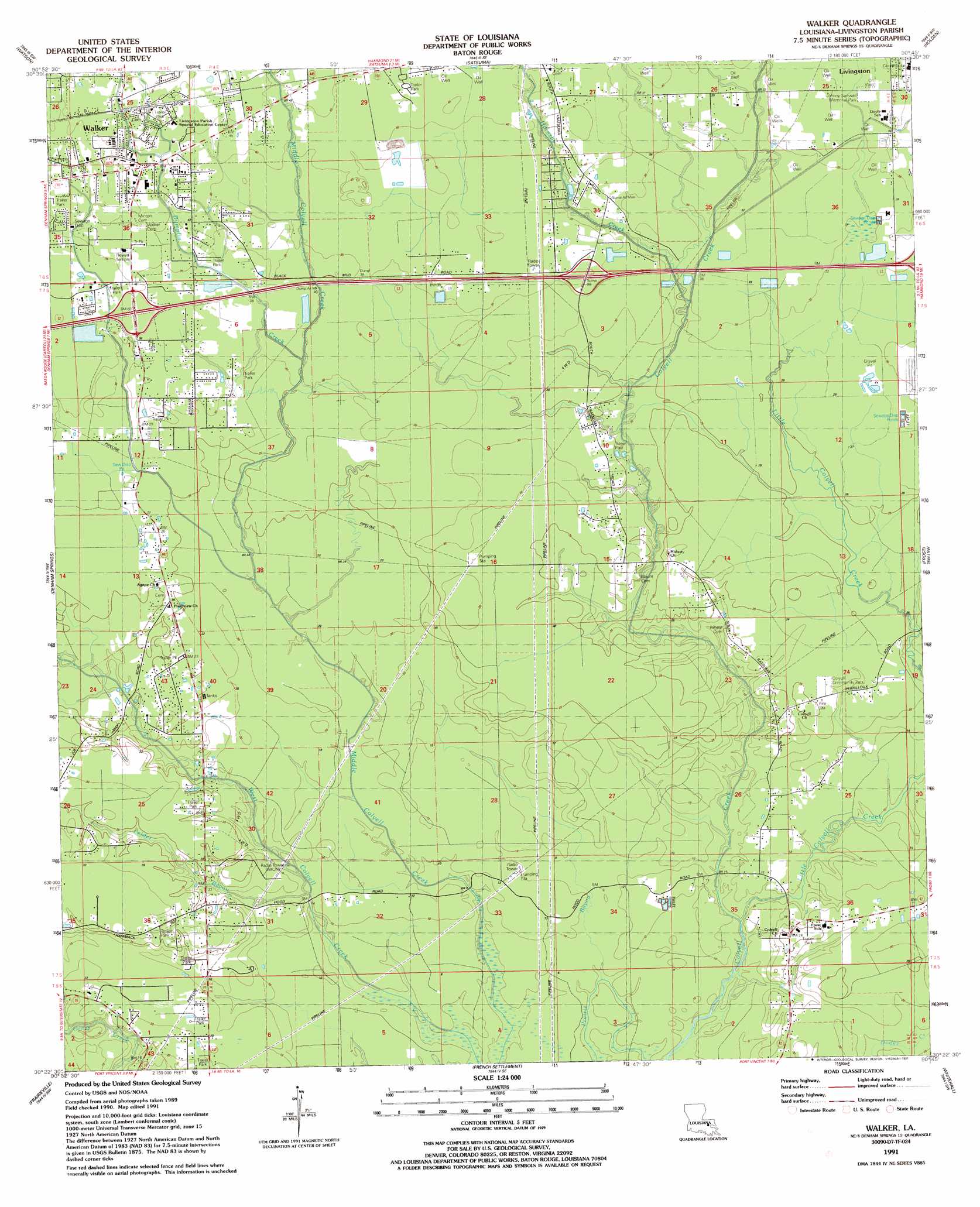
USGS Topo Quad 30090d7 - 1:24,000 scale
| Topo Map Name: | Walker |
| USGS Topo Quad ID: | 30090d7 |
| Print Size: | ca. 21 1/4" wide x 27" high |
| Southeast Coordinates: | 30.375° N latitude / 90.75° W longitude |
| Map Center Coordinates: | 30.4375° N latitude / 90.8125° W longitude |
| U.S. State: | LA |
| Filename: | o30090d7.jpg |
| Download Map JPG Image: | Walker topo map 1:24,000 scale |
| Map Type: | Topographic |
| Topo Series: | 7.5´ |
| Map Scale: | 1:24,000 |
| Source of Map Images: | United States Geological Survey (USGS) |
| Alternate Map Versions: |
Walker LA 1953, updated 1954 Download PDF Buy paper map Walker LA 1953, updated 1959 Download PDF Buy paper map Walker LA 1962, updated 1964 Download PDF Buy paper map Walker LA 1962, updated 1969 Download PDF Buy paper map Walker LA 1962, updated 1981 Download PDF Buy paper map Walker LA 1962, updated 1989 Download PDF Buy paper map Walker LA 1991, updated 1991 Download PDF Buy paper map Walker LA 1998, updated 2000 Download PDF Buy paper map Walker LA 2012 Download PDF Buy paper map Walker LA 2015 Download PDF Buy paper map |
1:24,000 Topo Quads surrounding Walker
Fred |
Pride |
Pine Grove |
Montpelier |
Amite |
Comite |
Watson |
Satsuma |
Holden |
Albany |
Baton Rouge East |
Denham Springs |
Walker |
Frost |
Springfield |
Saint Gabriel |
Prairieville |
French Settlement |
Whitehall |
Killian |
Carville |
Gonzales |
Sorrento |
Mount Airy Nw |
Mount Airy Ne |
> Back to 30090a1 at 1:100,000 scale
> Back to 30090a1 at 1:250,000 scale
> Back to U.S. Topo Maps home
Walker topo map: Gazetteer
Walker: Crossings
Interchange 15 elevation 12m 39′Interchange 19 elevation 14m 45′
Walker: Oilfields
Livingston Oil Field elevation 8m 26′Walker: Parks
Colyell Community Park elevation 7m 22′Johnny Sartwell Memorial Park elevation 11m 36′
Walker: Populated Places
Colyell elevation 8m 26′Corbin elevation 14m 45′
Walker elevation 14m 45′
Walker: Post Offices
Walker Post Office elevation 14m 45′Walker: Streams
Dumplin Creek elevation 8m 26′Felder Bayou elevation 3m 9′
Hornsby Creek elevation 7m 22′
Little Colyell Creek elevation 6m 19′
Walker: Swamps
Switch Canyon Slash (historical) elevation 9m 29′Walker digital topo map on disk
Buy this Walker topo map showing relief, roads, GPS coordinates and other geographical features, as a high-resolution digital map file on DVD: