Satsuma Topo Map Louisiana
To zoom in, hover over the map of Satsuma
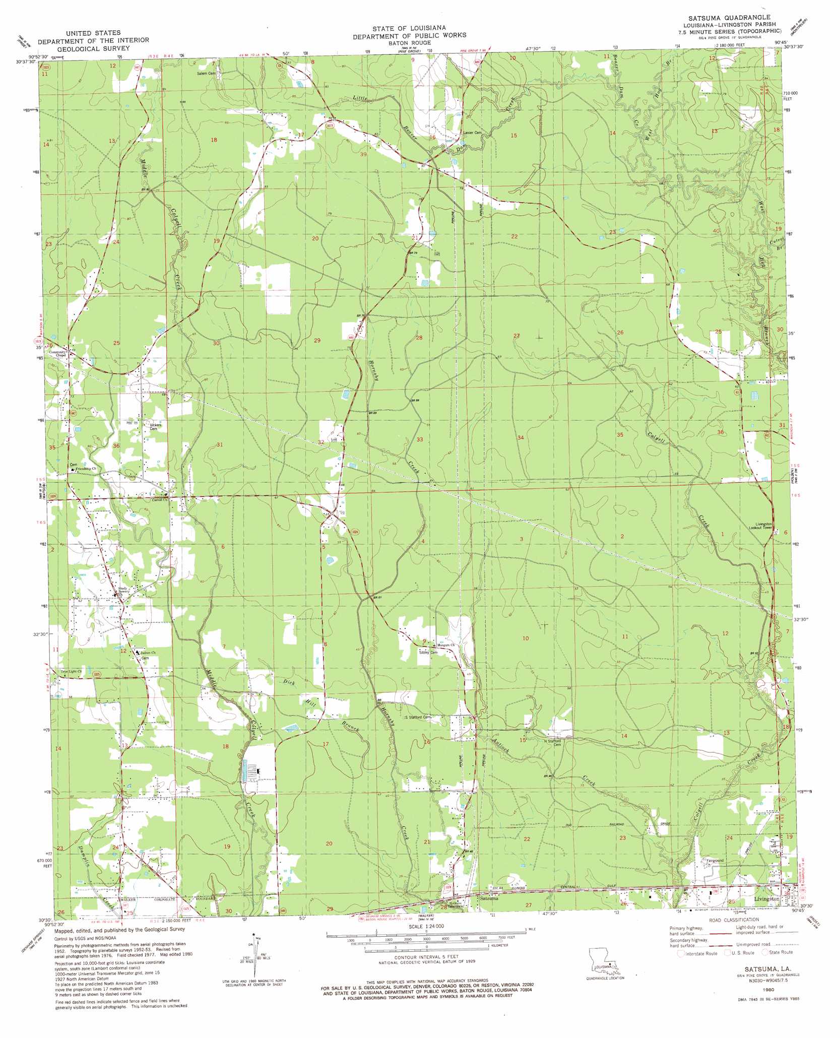
USGS Topo Quad 30090e7 - 1:24,000 scale
| Topo Map Name: | Satsuma |
| USGS Topo Quad ID: | 30090e7 |
| Print Size: | ca. 21 1/4" wide x 27" high |
| Southeast Coordinates: | 30.5° N latitude / 90.75° W longitude |
| Map Center Coordinates: | 30.5625° N latitude / 90.8125° W longitude |
| U.S. State: | LA |
| Filename: | o30090e7.jpg |
| Download Map JPG Image: | Satsuma topo map 1:24,000 scale |
| Map Type: | Topographic |
| Topo Series: | 7.5´ |
| Map Scale: | 1:24,000 |
| Source of Map Images: | United States Geological Survey (USGS) |
| Alternate Map Versions: |
Satsuma LA 1953, updated 1954 Download PDF Buy paper map Satsuma LA 1953, updated 1969 Download PDF Buy paper map Satsuma LA 1980, updated 1981 Download PDF Buy paper map Satsuma LA 2012 Download PDF Buy paper map Satsuma LA 2015 Download PDF Buy paper map |
1:24,000 Topo Quads surrounding Satsuma
Clinton |
Bluff Creek |
Hatchersville |
Greensburg |
Roseland |
Fred |
Pride |
Pine Grove |
Montpelier |
Amite |
Comite |
Watson |
Satsuma |
Holden |
Albany |
Baton Rouge East |
Denham Springs |
Walker |
Frost |
Springfield |
Saint Gabriel |
Prairieville |
French Settlement |
Whitehall |
Killian |
> Back to 30090e1 at 1:100,000 scale
> Back to 30090a1 at 1:250,000 scale
> Back to U.S. Topo Maps home
Satsuma topo map: Gazetteer
Satsuma: Populated Places
Friendship elevation 22m 72′Satsuma elevation 14m 45′
Satsuma: Streams
Antioch Creek elevation 10m 32′Beaver Dam Creek elevation 21m 68′
Cutrer Branch elevation 18m 59′
Dick Hill Branch elevation 13m 42′
Little Beaver Dam Creek elevation 20m 65′
Satsuma digital topo map on disk
Buy this Satsuma topo map showing relief, roads, GPS coordinates and other geographical features, as a high-resolution digital map file on DVD: