Folsom Topo Map Louisiana
To zoom in, hover over the map of Folsom
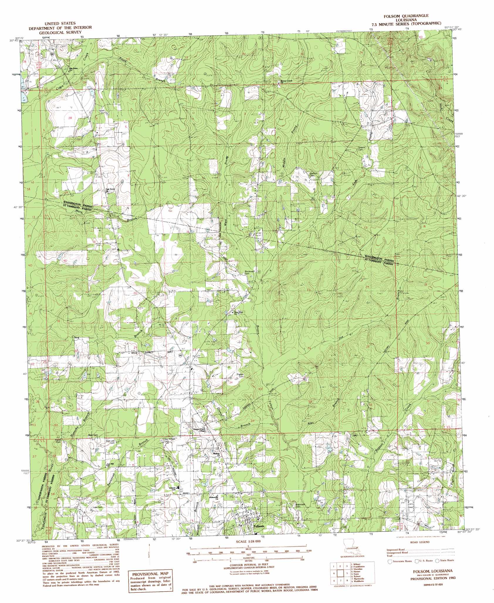
USGS Topo Quad 30090f2 - 1:24,000 scale
| Topo Map Name: | Folsom |
| USGS Topo Quad ID: | 30090f2 |
| Print Size: | ca. 21 1/4" wide x 27" high |
| Southeast Coordinates: | 30.625° N latitude / 90.125° W longitude |
| Map Center Coordinates: | 30.6875° N latitude / 90.1875° W longitude |
| U.S. State: | LA |
| Filename: | o30090f2.jpg |
| Download Map JPG Image: | Folsom topo map 1:24,000 scale |
| Map Type: | Topographic |
| Topo Series: | 7.5´ |
| Map Scale: | 1:24,000 |
| Source of Map Images: | United States Geological Survey (USGS) |
| Alternate Map Versions: |
Folsom NW LA 1976, updated 1977 Download PDF Buy paper map Folsom LA 1983, updated 1984 Download PDF Buy paper map Folsom LA 2012 Download PDF Buy paper map Folsom LA 2015 Download PDF Buy paper map |
1:24,000 Topo Quads surrounding Folsom
Spring Creek |
Sunny Hill |
Clifton |
Pine |
State Line |
Bolivar |
Wilmer |
Franklinton |
Sheridan |
Bogalusa West |
Loranger |
Husser |
Folsom |
Enon |
Sun |
Hammond |
Robert |
Martinville |
Waldheim |
Bush |
Ponchatoula |
Ponchatoula Ne |
Madisonville |
Covington |
Saint Tammany |
> Back to 30090e1 at 1:100,000 scale
> Back to 30090a1 at 1:250,000 scale
> Back to U.S. Topo Maps home
Folsom topo map: Gazetteer
Folsom: Dams
Erwins Pond Dam elevation 45m 147′Greens Pond Dam elevation 57m 187′
Louisiana Noname 35 Dam elevation 38m 124′
Yates New Pond Dam elevation 37m 121′
Folsom: Populated Places
Folsom elevation 47m 154′Folsom: Reservoirs
Erwin Pond elevation 45m 147′Greens Pond elevation 57m 187′
Yates New Pond elevation 37m 121′
Folsom: Streams
Alec Branch elevation 30m 98′Dismal Branch elevation 30m 98′
East Prong Bogue Falaya elevation 42m 137′
Hornsby Branch elevation 27m 88′
Joe Branch elevation 32m 104′
Middle Prong Bogue Falaya elevation 42m 137′
South Branch Catca Creek elevation 43m 141′
West Prong Bogue Falaya elevation 36m 118′
Folsom digital topo map on disk
Buy this Folsom topo map showing relief, roads, GPS coordinates and other geographical features, as a high-resolution digital map file on DVD: