Montpelier Topo Map Louisiana
To zoom in, hover over the map of Montpelier
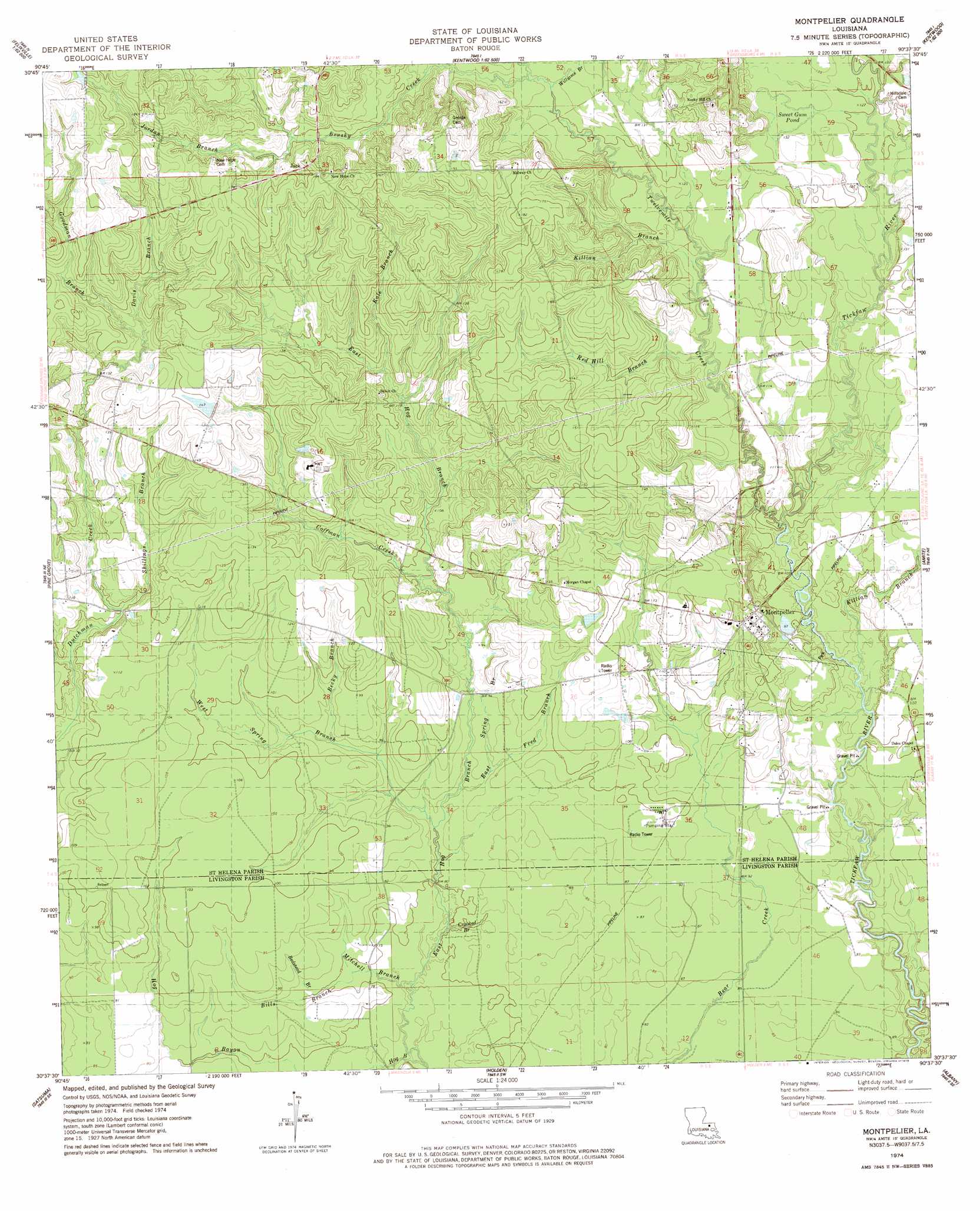
USGS Topo Quad 30090f6 - 1:24,000 scale
| Topo Map Name: | Montpelier |
| USGS Topo Quad ID: | 30090f6 |
| Print Size: | ca. 21 1/4" wide x 27" high |
| Southeast Coordinates: | 30.625° N latitude / 90.625° W longitude |
| Map Center Coordinates: | 30.6875° N latitude / 90.6875° W longitude |
| U.S. State: | LA |
| Filename: | o30090f6.jpg |
| Download Map JPG Image: | Montpelier topo map 1:24,000 scale |
| Map Type: | Topographic |
| Topo Series: | 7.5´ |
| Map Scale: | 1:24,000 |
| Source of Map Images: | United States Geological Survey (USGS) |
| Alternate Map Versions: |
Montpelier LA 1974, updated 1978 Download PDF Buy paper map Montpelier LA 2012 Download PDF Buy paper map Montpelier LA 2015 Download PDF Buy paper map |
1:24,000 Topo Quads surrounding Montpelier
Woodland |
Chipola |
Liverpool |
Kentwood |
Spring Creek |
Bluff Creek |
Hatchersville |
Greensburg |
Roseland |
Bolivar |
Pride |
Pine Grove |
Montpelier |
Amite |
Loranger |
Watson |
Satsuma |
Holden |
Albany |
Hammond |
Denham Springs |
Walker |
Frost |
Springfield |
Ponchatoula |
> Back to 30090e1 at 1:100,000 scale
> Back to 30090a1 at 1:250,000 scale
> Back to U.S. Topo Maps home
Montpelier topo map: Gazetteer
Montpelier: Lakes
Sweet Gum Pond elevation 39m 127′Montpelier: Populated Places
Jack elevation 55m 180′Montpelier elevation 37m 121′
Montpelier: Streams
Becky Branch elevation 26m 85′Bedstead Branch elevation 23m 75′
Bills Branch elevation 22m 72′
Brushy Creek elevation 39m 127′
Coffman Creek elevation 29m 95′
Crooked Branch elevation 23m 75′
Curtis Creek elevation 29m 95′
Davis Branch elevation 42m 137′
East Spring Branch elevation 25m 82′
Fred Branch elevation 26m 85′
Goodman Branch elevation 42m 137′
Hog Bayou elevation 21m 68′
Jordan Branch elevation 46m 150′
Kale Branch elevation 35m 114′
Killian Branch elevation 35m 114′
Killian Branch elevation 28m 91′
Mitchell Branch elevation 21m 68′
Red Hill Branch elevation 34m 111′
Shillings Branch elevation 31m 101′
Stone Branch elevation 42m 137′
Twelvemile Creek elevation 30m 98′
West Spring Branch elevation 24m 78′
Williams Branch elevation 39m 127′
Montpelier digital topo map on disk
Buy this Montpelier topo map showing relief, roads, GPS coordinates and other geographical features, as a high-resolution digital map file on DVD: