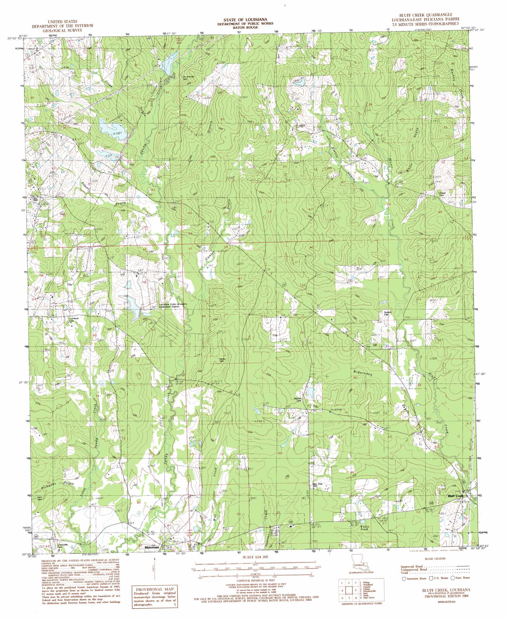
Bluff Creek Topo Map Louisiana
To zoom in, hover over the map of Bluff Creek
USGS Topo Quad 30090g8 - 1:24,000 scale
| Topo Map Name: | Bluff Creek |
| USGS Topo Quad ID: | 30090g8 |
| Print Size: | ca. 21 1/4" wide x 27" high |
| Southeast Coordinates: | 30.75° N latitude / 90.875° W longitude |
| Map Center Coordinates: | 30.8125° N latitude / 90.9375° W longitude |
| U.S. State: | LA |
| Filename: | o30090g8.jpg |
| Download Map JPG Image: | Bluff Creek topo map 1:24,000 scale |
| Map Type: | Topographic |
| Topo Series: | 7.5´ |
| Map Scale: | 1:24,000 |
| Source of Map Images: | United States Geological Survey (USGS) |
| Alternate Map Versions: |
Bluff Creek LA 1984, updated 1985 Download PDF Buy paper map Bluff Creek LA 1984, updated 1985 Download PDF Buy paper map Bluff Creek LA 2012 Download PDF Buy paper map Bluff Creek LA 2015 Download PDF Buy paper map |
1:24,000 Topo Quads surrounding Bluff Creek
Newtonia |
Centreville |
Berwick |
Street |
Gillsburg |
Rogillioville |
Wilson |
Woodland |
Chipola |
Liverpool |
Jackson |
Clinton |
Bluff Creek |
Hatchersville |
Greensburg |
Zachary |
Fred |
Pride |
Pine Grove |
Montpelier |
Scotlandville |
Comite |
Watson |
Satsuma |
Holden |
> Back to 30090e1 at 1:100,000 scale
> Back to 30090a1 at 1:250,000 scale
> Back to U.S. Topo Maps home
Bluff Creek topo map: Gazetteer
Bluff Creek: Dams
Avondale Boy Scout Lake Dam elevation 64m 209′Idlewild Lake Dam elevation 61m 200′
McGee Lake Dam elevation 60m 196′
Nesom Pond Dam elevation 56m 183′
Bluff Creek: Lakes
Willis Pond elevation 53m 173′Bluff Creek: Populated Places
Blairstown elevation 53m 173′Nesom (historical) elevation 66m 216′
Sunbeam (historical) elevation 57m 187′
Bluff Creek: Reservoirs
Avondale Boy Scout Lake elevation 64m 209′Idlewild Lake elevation 61m 200′
Bluff Creek: Streams
Cobb Branch elevation 56m 183′Horton Bayou elevation 55m 180′
Hunter Bayou elevation 50m 164′
McQuinney Branch elevation 42m 137′
Richards Bayou elevation 42m 137′
Roberts Bayou elevation 54m 177′
Stone Bayou elevation 59m 193′
White Bayou elevation 55m 180′
Bluff Creek digital topo map on disk
Buy this Bluff Creek topo map showing relief, roads, GPS coordinates and other geographical features, as a high-resolution digital map file on DVD: