Catahoula Topo Map Louisiana
To zoom in, hover over the map of Catahoula
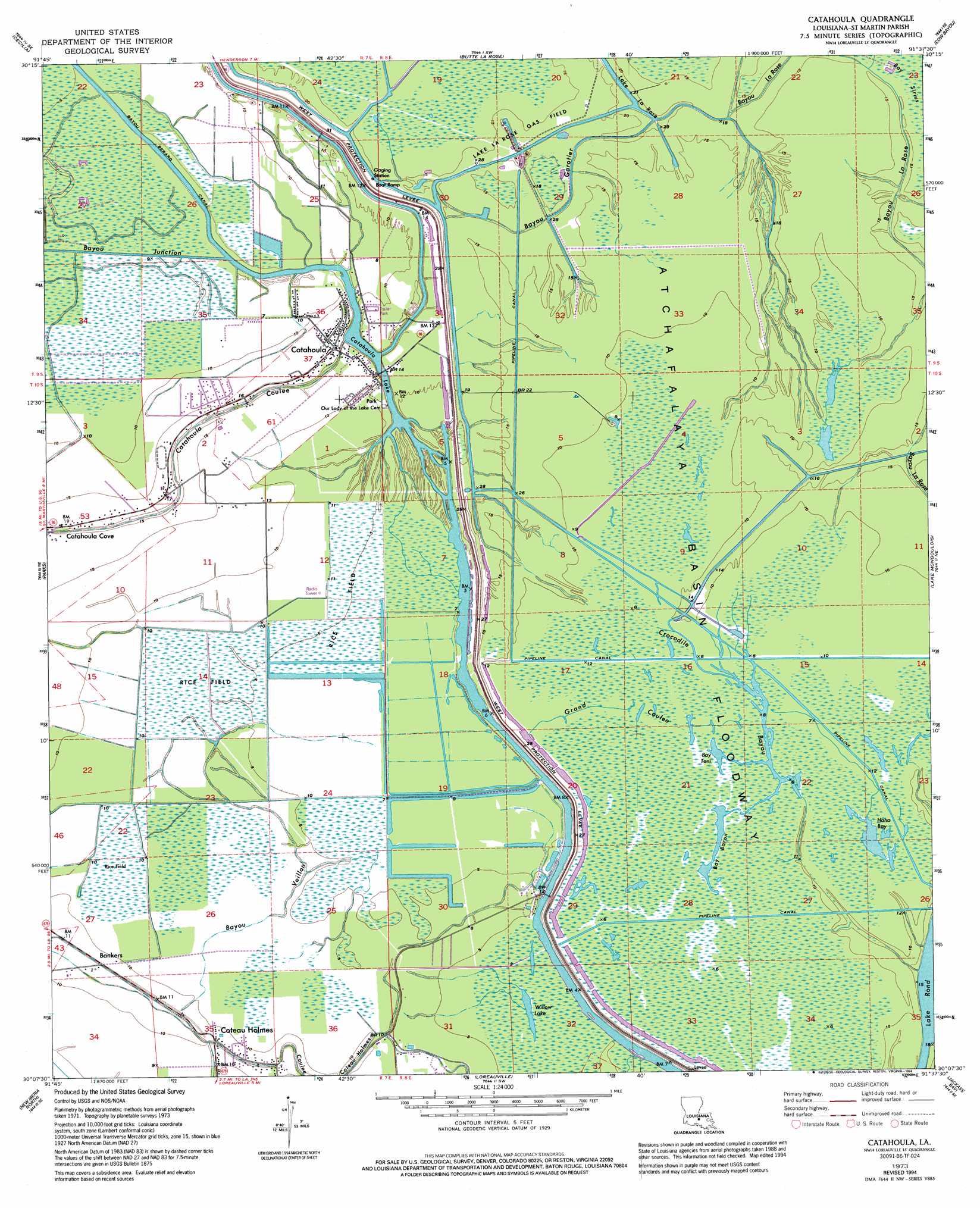
USGS Topo Quad 30091b6 - 1:24,000 scale
| Topo Map Name: | Catahoula |
| USGS Topo Quad ID: | 30091b6 |
| Print Size: | ca. 21 1/4" wide x 27" high |
| Southeast Coordinates: | 30.125° N latitude / 91.625° W longitude |
| Map Center Coordinates: | 30.1875° N latitude / 91.6875° W longitude |
| U.S. State: | LA |
| Filename: | o30091b6.jpg |
| Download Map JPG Image: | Catahoula topo map 1:24,000 scale |
| Map Type: | Topographic |
| Topo Series: | 7.5´ |
| Map Scale: | 1:24,000 |
| Source of Map Images: | United States Geological Survey (USGS) |
| Alternate Map Versions: |
Catahoula LA 1973, updated 1976 Download PDF Buy paper map Catahoula LA 1973, updated 1994 Download PDF Buy paper map Catahoula LA 2012 Download PDF Buy paper map Catahoula LA 2015 Download PDF Buy paper map |
1:24,000 Topo Quads surrounding Catahoula
Arnaudville |
Portage |
Maringouin Nw |
Maringouin |
Grosse Tete |
Breaux Bridge |
Cecilia |
Butte La Rose |
Cow Bayou |
Grosse Tete Sw |
Broussard |
Parks |
Catahoula |
Lake Mongoulois |
Grand River |
Youngsville |
New Iberia North |
Loreauville |
Jackass Bay |
Lake Chicot |
Delcambre |
New Iberia South |
Jeanerette |
Charenton |
Centerville Nw |
> Back to 30091a1 at 1:100,000 scale
> Back to 30090a1 at 1:250,000 scale
> Back to U.S. Topo Maps home
Catahoula topo map: Gazetteer
Catahoula: Guts
Bayou Mersier elevation 0m 0′Catahoula: Lakes
Bay Baron elevation 1m 3′Bay Toni elevation 1m 3′
Catahoula Lake elevation 0m 0′
Haha Bay elevation 2m 6′
Lake La Rose elevation 2m 6′
Willow Lake elevation 1m 3′
Catahoula: Oilfields
Bayou La Rose Gas Field elevation 3m 9′Crocodile Bayou Oil Field elevation 3m 9′
Lake La Rose Gas Field elevation 4m 13′
Catahoula: Populated Places
Bankers elevation 3m 9′Catahoula elevation 4m 13′
Catahoula Cove elevation 5m 16′
Coteau Holmes elevation 3m 9′
Catahoula: Streams
Bayou Garotier elevation 7m 22′Bayou Junction elevation 2m 6′
Bayou Veillon elevation 1m 3′
Catahoula Coulee elevation 1m 3′
Crocodile Bayou elevation 1m 3′
Catahoula: Swamps
Cypress Brake elevation 2m 6′Catahoula: Valleys
Grand Coulee elevation 2m 6′Catahoula digital topo map on disk
Buy this Catahoula topo map showing relief, roads, GPS coordinates and other geographical features, as a high-resolution digital map file on DVD: