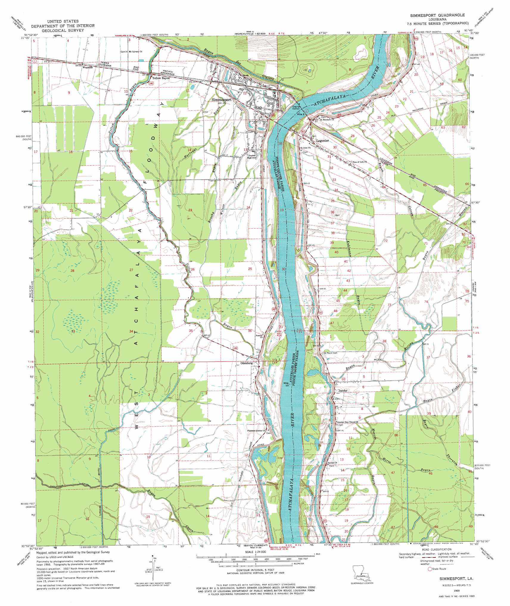
Simmesport Topo Map Louisiana
To zoom in, hover over the map of Simmesport
USGS Topo Quad 30091h7 - 1:24,000 scale
| Topo Map Name: | Simmesport |
| USGS Topo Quad ID: | 30091h7 |
| Print Size: | ca. 21 1/4" wide x 27" high |
| Southeast Coordinates: | 30.875° N latitude / 91.75° W longitude |
| Map Center Coordinates: | 30.9375° N latitude / 91.8125° W longitude |
| U.S. State: | LA |
| Filename: | o30091h7.jpg |
| Download Map JPG Image: | Simmesport topo map 1:24,000 scale |
| Map Type: | Topographic |
| Topo Series: | 7.5´ |
| Map Scale: | 1:24,000 |
| Source of Map Images: | United States Geological Survey (USGS) |
| Alternate Map Versions: |
Simmesport LA 1969, updated 1970 Download PDF Buy paper map Simmesport LA 1969, updated 1979 Download PDF Buy paper map Simmesport LA 1998, updated 2002 Download PDF Buy paper map Simmesport LA 2012 Download PDF Buy paper map Simmesport LA 2015 Download PDF Buy paper map |
1:24,000 Topo Quads surrounding Simmesport
Marksville North |
Lac Sainte Agnes |
Ile Natchitoches |
Shaw |
Lake Mary |
Marksville South |
Moreauville |
Big Bend |
Turnbull Island |
Fort Adams |
Cottonport |
Plaucheville |
Simmesport |
Innis |
Tunica |
Morrow |
Bayou Jack |
Bayou Current |
Batchelor |
Lacour |
Beggs |
Palmetto |
Swayze Lake |
Melville |
Morganza |
> Back to 30091e1 at 1:100,000 scale
> Back to 30090a1 at 1:250,000 scale
> Back to U.S. Topo Maps home
Simmesport topo map: Gazetteer
Simmesport: Canals
Turners Bayou Canal elevation 11m 36′Simmesport: Populated Places
Cason elevation 12m 39′Eden (historical) elevation 13m 42′
Glynville (historical) elevation 14m 45′
Jacoby elevation 13m 42′
Legonier elevation 13m 42′
Odenburg elevation 14m 45′
Simmesport elevation 12m 39′
Yellow Bayou elevation 15m 49′
Simmesport: Post Offices
Simmesport Post Office elevation 14m 45′Simmesport: Streams
Bayou à Ferdinand elevation 12m 39′Bayou Cason elevation 10m 32′
Bayou Coteau elevation 12m 39′
Bayou Creux elevation 11m 36′
Bayou des Glaises elevation 8m 26′
Bayou du Corail elevation 10m 32′
Bayou Moreau elevation 12m 39′
Bayou Thornton elevation 7m 22′
Beauregard Slough elevation 11m 36′
Brushy Bayou elevation 12m 39′
Harlands Bayou elevation 11m 36′
Horse Bayou elevation 11m 36′
Kuhlmann Bayou elevation 12m 39′
La Baie à Cason elevation 9m 29′
Marine Bayou elevation 10m 32′
Wilson Bayou elevation 11m 36′
Yellow Bayou elevation 14m 45′
Simmesport digital topo map on disk
Buy this Simmesport topo map showing relief, roads, GPS coordinates and other geographical features, as a high-resolution digital map file on DVD: