Thornwell Topo Map Louisiana
To zoom in, hover over the map of Thornwell
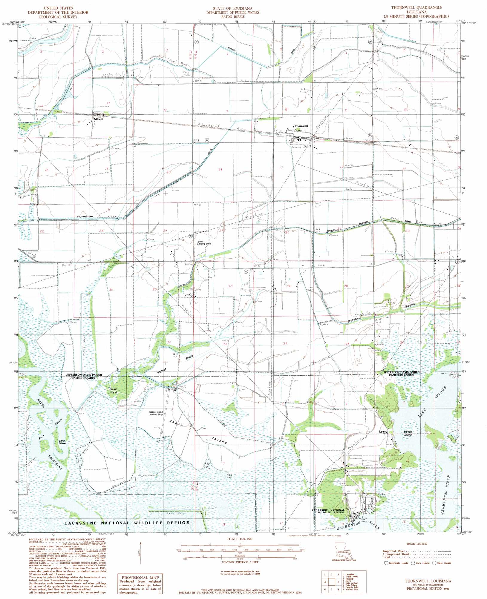
USGS Topo Quad 30092a7 - 1:24,000 scale
| Topo Map Name: | Thornwell |
| USGS Topo Quad ID: | 30092a7 |
| Print Size: | ca. 21 1/4" wide x 27" high |
| Southeast Coordinates: | 30° N latitude / 92.75° W longitude |
| Map Center Coordinates: | 30.0625° N latitude / 92.8125° W longitude |
| U.S. State: | LA |
| Filename: | o30092a7.jpg |
| Download Map JPG Image: | Thornwell topo map 1:24,000 scale |
| Map Type: | Topographic |
| Topo Series: | 7.5´ |
| Map Scale: | 1:24,000 |
| Source of Map Images: | United States Geological Survey (USGS) |
| Alternate Map Versions: |
Thornwell LA 1985, updated 1985 Download PDF Buy paper map Thornwell LA 2012 Download PDF Buy paper map Thornwell LA 2015 Download PDF Buy paper map |
1:24,000 Topo Quads surrounding Thornwell
Hecker |
Fenton |
Welsh North |
Hathaway |
Evangeline |
Iowa |
Lacassine |
Welsh South |
Jennings |
Mermentau |
Lake Charles Se |
Hayes |
Thornwell |
Lake Arthur |
Gueydan |
Boudreaux Lake |
Lake Misere |
Latania Lake |
Mallard Bay |
Latanier Bayou |
Creole |
Grand Cheniere |
Catfish Lake |
Collicon Lake |
Lake Le Bleu |
> Back to 30092a1 at 1:100,000 scale
> Back to 30092a1 at 1:250,000 scale
> Back to U.S. Topo Maps home
Thornwell topo map: Gazetteer
Thornwell: Airports
Goose Island Airport elevation 1m 3′Lyon Airport elevation 1m 3′
Thornwell: Areas
Great Quelqueshoe Prairie elevation 1m 3′Thornwell: Canals
Holton and Winn Drainage Canal elevation 1m 3′Niblett Canal elevation 3m 9′
Southwestern Canal elevation 1m 3′
Thornwell Drainage Canal elevation 1m 3′
Thornwell: Dams
Louisiana Noname 111 Dam elevation 1m 3′Thornwell: Flats
Coto Plot elevation 1m 3′Thornwell: Guts
Four Rivers elevation 1m 3′Thornwell: Islands
Biscuit Island elevation 0m 0′Cane Island elevation 0m 0′
Goose Island elevation 1m 3′
Pine Island elevation 1m 3′
Round Island elevation 1m 3′
Thornwell: Oilfields
South Thornwell Gas Field elevation 1m 3′Southwest Lake Arthur Gas Field elevation 0m 0′
Thornwell: Populated Places
Lowry elevation 3m 9′Niblett elevation 1m 3′
Thornwell elevation 4m 13′
Thornwell: Ridges
Wildcat Ridge elevation 1m 3′Thornwell digital topo map on disk
Buy this Thornwell topo map showing relief, roads, GPS coordinates and other geographical features, as a high-resolution digital map file on DVD: