Branch Topo Map Louisiana
To zoom in, hover over the map of Branch
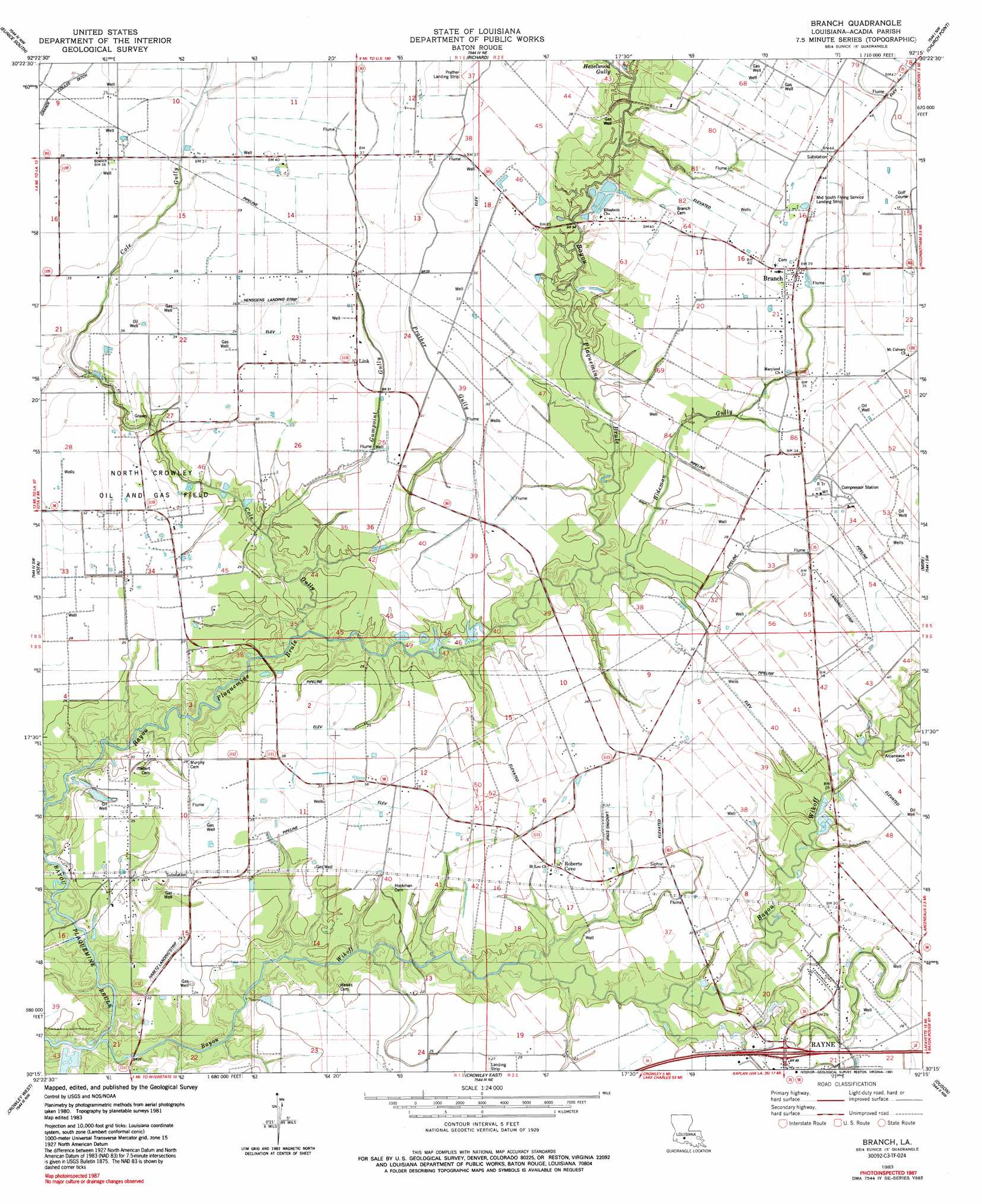
USGS Topo Quad 30092c3 - 1:24,000 scale
| Topo Map Name: | Branch |
| USGS Topo Quad ID: | 30092c3 |
| Print Size: | ca. 21 1/4" wide x 27" high |
| Southeast Coordinates: | 30.25° N latitude / 92.25° W longitude |
| Map Center Coordinates: | 30.3125° N latitude / 92.3125° W longitude |
| U.S. State: | LA |
| Filename: | o30092c3.jpg |
| Download Map JPG Image: | Branch topo map 1:24,000 scale |
| Map Type: | Topographic |
| Topo Series: | 7.5´ |
| Map Scale: | 1:24,000 |
| Source of Map Images: | United States Geological Survey (USGS) |
| Alternate Map Versions: |
Branch LA 1983, updated 1983 Download PDF Buy paper map Branch LA 1983, updated 1991 Download PDF Buy paper map Branch LA 2012 Download PDF Buy paper map Branch LA 2015 Download PDF Buy paper map |
1:24,000 Topo Quads surrounding Branch
Duralde |
Eunice North |
Chataignier |
Lawtell |
Opelousas |
Basile |
Eunice South |
Richard |
Church Point |
Sunset |
Evangeline |
Iota |
Branch |
Mire |
Carencro |
Mermentau |
Crowley West |
Crowley East |
Duson |
Lafayette |
Gueydan |
Wright |
Kaplan North |
Leroy |
Milton |
> Back to 30092a1 at 1:100,000 scale
> Back to 30092a1 at 1:250,000 scale
> Back to U.S. Topo Maps home
Branch topo map: Gazetteer
Branch: Airports
Habetz Landing Strip elevation 7m 22′Hensgens Strip elevation 11m 36′
Mid South Flying Service Landing Strip elevation 13m 42′
Prather Landing Strip elevation 11m 36′
Branch: Crossings
Interchange 87 elevation 9m 29′Branch: Dams
Louisiana Noname 106 Dam elevation 11m 36′Branch: Oilfields
North Crowley Oil and Gas Field elevation 9m 29′Northwest Branch Oil and Gas Field elevation 13m 42′
Branch: Populated Places
Branch elevation 12m 39′Roberts Cove elevation 10m 32′
Branch: Post Offices
Branch Post Office elevation 12m 39′Branch: Streams
Bayou Wikoff elevation 3m 9′Bideman Gully elevation 3m 9′
Cole Gully elevation 1m 3′
Coulee Duralde elevation 3m 9′
Gumpoint Gully elevation 5m 16′
Hazelwood Gully elevation 4m 13′
Long Point Gully elevation 2m 6′
Prather Gully elevation 4m 13′
Branch digital topo map on disk
Buy this Branch topo map showing relief, roads, GPS coordinates and other geographical features, as a high-resolution digital map file on DVD: