Fenton Topo Map Louisiana
To zoom in, hover over the map of Fenton
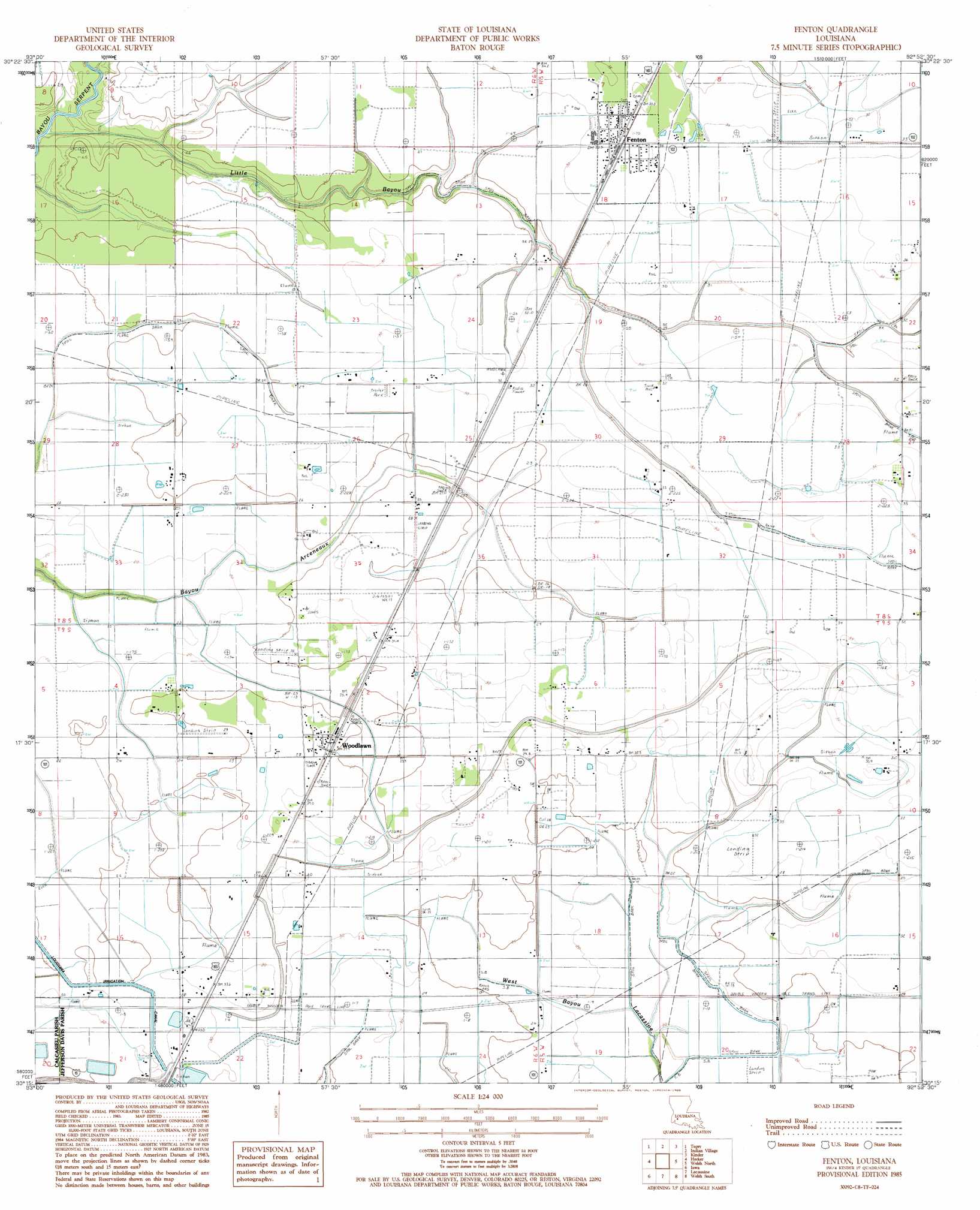
USGS Topo Quad 30092c8 - 1:24,000 scale
| Topo Map Name: | Fenton |
| USGS Topo Quad ID: | 30092c8 |
| Print Size: | ca. 21 1/4" wide x 27" high |
| Southeast Coordinates: | 30.25° N latitude / 92.875° W longitude |
| Map Center Coordinates: | 30.3125° N latitude / 92.9375° W longitude |
| U.S. State: | LA |
| Filename: | o30092c8.jpg |
| Download Map JPG Image: | Fenton topo map 1:24,000 scale |
| Map Type: | Topographic |
| Topo Series: | 7.5´ |
| Map Scale: | 1:24,000 |
| Source of Map Images: | United States Geological Survey (USGS) |
| Alternate Map Versions: |
Fenton LA 1985, updated 1985 Download PDF Buy paper map Fenton LA 2012 Download PDF Buy paper map Fenton LA 2015 Download PDF Buy paper map |
1:24,000 Topo Quads surrounding Fenton
Longville |
Reeves |
Le Blanc |
Oberlin |
Soileau |
Gaytine |
Topsy |
Indian Village |
Kinder |
Elton |
Moss Bluff |
Hecker |
Fenton |
Welsh North |
Hathaway |
Lake Charles |
Iowa |
Lacassine |
Welsh South |
Jennings |
Lake Charles Sw |
Lake Charles Se |
Hayes |
Thornwell |
Lake Arthur |
> Back to 30092a1 at 1:100,000 scale
> Back to 30092a1 at 1:250,000 scale
> Back to U.S. Topo Maps home
Fenton topo map: Gazetteer
Fenton: Oilfields
Fenton Gas Field elevation 9m 29′Lacassine Gas Field elevation 8m 26′
Woodlawn Oil and Gas Field elevation 8m 26′
Woodlawn Oil Field elevation 8m 26′
Fenton: Populated Places
Fenton elevation 10m 32′Woodlawn elevation 8m 26′
Fenton: Streams
Little Bayou elevation 1m 3′Fenton digital topo map on disk
Buy this Fenton topo map showing relief, roads, GPS coordinates and other geographical features, as a high-resolution digital map file on DVD: