Kinder Topo Map Louisiana
To zoom in, hover over the map of Kinder
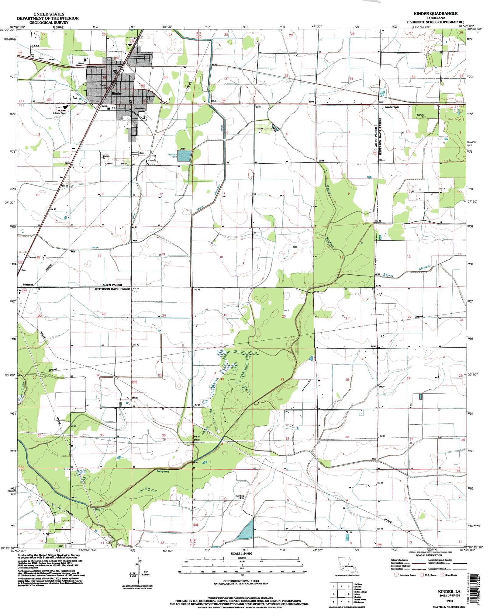
USGS Topo Quad 30092d7 - 1:24,000 scale
| Topo Map Name: | Kinder |
| USGS Topo Quad ID: | 30092d7 |
| Print Size: | ca. 21 1/4" wide x 27" high |
| Southeast Coordinates: | 30.375° N latitude / 92.75° W longitude |
| Map Center Coordinates: | 30.4375° N latitude / 92.8125° W longitude |
| U.S. State: | LA |
| Filename: | o30092d7.jpg |
| Download Map JPG Image: | Kinder topo map 1:24,000 scale |
| Map Type: | Topographic |
| Topo Series: | 7.5´ |
| Map Scale: | 1:24,000 |
| Source of Map Images: | United States Geological Survey (USGS) |
| Alternate Map Versions: |
Kinder LA 1985, updated 1985 Download PDF Buy paper map Kinder LA 1994, updated 1996 Download PDF Buy paper map Kinder LA 2012 Download PDF Buy paper map Kinder LA 2015 Download PDF Buy paper map |
1:24,000 Topo Quads surrounding Kinder
Dry Creek |
Mittie |
Pine Chapel |
Guy |
Bond |
Reeves |
Le Blanc |
Oberlin |
Soileau |
Duralde |
Topsy |
Indian Village |
Kinder |
Elton |
Basile |
Hecker |
Fenton |
Welsh North |
Hathaway |
Evangeline |
Iowa |
Lacassine |
Welsh South |
Jennings |
Mermentau |
> Back to 30092a1 at 1:100,000 scale
> Back to 30092a1 at 1:250,000 scale
> Back to U.S. Topo Maps home
Kinder topo map: Gazetteer
Kinder: Canals
Kinder Canal elevation 13m 42′Kinder Ditch elevation 11m 36′
Kinder: Dams
Louisiana Noname 107 Dam elevation 15m 49′Kinder: Oilfields
North Edna Oil Field elevation 13m 42′West Edna Gas Field elevation 11m 36′
Kinder: Populated Places
Coverdale elevation 15m 49′Kinder elevation 14m 45′
Lauderdale elevation 16m 52′
Kinder: Post Offices
Kinder Post Office elevation 15m 49′Kinder: Streams
Bayou Alligator elevation 11m 36′Kinder digital topo map on disk
Buy this Kinder topo map showing relief, roads, GPS coordinates and other geographical features, as a high-resolution digital map file on DVD: