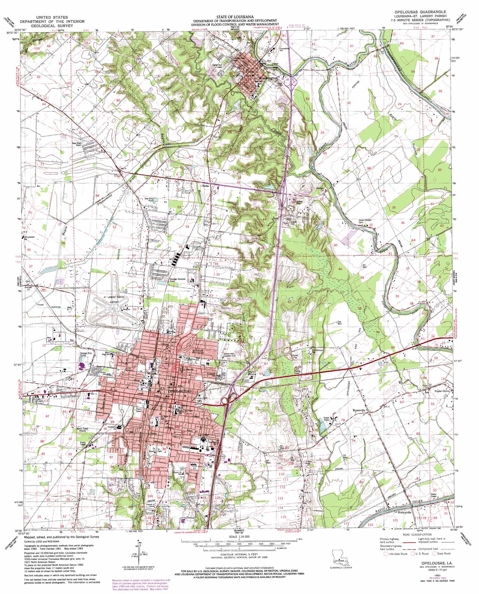
Opelousas Topo Map Louisiana
To zoom in, hover over the map of Opelousas
USGS Topo Quad 30092e1 - 1:24,000 scale
| Topo Map Name: | Opelousas |
| USGS Topo Quad ID: | 30092e1 |
| Print Size: | ca. 21 1/4" wide x 27" high |
| Southeast Coordinates: | 30.5° N latitude / 92° W longitude |
| Map Center Coordinates: | 30.5625° N latitude / 92.0625° W longitude |
| U.S. State: | LA |
| Filename: | o30092e1.jpg |
| Download Map JPG Image: | Opelousas topo map 1:24,000 scale |
| Map Type: | Topographic |
| Topo Series: | 7.5´ |
| Map Scale: | 1:24,000 |
| Source of Map Images: | United States Geological Survey (USGS) |
| Alternate Map Versions: |
Opelousas LA 1983, updated 1983 Download PDF Buy paper map Opelousas LA 1983, updated 1992 Download PDF Buy paper map Opelousas LA 2012 Download PDF Buy paper map Opelousas LA 2015 Download PDF Buy paper map |
1:24,000 Topo Quads surrounding Opelousas
Saint Landry |
Whiteville |
Morrow |
Bayou Jack |
Bayou Current |
Ville Platte |
Tate Cove |
Beggs |
Palmetto |
Swayze Lake |
Chataignier |
Lawtell |
Opelousas |
Port Barre |
Krotz Springs |
Richard |
Church Point |
Sunset |
Arnaudville |
Portage |
Branch |
Mire |
Carencro |
Breaux Bridge |
Cecilia |
> Back to 30092e1 at 1:100,000 scale
> Back to 30092a1 at 1:250,000 scale
> Back to U.S. Topo Maps home
Opelousas topo map: Gazetteer
Opelousas: Airports
Saint Landry Parish Airport elevation 21m 68′Opelousas: Crossings
Interchange 18 elevation 20m 65′Interchange 19 elevation 19m 62′
Opelousas: Oilfields
North Vellin Oil Field elevation 20m 65′Opelousas Oil and Gas Field elevation 9m 29′
Opelousas: Parks
North Park elevation 20m 65′Opelousas Historic District elevation 21m 68′
South Park elevation 20m 65′
Washington Historic District elevation 14m 45′
Opelousas: Populated Places
Boscoville elevation 9m 29′Notelyville elevation 5m 16′
Nuba elevation 22m 72′
Opelousas elevation 20m 65′
Washington elevation 14m 45′
Opelousas: Post Offices
Opelousas Post Office elevation 20m 65′Washington Post Office elevation 19m 62′
Opelousas: Streams
Bayou Carron elevation 5m 16′Bayou Tesson elevation 11m 36′
Bayou Yarbor elevation 16m 52′
Opelousas digital topo map on disk
Buy this Opelousas topo map showing relief, roads, GPS coordinates and other geographical features, as a high-resolution digital map file on DVD: