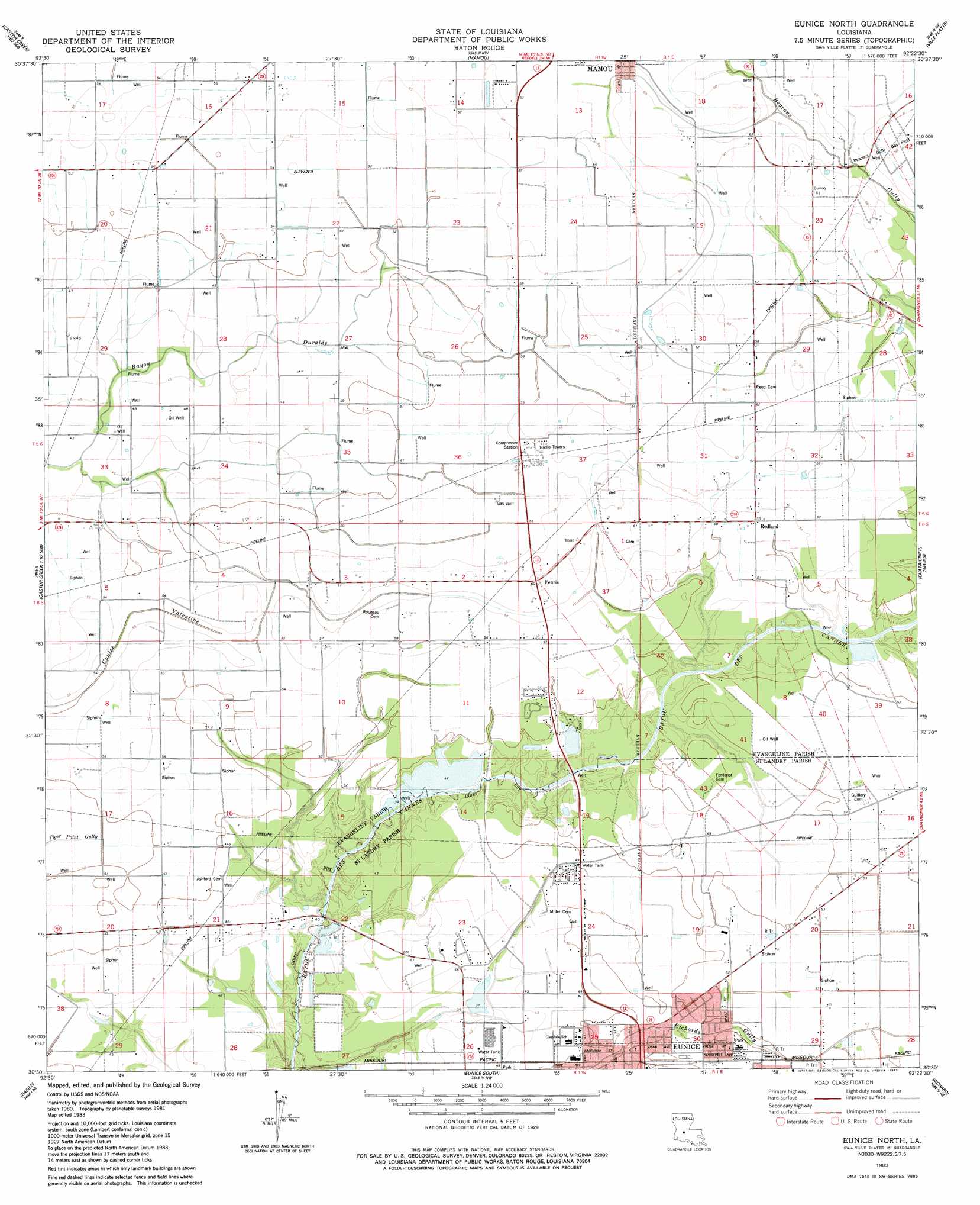
Eunice North Topo Map Louisiana
To zoom in, hover over the map of Eunice North
USGS Topo Quad 30092e4 - 1:24,000 scale
| Topo Map Name: | Eunice North |
| USGS Topo Quad ID: | 30092e4 |
| Print Size: | ca. 21 1/4" wide x 27" high |
| Southeast Coordinates: | 30.5° N latitude / 92.375° W longitude |
| Map Center Coordinates: | 30.5625° N latitude / 92.4375° W longitude |
| U.S. State: | LA |
| Filename: | o30092e4.jpg |
| Download Map JPG Image: | Eunice North topo map 1:24,000 scale |
| Map Type: | Topographic |
| Topo Series: | 7.5´ |
| Map Scale: | 1:24,000 |
| Source of Map Images: | United States Geological Survey (USGS) |
| Alternate Map Versions: |
Eunice North LA 1983, updated 1983 Download PDF Buy paper map Eunice North LA 2012 Download PDF Buy paper map Eunice North LA 2015 Download PDF Buy paper map |
1:24,000 Topo Quads surrounding Eunice North
Oakdale |
Beaver |
Pine Prairie |
Saint Landry |
Whiteville |
Guy |
Bond |
Mamou |
Ville Platte |
Tate Cove |
Soileau |
Duralde |
Eunice North |
Chataignier |
Lawtell |
Elton |
Basile |
Eunice South |
Richard |
Church Point |
Hathaway |
Evangeline |
Iota |
Branch |
Mire |
> Back to 30092e1 at 1:100,000 scale
> Back to 30092a1 at 1:250,000 scale
> Back to U.S. Topo Maps home
Eunice North topo map: Gazetteer
Eunice North: Dams
Cliffs Pond Dam elevation 14m 45′Fred Bellow Lake Dam elevation 11m 36′
Ledouxs Pond Dam elevation 9m 29′
Eunice North: Oilfields
Beacons Gully Gas Field elevation 19m 62′East Fenris Gas Field elevation 16m 52′
Fenris Oil and Gas Field elevation 14m 45′
North Eunice Gas Field elevation 16m 52′
Eunice North: Parks
Lakeview Park elevation 14m 45′Eunice North: Populated Places
Fenris elevation 18m 59′Redland elevation 16m 52′
Eunice North: Reservoirs
Fred Bellow Lake elevation 11m 36′Eunice North digital topo map on disk
Buy this Eunice North topo map showing relief, roads, GPS coordinates and other geographical features, as a high-resolution digital map file on DVD: