Beggs Topo Map Louisiana
To zoom in, hover over the map of Beggs
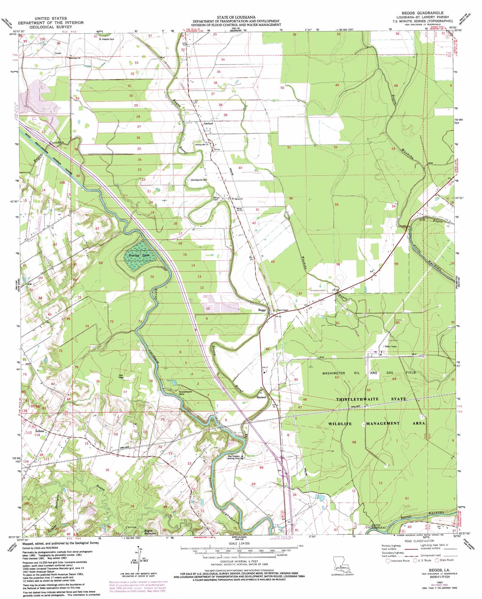
USGS Topo Quad 30092f1 - 1:24,000 scale
| Topo Map Name: | Beggs |
| USGS Topo Quad ID: | 30092f1 |
| Print Size: | ca. 21 1/4" wide x 27" high |
| Southeast Coordinates: | 30.625° N latitude / 92° W longitude |
| Map Center Coordinates: | 30.6875° N latitude / 92.0625° W longitude |
| U.S. State: | LA |
| Filename: | o30092f1.jpg |
| Download Map JPG Image: | Beggs topo map 1:24,000 scale |
| Map Type: | Topographic |
| Topo Series: | 7.5´ |
| Map Scale: | 1:24,000 |
| Source of Map Images: | United States Geological Survey (USGS) |
| Alternate Map Versions: |
Beggs LA 1983, updated 1983 Download PDF Buy paper map Beggs LA 1983, updated 1992 Download PDF Buy paper map Beggs LA 2012 Download PDF Buy paper map Beggs LA 2015 Download PDF Buy paper map |
1:24,000 Topo Quads surrounding Beggs
Lone Pine |
Bunkie |
Cottonport |
Plaucheville |
Simmesport |
Saint Landry |
Whiteville |
Morrow |
Bayou Jack |
Bayou Current |
Ville Platte |
Tate Cove |
Beggs |
Palmetto |
Swayze Lake |
Chataignier |
Lawtell |
Opelousas |
Port Barre |
Krotz Springs |
Richard |
Church Point |
Sunset |
Arnaudville |
Portage |
> Back to 30092e1 at 1:100,000 scale
> Back to 30092a1 at 1:250,000 scale
> Back to U.S. Topo Maps home
Beggs topo map: Gazetteer
Beggs: Airports
Star Dusters Airport elevation 9m 29′Beggs: Lakes
Grassy Lake elevation 10m 32′Beggs: Oilfields
Washington Oil and Gas Field elevation 9m 29′Beggs: Populated Places
Beggs elevation 12m 39′Garland elevation 12m 39′
Macland elevation 12m 39′
Soileau elevation 17m 55′
Beggs: Post Offices
Begg Post Office (historical) elevation 12m 39′Beggs: Streams
Bayou Belleview elevation 10m 32′Bayou Boeuf elevation 6m 19′
Bayou Cocodrie elevation 5m 16′
Bayou Wauksha elevation 7m 22′
Dry Bayou elevation 6m 19′
Beggs: Valleys
Coulee Garrigue elevation 12m 39′Beggs digital topo map on disk
Buy this Beggs topo map showing relief, roads, GPS coordinates and other geographical features, as a high-resolution digital map file on DVD: