Mamou Topo Map Louisiana
To zoom in, hover over the map of Mamou
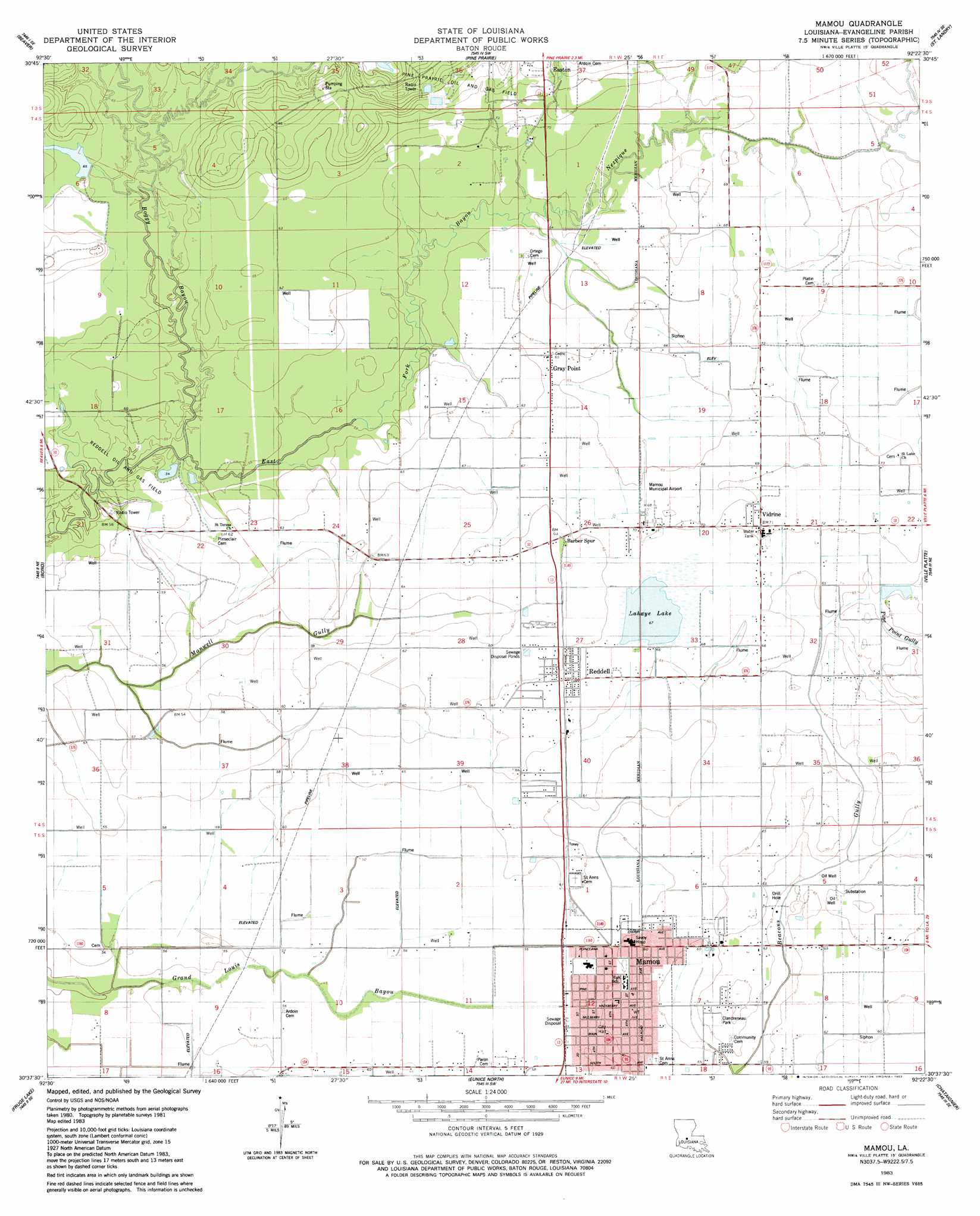
USGS Topo Quad 30092f4 - 1:24,000 scale
| Topo Map Name: | Mamou |
| USGS Topo Quad ID: | 30092f4 |
| Print Size: | ca. 21 1/4" wide x 27" high |
| Southeast Coordinates: | 30.625° N latitude / 92.375° W longitude |
| Map Center Coordinates: | 30.6875° N latitude / 92.4375° W longitude |
| U.S. State: | LA |
| Filename: | o30092f4.jpg |
| Download Map JPG Image: | Mamou topo map 1:24,000 scale |
| Map Type: | Topographic |
| Topo Series: | 7.5´ |
| Map Scale: | 1:24,000 |
| Source of Map Images: | United States Geological Survey (USGS) |
| Alternate Map Versions: |
Mamou LA 1983, updated 1983 Download PDF Buy paper map Mamou LA 2012 Download PDF Buy paper map Mamou LA 2015 Download PDF Buy paper map |
1:24,000 Topo Quads surrounding Mamou
Pawnee |
Glenmora |
Cocodrie Lake |
Lone Pine |
Bunkie |
Oakdale |
Beaver |
Pine Prairie |
Saint Landry |
Whiteville |
Guy |
Bond |
Mamou |
Ville Platte |
Tate Cove |
Soileau |
Duralde |
Eunice North |
Chataignier |
Lawtell |
Elton |
Basile |
Eunice South |
Richard |
Church Point |
> Back to 30092e1 at 1:100,000 scale
> Back to 30092a1 at 1:250,000 scale
> Back to U.S. Topo Maps home
Mamou topo map: Gazetteer
Mamou: Airports
Mamou Municipal Airport elevation 20m 65′Mamou: Dams
Lahaye Lake Dam elevation 19m 62′Louisiana Noname 104 Dam elevation 19m 62′
Mamou: Oilfields
Mamou Oil Field elevation 19m 62′Pine Prairie Oil and Gas Field elevation 29m 95′
Reddell Oil and Gas Field elevation 17m 55′
Mamou: Parks
Clandreneau Park elevation 19m 62′Mamou: Populated Places
Barber Spur elevation 19m 62′Gray Point elevation 20m 65′
Mamou elevation 19m 62′
Reddell elevation 20m 65′
Vidrine elevation 22m 72′
Mamou: Post Offices
Reddell Post Office elevation 20m 65′Mamou: Reservoirs
Lahaye Lake elevation 19m 62′Mamou: Streams
Boggy Bayou elevation 16m 52′Mamou digital topo map on disk
Buy this Mamou topo map showing relief, roads, GPS coordinates and other geographical features, as a high-resolution digital map file on DVD: