Beaver Topo Map Louisiana
To zoom in, hover over the map of Beaver
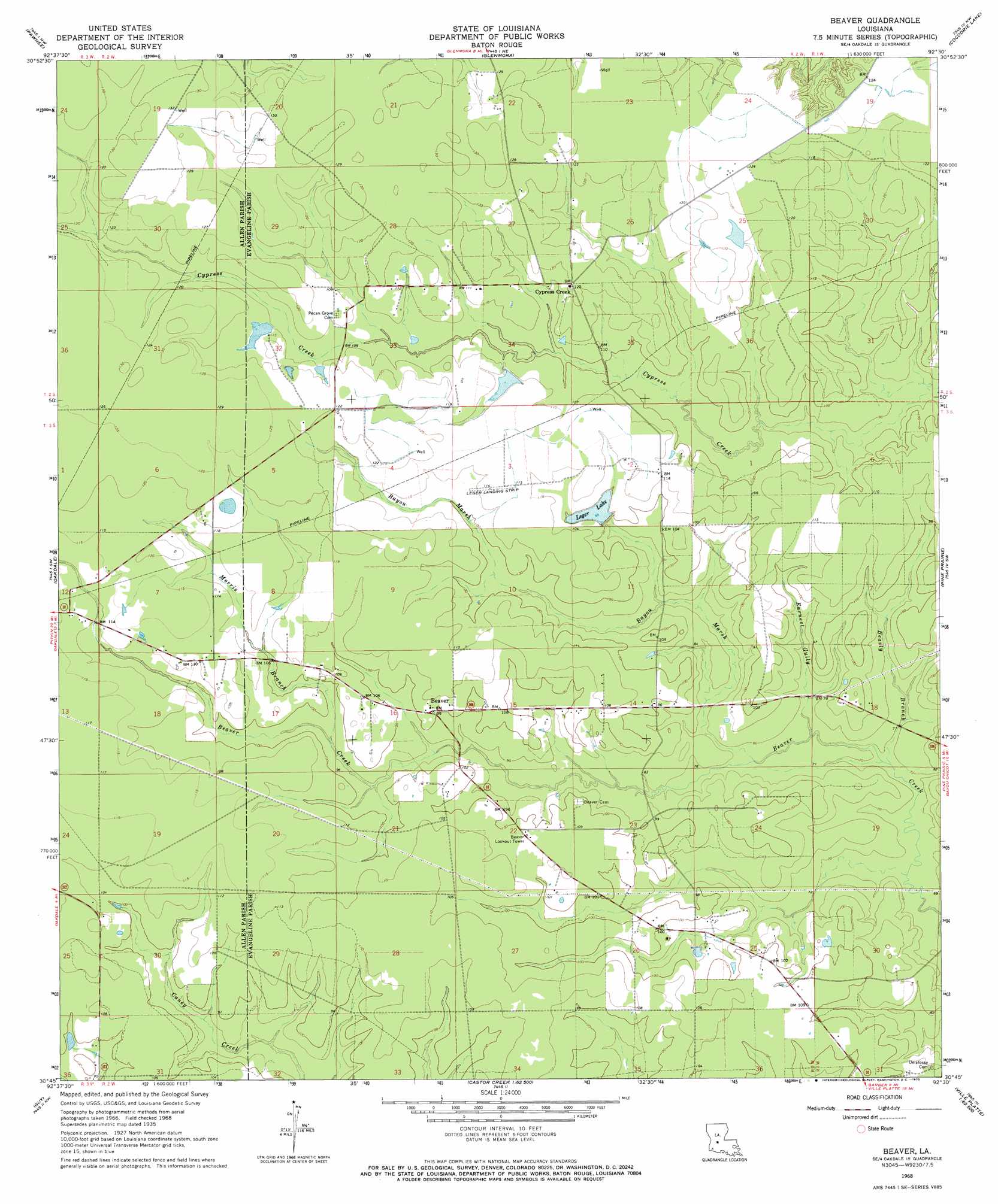
USGS Topo Quad 30092g5 - 1:24,000 scale
| Topo Map Name: | Beaver |
| USGS Topo Quad ID: | 30092g5 |
| Print Size: | ca. 21 1/4" wide x 27" high |
| Southeast Coordinates: | 30.75° N latitude / 92.5° W longitude |
| Map Center Coordinates: | 30.8125° N latitude / 92.5625° W longitude |
| U.S. State: | LA |
| Filename: | o30092g5.jpg |
| Download Map JPG Image: | Beaver topo map 1:24,000 scale |
| Map Type: | Topographic |
| Topo Series: | 7.5´ |
| Map Scale: | 1:24,000 |
| Source of Map Images: | United States Geological Survey (USGS) |
| Alternate Map Versions: |
Beaver LA 1968, updated 1970 Download PDF Buy paper map Beaver LA 1998, updated 2002 Download PDF Buy paper map Beaver LA 1998, updated 2002 Download PDF Buy paper map Beaver LA 2012 Download PDF Buy paper map Beaver LA 2015 Download PDF Buy paper map |
1:24,000 Topo Quads surrounding Beaver
Afeman |
Melder |
Forest Hill |
Lecompte |
Cheneyville |
Steep Gully |
Pawnee |
Glenmora |
Cocodrie Lake |
Lone Pine |
Elizabeth |
Oakdale |
Beaver |
Pine Prairie |
Saint Landry |
Pine Chapel |
Guy |
Bond |
Mamou |
Ville Platte |
Oberlin |
Soileau |
Duralde |
Eunice North |
Chataignier |
> Back to 30092e1 at 1:100,000 scale
> Back to 30092a1 at 1:250,000 scale
> Back to U.S. Topo Maps home
Beaver topo map: Gazetteer
Beaver: Airports
Dyer Airport elevation 35m 114′Leger Landing Strip elevation 34m 111′
Beaver: Areas
Marsh Bayou State Wildlife Management Area elevation 35m 114′Beaver: Dams
Leger Lake Dam elevation 30m 98′Louisiana Noname 100 Dam elevation 33m 108′
Louisiana Noname 99 Dam elevation 34m 111′
Beaver: Populated Places
Beaver elevation 31m 101′Cypress Creek elevation 37m 121′
Beaver: Reservoirs
Leger Lake elevation 30m 98′Beaver: Streams
Bayou Marsh elevation 22m 72′Beasly Branch elevation 21m 68′
Earnest Gully elevation 22m 72′
Morris Branch elevation 29m 95′
Beaver digital topo map on disk
Buy this Beaver topo map showing relief, roads, GPS coordinates and other geographical features, as a high-resolution digital map file on DVD: