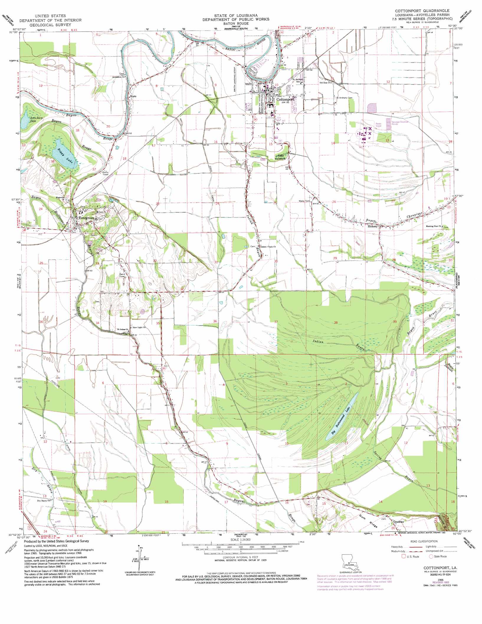
Cottonport Topo Map Louisiana
To zoom in, hover over the map of Cottonport
USGS Topo Quad 30092h1 - 1:24,000 scale
| Topo Map Name: | Cottonport |
| USGS Topo Quad ID: | 30092h1 |
| Print Size: | ca. 21 1/4" wide x 27" high |
| Southeast Coordinates: | 30.875° N latitude / 92° W longitude |
| Map Center Coordinates: | 30.9375° N latitude / 92.0625° W longitude |
| U.S. State: | LA |
| Filename: | o30092h1.jpg |
| Download Map JPG Image: | Cottonport topo map 1:24,000 scale |
| Map Type: | Topographic |
| Topo Series: | 7.5´ |
| Map Scale: | 1:24,000 |
| Source of Map Images: | United States Geological Survey (USGS) |
| Alternate Map Versions: |
Cottonport LA 1966, updated 1967 Download PDF Buy paper map Cottonport LA 1966, updated 1986 Download PDF Buy paper map Cottonport LA 1966, updated 1993 Download PDF Buy paper map Cottonport LA 2012 Download PDF Buy paper map Cottonport LA 2015 Download PDF Buy paper map |
1:24,000 Topo Quads surrounding Cottonport
Latanier |
Effie |
Marksville North |
Lac Sainte Agnes |
Ile Natchitoches |
Cheneyville |
Belle D'Eau |
Marksville South |
Moreauville |
Big Bend |
Lone Pine |
Bunkie |
Cottonport |
Plaucheville |
Simmesport |
Saint Landry |
Whiteville |
Morrow |
Bayou Jack |
Bayou Current |
Ville Platte |
Tate Cove |
Beggs |
Palmetto |
Swayze Lake |
> Back to 30092e1 at 1:100,000 scale
> Back to 30092a1 at 1:250,000 scale
> Back to U.S. Topo Maps home
Cottonport topo map: Gazetteer
Cottonport: Canals
Coco Canal elevation 15m 49′Cottonport: Lakes
Big Buttonwood Lake elevation 11m 36′Boggy Lake elevation 16m 52′
Jews-harp Lake elevation 16m 52′
Cottonport: Oilfields
Big Cane Gas Field elevation 12m 39′Cottonport: Populated Places
Cottonport elevation 17m 55′Deats (historical) elevation 17m 55′
Dora (historical) elevation 17m 55′
Enterprise elevation 17m 55′
Evergreen elevation 19m 62′
Hickory elevation 14m 45′
Karo elevation 19m 62′
Cottonport: Streams
Bayou Bruce elevation 11m 36′Bayou Huffpower elevation 15m 49′
Indian Bayou elevation 11m 36′
Cottonport digital topo map on disk
Buy this Cottonport topo map showing relief, roads, GPS coordinates and other geographical features, as a high-resolution digital map file on DVD: