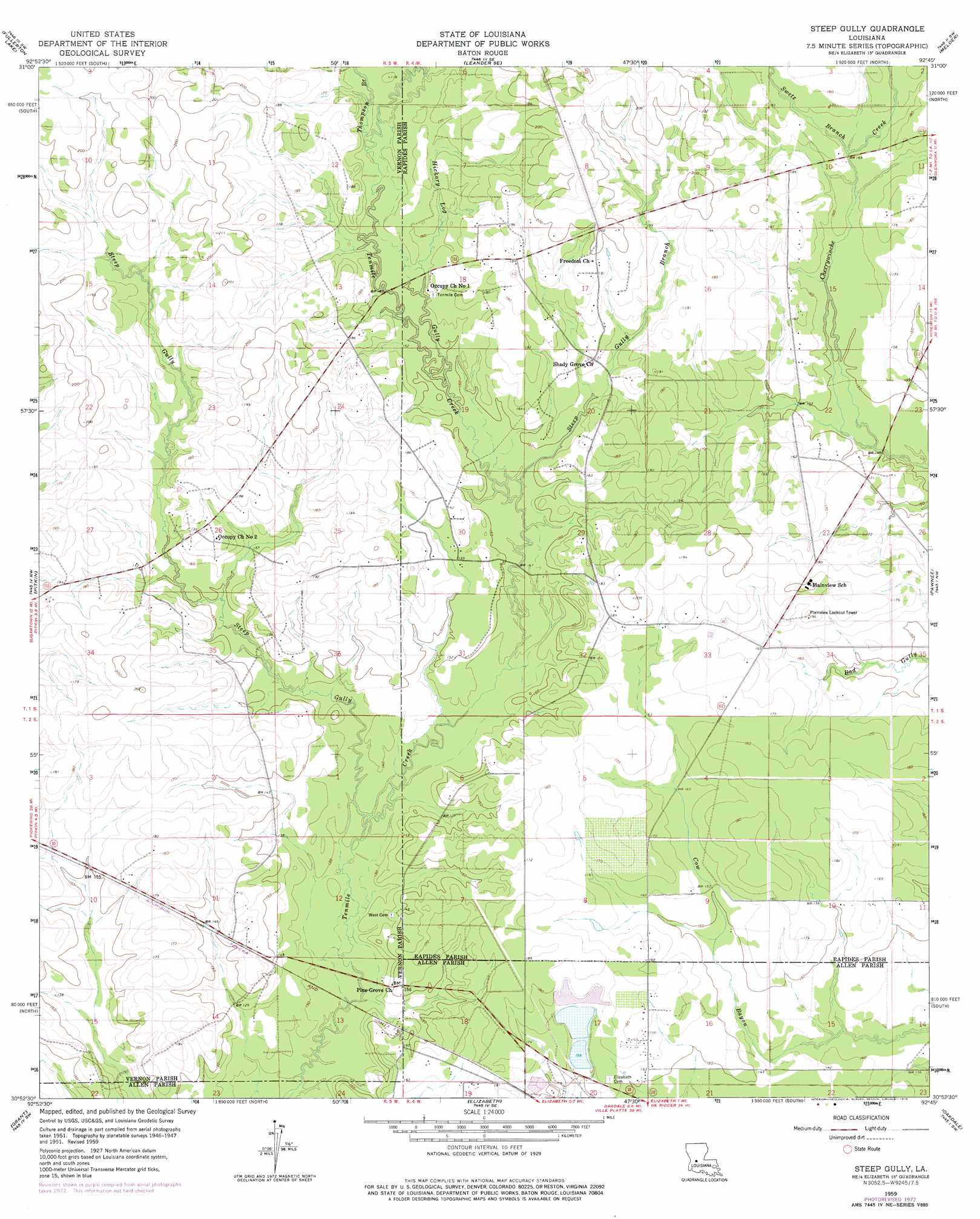
Steep Gully Topo Map Louisiana
To zoom in, hover over the map of Steep Gully
USGS Topo Quad 30092h7 - 1:24,000 scale
| Topo Map Name: | Steep Gully |
| USGS Topo Quad ID: | 30092h7 |
| Print Size: | ca. 21 1/4" wide x 27" high |
| Southeast Coordinates: | 30.875° N latitude / 92.75° W longitude |
| Map Center Coordinates: | 30.9375° N latitude / 92.8125° W longitude |
| U.S. State: | LA |
| Filename: | o30092h7.jpg |
| Download Map JPG Image: | Steep Gully topo map 1:24,000 scale |
| Map Type: | Topographic |
| Topo Series: | 7.5´ |
| Map Scale: | 1:24,000 |
| Source of Map Images: | United States Geological Survey (USGS) |
| Alternate Map Versions: |
Steep Gully LA 1951, updated 1952 Download PDF Buy paper map Steep Gully LA 1959, updated 1960 Download PDF Buy paper map Steep Gully LA 1959, updated 1964 Download PDF Buy paper map Steep Gully LA 1959, updated 1976 Download PDF Buy paper map Steep Gully LA 1997, updated 2001 Download PDF Buy paper map Steep Gully LA 2012 Download PDF Buy paper map Steep Gully LA 2015 Download PDF Buy paper map |
1:24,000 Topo Quads surrounding Steep Gully
Simpson South |
Lacamp |
Sieper |
Elmer |
Woodworth West |
Birds Creek |
Fullerton Lake |
Afeman |
Melder |
Forest Hill |
Sugrue |
Pitkin |
Steep Gully |
Pawnee |
Glenmora |
Sugartown |
Grant |
Elizabeth |
Oakdale |
Beaver |
Dry Creek |
Mittie |
Pine Chapel |
Guy |
Bond |
> Back to 30092e1 at 1:100,000 scale
> Back to 30092a1 at 1:250,000 scale
> Back to U.S. Topo Maps home
Steep Gully topo map: Gazetteer
Steep Gully: Dams
Louisiana Noname 61 Dam elevation 45m 147′Steep Gully: Populated Places
Westport elevation 52m 170′Steep Gully: Streams
Steep Gully Branch elevation 44m 144′Swetz Branch elevation 49m 160′
Thompson Branch elevation 48m 157′
Steep Gully: Valleys
Hickory Log Gully elevation 46m 150′Steep Gully elevation 39m 127′
Steep Gully digital topo map on disk
Buy this Steep Gully topo map showing relief, roads, GPS coordinates and other geographical features, as a high-resolution digital map file on DVD: