Mauriceville Topo Map Texas
To zoom in, hover over the map of Mauriceville
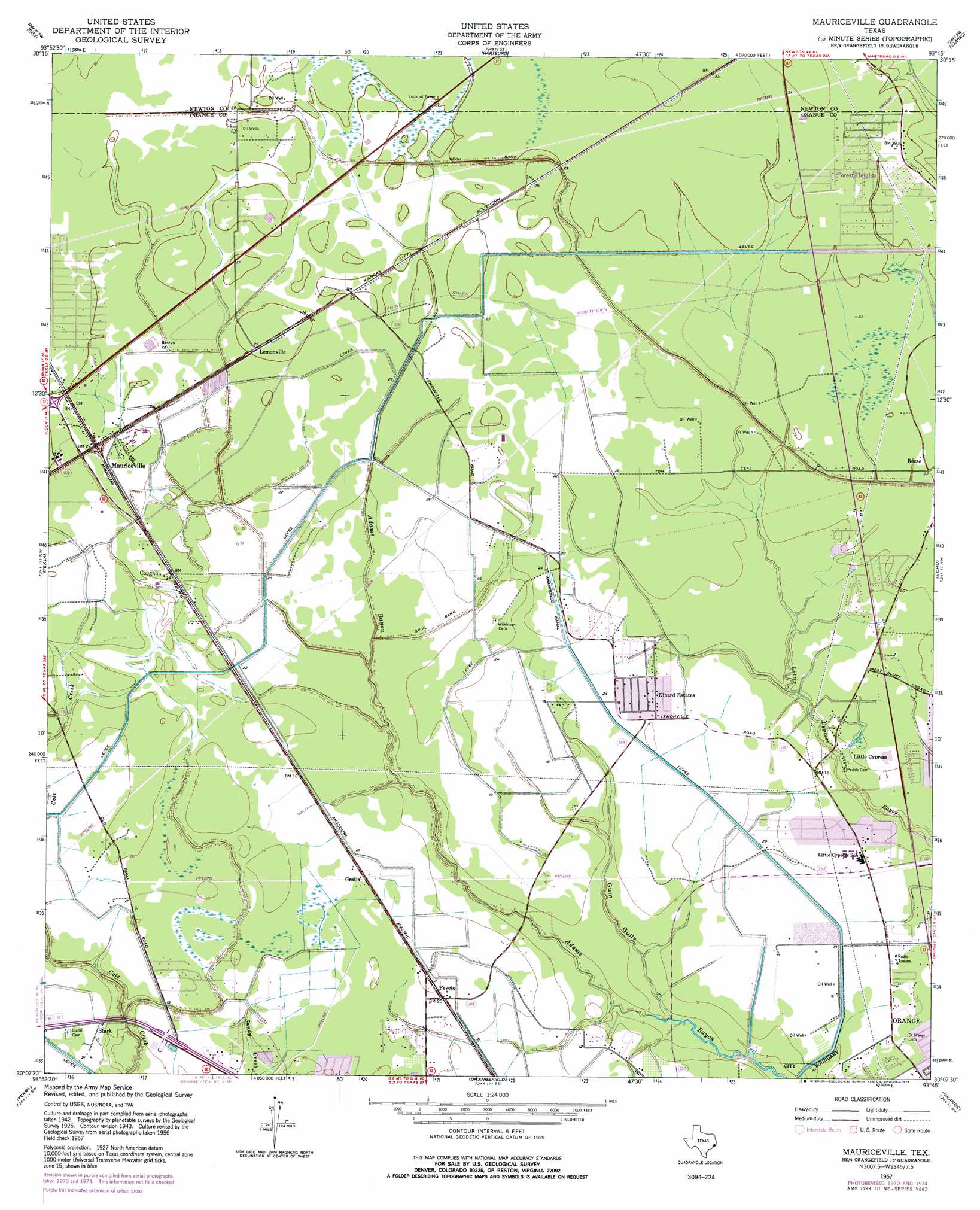
USGS Topo Quad 30093b7 - 1:24,000 scale
| Topo Map Name: | Mauriceville |
| USGS Topo Quad ID: | 30093b7 |
| Print Size: | ca. 21 1/4" wide x 27" high |
| Southeast Coordinates: | 30.125° N latitude / 93.75° W longitude |
| Map Center Coordinates: | 30.1875° N latitude / 93.8125° W longitude |
| U.S. State: | TX |
| Filename: | o30093b7.jpg |
| Download Map JPG Image: | Mauriceville topo map 1:24,000 scale |
| Map Type: | Topographic |
| Topo Series: | 7.5´ |
| Map Scale: | 1:24,000 |
| Source of Map Images: | United States Geological Survey (USGS) |
| Alternate Map Versions: |
Mauriceville TX 1926 Download PDF Buy paper map Mauriceville TX 1943, updated 1953 Download PDF Buy paper map Mauriceville TX 1957, updated 1958 Download PDF Buy paper map Mauriceville TX 1957, updated 1972 Download PDF Buy paper map Mauriceville TX 1957, updated 1978 Download PDF Buy paper map Mauriceville TX 2010 Download PDF Buy paper map Mauriceville TX 2012 Download PDF Buy paper map Mauriceville TX 2016 Download PDF Buy paper map |
1:24,000 Topo Quads surrounding Mauriceville
Franklin Lake |
Buna |
Sudduth Bluff |
Shoats Creek |
Clark Hollow |
Evadale |
Gist |
Hartburg |
Starks |
Lunita |
Pine Forest |
Texla |
Mauriceville |
Echo |
Vinton |
Beaumont East |
Terry |
Orangefield |
Orange |
Cameron Farms |
Port Acres |
Port Arthur North |
West Of Greens Bayou |
Greens Bayou |
Five Lakes |
> Back to 30093a1 at 1:100,000 scale
> Back to 30092a1 at 1:250,000 scale
> Back to U.S. Topo Maps home
Mauriceville topo map: Gazetteer
Mauriceville: Populated Places
Coughlin elevation 6m 19′Forest Heights elevation 8m 26′
Gratis elevation 6m 19′
Kinard Estates elevation 5m 16′
Lemonville elevation 8m 26′
Little Cypress elevation 5m 16′
Mauriceville elevation 8m 26′
Peveto elevation 6m 19′
Reese elevation 6m 19′
Stark elevation 5m 16′
Mauriceville: Valleys
Gum Gully elevation 2m 6′Mauriceville digital topo map on disk
Buy this Mauriceville topo map showing relief, roads, GPS coordinates and other geographical features, as a high-resolution digital map file on DVD: