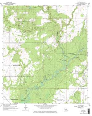
Topsy Topo Map Louisiana
To zoom in, hover over the map of Topsy
USGS Topo Quad 30093d1 - 1:24,000 scale
| Topo Map Name: | Topsy |
| USGS Topo Quad ID: | 30093d1 |
| Print Size: | ca. 21 1/4" wide x 27" high |
| Southeast Coordinates: | 30.375° N latitude / 93° W longitude |
| Map Center Coordinates: | 30.4375° N latitude / 93.0625° W longitude |
| U.S. State: | LA |
| Filename: | o30093d1.jpg |
| Download Map JPG Image: | Topsy topo map 1:24,000 scale |
| Map Type: | Topographic |
| Topo Series: | 7.5´ |
| Map Scale: | 1:24,000 |
| Source of Map Images: | United States Geological Survey (USGS) |
| Alternate Map Versions: |
Topsy LA 1957, updated 1958 Download PDF Buy paper map Topsy LA 1957, updated 1968 Download PDF Buy paper map Topsy LA 1957, updated 1976 Download PDF Buy paper map Topsy LA 1957, updated 1976 Download PDF Buy paper map Topsy LA 1998, updated 2002 Download PDF Buy paper map Topsy LA 2012 Download PDF Buy paper map Topsy LA 2015 Download PDF Buy paper map |
1:24,000 Topo Quads surrounding Topsy
> Back to 30093a1 at 1:100,000 scale
> Back to 30092a1 at 1:250,000 scale
> Back to U.S. Topo Maps home
Topsy topo map: Gazetteer
Topsy: Bays
Francois Bay elevation 3m 9′Joe Cooley Bay elevation 1m 3′
Old River Bay elevation 2m 6′
Topsy: Bends
Dawson Bend elevation 3m 9′Marsh Bayou Cutoff elevation 1m 3′
Old Barnes Creek Cutoff elevation 3m 9′
Pinto Cutoff elevation 3m 9′
Tom Bayou Cutoff elevation 3m 9′
Topsy: Channels
Bird Bay Channel elevation 2m 6′Topsy: Cliffs
Grays Bluff elevation 2m 6′Topsy: Oilfields
Barnes Creek Oil Field elevation 19m 62′Indian Village Oil Field elevation 8m 26′
Reeves Oil Field elevation 12m 39′
Thompson Bluff Oil Field elevation 3m 9′
Topsy: Populated Places
Buller elevation 8m 26′Topsy elevation 7m 22′
Topsy: Streams
Barnes Creek elevation 2m 6′Bear Creek elevation 3m 9′
Boggy Creek elevation 7m 22′
Brushy Creek elevation 7m 22′
Clear Creek elevation 6m 19′
Gilley Gully elevation 4m 13′
Hickory Gully elevation 2m 6′
Little Marsh Bayou elevation 2m 6′
Marsh Bayou elevation 1m 3′
Tom Bayou elevation 1m 3′
Wolf Creek elevation 10m 32′
Topsy: Swamps
Buller Marsh elevation 7m 22′Thompson Marsh elevation 8m 26′
Topsy digital topo map on disk
Buy this Topsy topo map showing relief, roads, GPS coordinates and other geographical features, as a high-resolution digital map file on DVD:


