Gaytine Topo Map Louisiana
To zoom in, hover over the map of Gaytine
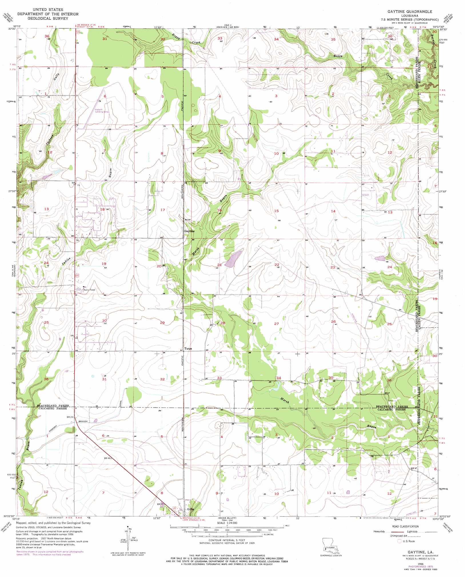
USGS Topo Quad 30093d2 - 1:24,000 scale
| Topo Map Name: | Gaytine |
| USGS Topo Quad ID: | 30093d2 |
| Print Size: | ca. 21 1/4" wide x 27" high |
| Southeast Coordinates: | 30.375° N latitude / 93.125° W longitude |
| Map Center Coordinates: | 30.4375° N latitude / 93.1875° W longitude |
| U.S. State: | LA |
| Filename: | o30093d2.jpg |
| Download Map JPG Image: | Gaytine topo map 1:24,000 scale |
| Map Type: | Topographic |
| Topo Series: | 7.5´ |
| Map Scale: | 1:24,000 |
| Source of Map Images: | United States Geological Survey (USGS) |
| Alternate Map Versions: |
Gaytine LA 1956, updated 1957 Download PDF Buy paper map Gaytine LA 1956, updated 1976 Download PDF Buy paper map Gaytine LA 1994, updated 1996 Download PDF Buy paper map Gaytine LA 2012 Download PDF Buy paper map Gaytine LA 2015 Download PDF Buy paper map |
1:24,000 Topo Quads surrounding Gaytine
Singer |
Mach Branch |
Redhead Branch |
Dry Creek |
Mittie |
Oretta |
Kernan |
Longville |
Reeves |
Le Blanc |
De Quincy |
Gordon |
Gaytine |
Topsy |
Indian Village |
Brimstone |
Buhler |
Moss Bluff |
Hecker |
Fenton |
Sulphur |
Westlake |
Lake Charles |
Iowa |
Lacassine |
> Back to 30093a1 at 1:100,000 scale
> Back to 30092a1 at 1:250,000 scale
> Back to U.S. Topo Maps home
Gaytine topo map: Gazetteer
Gaytine: Airports
Habetz Airport elevation 25m 82′Gaytine: Canals
Hickory Branch Canal elevation 8m 26′Gaytine: Oilfields
South Fulton Oil Field elevation 24m 78′Gaytine: Populated Places
Gaytine elevation 18m 59′Turps elevation 12m 39′
Gaytine digital topo map on disk
Buy this Gaytine topo map showing relief, roads, GPS coordinates and other geographical features, as a high-resolution digital map file on DVD: