Gordon Topo Map Louisiana
To zoom in, hover over the map of Gordon
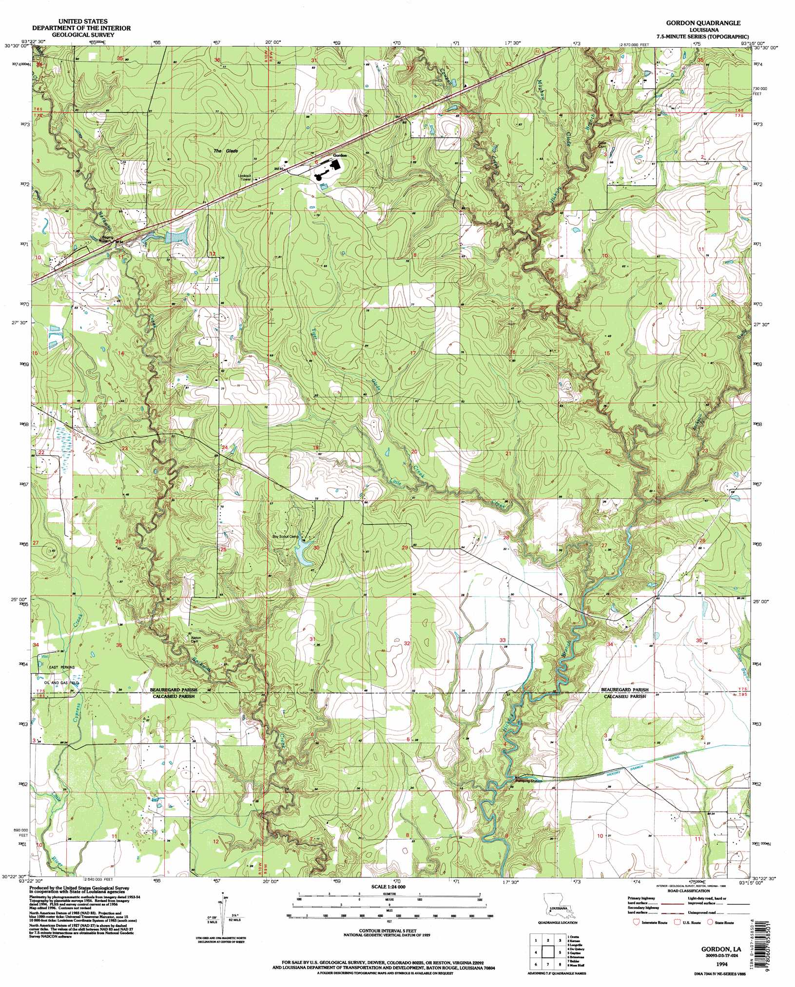
USGS Topo Quad 30093d3 - 1:24,000 scale
| Topo Map Name: | Gordon |
| USGS Topo Quad ID: | 30093d3 |
| Print Size: | ca. 21 1/4" wide x 27" high |
| Southeast Coordinates: | 30.375° N latitude / 93.25° W longitude |
| Map Center Coordinates: | 30.4375° N latitude / 93.3125° W longitude |
| U.S. State: | LA |
| Filename: | o30093d3.jpg |
| Download Map JPG Image: | Gordon topo map 1:24,000 scale |
| Map Type: | Topographic |
| Topo Series: | 7.5´ |
| Map Scale: | 1:24,000 |
| Source of Map Images: | United States Geological Survey (USGS) |
| Alternate Map Versions: |
Gordon LA 1956, updated 1957 Download PDF Buy paper map Gordon LA 1956, updated 1976 Download PDF Buy paper map Gordon LA 1994, updated 1996 Download PDF Buy paper map Gordon LA 2012 Download PDF Buy paper map Gordon LA 2015 Download PDF Buy paper map |
1:24,000 Topo Quads surrounding Gordon
Merryville South |
Singer |
Mach Branch |
Redhead Branch |
Dry Creek |
Fields |
Oretta |
Kernan |
Longville |
Reeves |
Clark Hollow |
De Quincy |
Gordon |
Gaytine |
Topsy |
Lunita |
Brimstone |
Buhler |
Moss Bluff |
Hecker |
Vinton |
Sulphur |
Westlake |
Lake Charles |
Iowa |
> Back to 30093a1 at 1:100,000 scale
> Back to 30092a1 at 1:250,000 scale
> Back to U.S. Topo Maps home
Gordon topo map: Gazetteer
Gordon: Dams
Louisiana Noname 82 Dam elevation 14m 45′Gordon: Flats
The Glade elevation 18m 59′Gordon: Oilfields
East Perkins Oil and Gas Field elevation 10m 32′Gordon: Populated Places
Abbie Joe (historical) elevation 20m 65′Evart (historical) elevation 16m 52′
Gekop elevation 15m 49′
Gordon elevation 21m 68′
Gordon: Streams
Cowpen Creek elevation 10m 32′Cypress Creek elevation 8m 26′
Jackson Gully elevation 7m 22′
Little Creek elevation 6m 19′
Mayhaw Glade elevation 6m 19′
Tiger Glade Creek elevation 9m 29′
Gordon digital topo map on disk
Buy this Gordon topo map showing relief, roads, GPS coordinates and other geographical features, as a high-resolution digital map file on DVD: