Reeves Topo Map Louisiana
To zoom in, hover over the map of Reeves
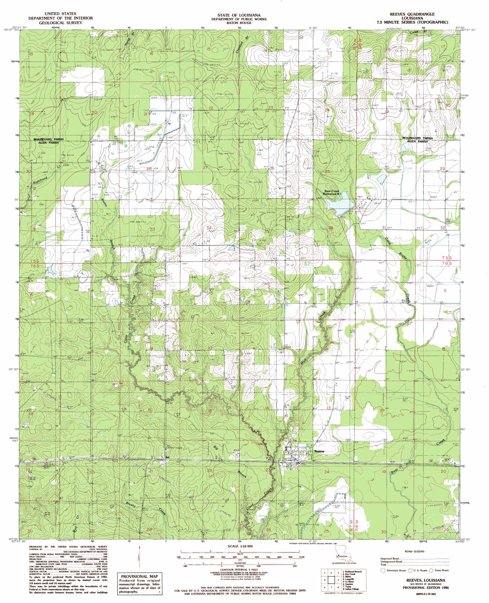
USGS Topo Quad 30093e1 - 1:24,000 scale
| Topo Map Name: | Reeves |
| USGS Topo Quad ID: | 30093e1 |
| Print Size: | ca. 21 1/4" wide x 27" high |
| Southeast Coordinates: | 30.5° N latitude / 93° W longitude |
| Map Center Coordinates: | 30.5625° N latitude / 93.0625° W longitude |
| U.S. State: | LA |
| Filename: | o30093e1.jpg |
| Download Map JPG Image: | Reeves topo map 1:24,000 scale |
| Map Type: | Topographic |
| Topo Series: | 7.5´ |
| Map Scale: | 1:24,000 |
| Source of Map Images: | United States Geological Survey (USGS) |
| Alternate Map Versions: |
Reeves LA 1986, updated 1987 Download PDF Buy paper map Reeves LA 2012 Download PDF Buy paper map Reeves LA 2015 Download PDF Buy paper map |
1:24,000 Topo Quads surrounding Reeves
De Ridder |
Boneset Creek |
Sugartown |
Grant |
Elizabeth |
Mach Branch |
Redhead Branch |
Dry Creek |
Mittie |
Pine Chapel |
Kernan |
Longville |
Reeves |
Le Blanc |
Oberlin |
Gordon |
Gaytine |
Topsy |
Indian Village |
Kinder |
Buhler |
Moss Bluff |
Hecker |
Fenton |
Welsh North |
> Back to 30093e1 at 1:100,000 scale
> Back to 30092a1 at 1:250,000 scale
> Back to U.S. Topo Maps home
Reeves topo map: Gazetteer
Reeves: Dams
Bear Creek Number One Dam elevation 26m 85′Bear Creek Number Two Dam elevation 24m 78′
Reeves: Oilfields
Mud Creek Oil Field elevation 24m 78′North Bell Oil Field elevation 24m 78′
Reeves: Populated Places
Bel elevation 24m 78′Reeves elevation 16m 52′
Reeves: Post Offices
Reeves Post Office elevation 15m 49′Reeves: Reservoirs
Bear Creek Watershed Number 1 elevation 26m 85′Reeves: Streams
Austin Branch elevation 21m 68′Big Branch elevation 6m 19′
Cane Brake Creek elevation 13m 42′
Mud Creek elevation 11m 36′
Reeves digital topo map on disk
Buy this Reeves topo map showing relief, roads, GPS coordinates and other geographical features, as a high-resolution digital map file on DVD: